
Historic bridges · West Midlands
Road Bridge opposite east end of Reservoir Dam
In or near Heaton.
Road Bridge opposite east end of Reservoir Dam — Grade II listed building-listed bridge in england-west-midlands, United Kingdom.

Ian Warburton — CC BY-SA 2.0 via Wikimedia Commons licence
_-_geograph.org.uk_-_89190.jpg)
Plan your visit
- Typical visit
- 15 min–30 min
- Nearest railway station
- Hunthouse Wood · 6.1 km
- Free entry
- Dog-friendly
Getting there & planning your visit
To visit the Road Bridge opposite the east end of Reservoir Dam, the nearest railway station is Hunthouse Wood, located 6.1 km away. Entry is free, and the postcode for sat-nav is SK11 0NZ.
About
Road Bridge opposite east end of Reservoir Dam is a Grade II listed building-listed bridge in england-west-midlands, United Kingdom, registered on the National Heritage List for England (NHLE entry 1138906). Listed status protects buildings and structures of special architectural or historic interest. See the linked Wikipedia article for further details.
Photo gallery
Heritage listing
Details BOSLEY C.P. BOSLEY RESERVOIR SJ 96 NW 1/2 Road Bridge opposite east end of Reservoir Dam GV II Roadbridge circa.1830 probably by William Crosley engineer, of tooled ashlar reddish-buff sandstone. Horseshoe elliptical arch with keystones. Abutments are curved in plan and battered. Plain projecting strings at road level carry stone parapets with plain projecting copings, terminating in square piers. In form and detailing the bridge is similar to those on the Macclesfield Canal. Listing NGR: SJ9263965490 Legacy The contents of this record have been generated from a legacy data system. Legacy System number: 58117 Legacy System: LBS
From the Historic England List Entry under OGL v3.
Place summary
The Road Bridge opposite the east end of Reservoir Dam is located in Bosley, West Midlands. This structure is a Grade II listed building, recognising its architectural and historical significance.
AI-generated from the structured facts on this page (operator, designation, listing, era). Not a substitute for visiting.
- Coordinates
- 53.1864, -2.1116
- District
- Cheshire East
- Parish
- Bosley
- Postcode
- SK11 0NZ
- Parliamentary constituency
- Macclesfield
- Nearest railway station
- Hunthouse Wood — 6.1 km
Sources
- wikidata: Q59362887 (CC0)
Other places nearby
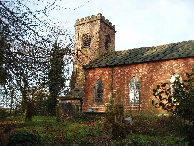
Church of St Mary the Virgin, Bosley
Historic churches · 0.8 km

Bosley Tug of War Club
Memorials & monuments · 1.0 km

Lymford Bridge
Historic bridges · 1.5 km

Bosley Lock Number 11 and lock pound
Canal locks · 1.8 km

Bosley Lock Number 12 and lock pound
Canal locks · 1.8 km

Bosley Minn
Mountains & hills · 1.8 km

Bosley Lock Number 10 and lock pound
Canal locks · 1.9 km

Hug Bridge
Historic bridges · 1.9 km

Bosley Lock Number 9 and lock pound
Canal locks · 2.0 km

Dane Aqueduct
Historic bridges · 2.0 km

Bosley Lock Number 8 and lock pound
Canal locks · 2.0 km

Bosley Lock Number 7 and lock pound
Canal locks · 2.1 km
Nearby
📷 3Historic churches · West Midlands
Church of St Mary the Virgin, Bosley
Church of St Mary the Virgin, Bosley — Grade II* listed church in Bosley, Cheshire East, Cheshire, England, UK.
📷 3Memorials & monuments · West Midlands
Bosley Tug of War Club
Bosley Tug of War Club — a memorial in england-west-midlands, United Kingdom.
📷 3Historic bridges · West Midlands
Lymford Bridge
Lymford Bridge — Grade II listed building-listed bridge in england-west-midlands, United Kingdom.
📷 3Canal locks · West Midlands
Bosley Lock Number 11 and lock pound
Bosley Lock Number 11 and lock pound — Grade II listed building in Bosley, Cheshire, England, UK.
📷 3Canal locks · West Midlands
Bosley Lock Number 12 and lock pound
Bosley Lock Number 12 and lock pound — Grade II listed building in Bosley, Cheshire, England, UK.
📷 5Mountains & hills · West Midlands
Bosley Minn
Bosley Minn — a hill or mountain in england west midlands.
Where to eat & stay near Road Bridge opposite east end of Reservoir Dam
Places to stay
 📷 5
📷 5Caravan parks · West Midlands
Stoneyfold Caravan Park
Stoneyfold Caravan Park — a caravan park in england west midlands.
 📷 5
📷 5Campsites · West Midlands
Barnswood Scout Camp Site
Barnswood Scout Camp Site — a campsite in england west midlands.
 📷 5📷 5
Campsites · West Midlands
Gradbach Scout Camp
Gradbach Scout Camp — a campsite in england west midlands.
📷 5 📷 5
📷 5Caravan parks · West Midlands
Sky View CAMC Certificated Location
Sky View CAMC Certificated Location — a caravan park in england west midlands.
Places to eat & drink
 📷 5
📷 5Historic pubs · North West England
Harrington Arms
Harrington Arms in England North West, United Kingdom.
 📷 5
📷 5Restaurants · West Midlands
Sutton Hall
Sutton Hall — a restaurant in england west midlands.
 📷 3
📷 3Historic pubs · North West England
Olde Kings Arms
Olde Kings Arms — Historic pub — listed building or notable heritage status.
 📷 5
📷 5Historic pubs · North West England
The Counting House
The Counting House in England North West, United Kingdom.
 📷 5
📷 5Historic pubs · North West England
Lord Byron Public House
Lord Byron Public House in England North West, United Kingdom.
 📷 5
📷 5Historic pubs · North West England
The Castle, Macclesfield
The Castle, Macclesfield in England North West, United Kingdom.
More bridges in this region
 📷 3
📷 3Historic bridges · West Midlands
Wolseley Bridge
Wolseley Bridge is a historic bridge in the United Kingdom.
 📷 3
📷 3Historic bridges · West Midlands
Bridge, Gatepiers, Walls And Ha Ha South Of Blithfield Hall
Bridge, Gatepiers, Walls And Ha Ha South Of Blithfield Hall — Grade II listed building-listed bridge in england-east-midlands, United Kingdom.
 📷 3
📷 3Historic bridges · West Midlands
Bridge Over River Swarbourn At West End Of Town Hill
Bridge Over River Swarbourn At West End Of Town Hill — Grade II listed building-listed bridge in england-east-midlands, United Kingdom.
 📷 3
📷 3Historic bridges · West Midlands
Viaduct over Trent and Mersey Canal at SK 0485 1780
Viaduct over Trent and Mersey Canal at SK 0485 1780 — Grade II listed building-listed bridge in england-east-midlands, United Kingdom.
Frequently asked questions
- Where is Road Bridge opposite east end of Reservoir Dam?
- Road Bridge opposite east end of Reservoir Dam is in the West Midlands, United Kingdom (postcode SK11 0NZ), in the parish of Bosley.
- What is Road Bridge opposite east end of Reservoir Dam?
- Road Bridge opposite east end of Reservoir Dam — Grade II listed building-listed bridge in england-west-midlands, United Kingdom.
- How do I get to Road Bridge opposite east end of Reservoir Dam?
- The nearest railway station is Hunthouse Wood, about 6.1 km away. The nearest town is Heaton. Drivers can use postcode SK11 0NZ.
- Is Road Bridge opposite east end of Reservoir Dam a listed building?
- Road Bridge opposite east end of Reservoir Dam is officially recognised as Grade II listed building listed.
- Is Road Bridge opposite east end of Reservoir Dam free to visit?
- Yes, Road Bridge opposite east end of Reservoir Dam is free to enter.
- How do I get to Road Bridge opposite east end of Reservoir Dam?
- The nearest railway station is Hunthouse Wood, about 6.1 km away. Drivers can navigate to postcode SK11 0NZ.