Historic bridges · South West England
Road Bridge Approximately 20M South-West Of French's Farmhouse
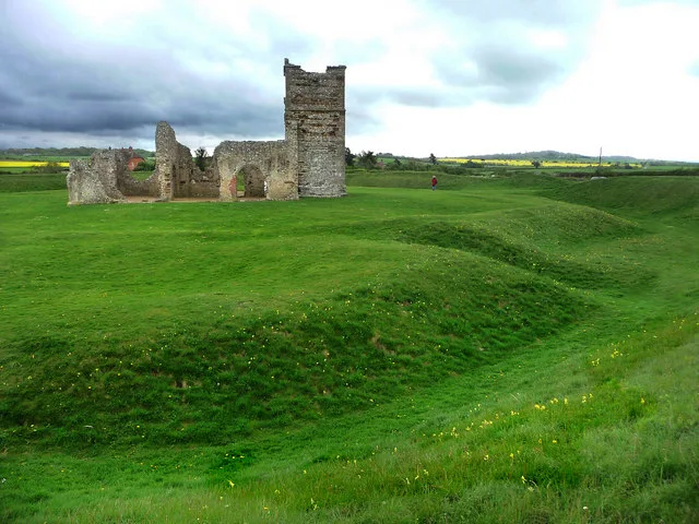
In or near Cranborne.
Road Bridge Approximately 20M South-West Of French's Farmhouse — Grade II listed building-listed bridge in england-south-east, United Kingdom.

Simon Barnes — CC BY-SA 2.0 via Wikimedia Commons licence
Plan your visit
- Typical visit
- 15 min–30 min
- Nearest railway station
- Kingsmere · 9.9 km
- Free entry
- Dog-friendly
Getting there & planning your visit
To visit the Road Bridge Approximately 20M South-West Of French's Farmhouse, the nearest railway station is Kingsmere, located 9.9 km away. The postcode for navigation is BH21 5NQ, and entry to the site is free.
About
Road Bridge Approximately 20M South-West Of French's Farmhouse is a Grade II listed building-listed bridge in england-south-east, United Kingdom, registered on the National Heritage List for England (NHLE entry 1323517). Listed status protects buildings and structures of special architectural or historic interest. See the linked Wikipedia article for further details.
Photo gallery
Heritage listing
Details WIMBORNE ST GILES SU 01 SW BOTTLEBUSH LANE 6/106 Road bridge approximately 20m south-west of French's 18.3.55 Farmhouse (formerly listed as Bridge approximately 35 yards South of French's Farmhouse). GV II Roadbridge, over the river Allen, early C19. Brick of 5 segmental arches with plat band above. Partly rebuilt brick parapet with stone coping. Listing NGR: SU0278912422 Legacy The contents of this record have been generated from a legacy data system. Legacy System number: 107441 Legacy System: LBS
From the Historic England List Entry under OGL v3.
Protected designations
- Site of Special Scientific Interest: River Avon System SSSI
- Area of Outstanding Natural Beauty: Dorset
- Area of Outstanding Natural Beauty: Cranborne Chase & West Wiltshire Downs
Designations sourced from Natural England open data under OGL v3.
Place summary
The Road Bridge Approximately 20M South-West Of French's Farmhouse is located in Wimborne St. Giles, South-East England. This bridge is designated as a Grade II listed building, indicating its historical significance.
AI-generated from the structured facts on this page (operator, designation, listing, era). Not a substitute for visiting.
- Coordinates
- 50.9113, -1.9617
- District
- Dorset
- Parish
- Wimborne St. Giles
- Postcode
- BH21 5NQ
- Parliamentary constituency
- North Dorset
- Nearest railway station
- Kingsmere — 9.9 km
Sources
- wikidata: Q26609238 (CC0)
Other places nearby

Wimborne St Giles Village Signs
Public art & sculpture · 0.5 km

St Giles House
Manor houses · 0.9 km
St Giles House, Wimborne St Giles
Historic houses · 0.9 km

St Giles House folly
Follies · 1.0 km
St Giles House Grotto
Follies · 1.2 km

Wimborne St Giles
Villages · 1.5 km

Bugad Classic Bikes
Museums · 1.5 km

Medieval settlement at Brockington, immediately north east of Brockington Farm
Vineyards · 1.8 km

Knowlton Church
Historic houses · 2.2 km

Knowlton Church
Archaeological sites · 2.2 km
Knowlton Circles
Hill forts · 2.2 km
Knowlton Church and Earth Works
Archaeological sites · 2.2 km
Nearby
📷 5Public art & sculpture · South West England
Wimborne St Giles Village Signs
Wimborne St Giles Village Signs — a public art in england-south-east, United Kingdom.
📷 5Manor houses · South West England
St Giles House
St Giles House — a manor in england-south-east, United Kingdom.
Flagship📷 5Historic houses · South West England
St Giles House, Wimborne St Giles
St Giles House, Wimborne St Giles — a Grade I-listed historic house in england-south-east, United Kingdom.
📷 5Follies · South West England
St Giles House folly
St Giles House folly — Folly or eyecatcher.
📷 5Follies · South West England
St Giles House Grotto
St Giles House Grotto — Folly or eyecatcher.
📷 5Where to eat & stay near Road Bridge Approximately 20M South-West Of French's Farmhouse
Places to stay
 📷 5
📷 5Caravan parks · South West England
Lower Farm Caravan Site
Lower Farm Caravan Site — a caravan park in england south east.
 📷 5
📷 5Campsites · South West England
Verwood Camping & Caravan Club site
Verwood Camping & Caravan Club site — a campsite in england south east.
 📷 5
📷 5 📷 4
📷 4Campsites · South West England
Riverside Lakes
Riverside Lakes — a campsite in england south east.
 📷 5
📷 5Caravan parks · South West England
Church Farm Campsite
Church Farm Campsite — a caravan park in england south east.
 📷 5
📷 5Campsites · South West England
Hillside Camping and Caravan Site
Hillside Camping and Caravan Site — a campsite in england south east.
Places to eat & drink
 📷 5
📷 5Historic pubs · South East England
The Cart Wheel Public House
The Cart Wheel Public House in England South West, United Kingdom.
 📷 7
📷 7Historic pubs · South West England
The Man in the Wall
The Man in the Wall in England South West, United Kingdom.
 📷 5
📷 5Historic pubs · South East England
The Old Beams Inn
The Old Beams Inn in England South West, United Kingdom.
 📷 5
📷 5Historic pubs · South West England
The Vine, Pamphill
The Vine, Pamphill in England South West, United Kingdom.
 📷 7
📷 7Historic pubs · South West England
The Green Man Inn
The Green Man Inn in England South West, United Kingdom.
 📷 5
📷 5Historic pubs · South West England
Albion Hotel And Chandlers Wine Shop
Albion Hotel And Chandlers Wine Shop in England South West, United Kingdom.
More bridges in this region
 📷 5
📷 5Historic bridges · South West England
Avoncliff Aqueduct
Avoncliff Aqueduct is a historic bridge in the United Kingdom.
📷 5Historic bridges · South West England
Avoncliff Aqueduct
Avoncliff Aqueduct is a historic bridge in the United Kingdom.
 📷 5
📷 5Historic bridges · South West England
Bradford Viaduct
Bradford Viaduct is a historic bridge in the United Kingdom.
 📷 5
📷 5Historic bridges · South West England
Chippenham Viaduct
Chippenham Viaduct is a historic bridge in the United Kingdom.
Frequently asked questions
- Where is Road Bridge Approximately 20M South-West Of French's Farmhouse?
- Road Bridge Approximately 20M South-West Of French's Farmhouse is in South-East England, United Kingdom (postcode BH21 5NQ), in the parish of Wimborne St. Giles.
- What is Road Bridge Approximately 20M South-West Of French's Farmhouse?
- Road Bridge Approximately 20M South-West Of French's Farmhouse — Grade II listed building-listed bridge in england-south-east, United Kingdom.
- How do I get to Road Bridge Approximately 20M South-West Of French's Farmhouse?
- The nearest railway station is Kingsmere, about 9.9 km away. Drivers can use postcode BH21 5NQ.
- Is Road Bridge Approximately 20M South-West Of French's Farmhouse a listed building?
- Road Bridge Approximately 20M South-West Of French's Farmhouse is officially recognised as Grade II listed building listed.
- Is Road Bridge Approximately 20M South-West Of French's Farmhouse a protected site?
- Yes — Road Bridge Approximately 20M South-West Of French's Farmhouse is part of the River Avon System SSSI Site of Special Scientific Interest and the Dorset National Landscape (AONB).
- Is Road Bridge Approximately 20M South-West Of French's Farmhouse free to visit?
- Yes, Road Bridge Approximately 20M South-West Of French's Farmhouse is free to enter.
- How do I get to Road Bridge Approximately 20M South-West Of French's Farmhouse?
- Drivers can navigate to postcode BH21 5NQ. It sits within the North Dorset parliamentary constituency.