
Vineyards · South West England
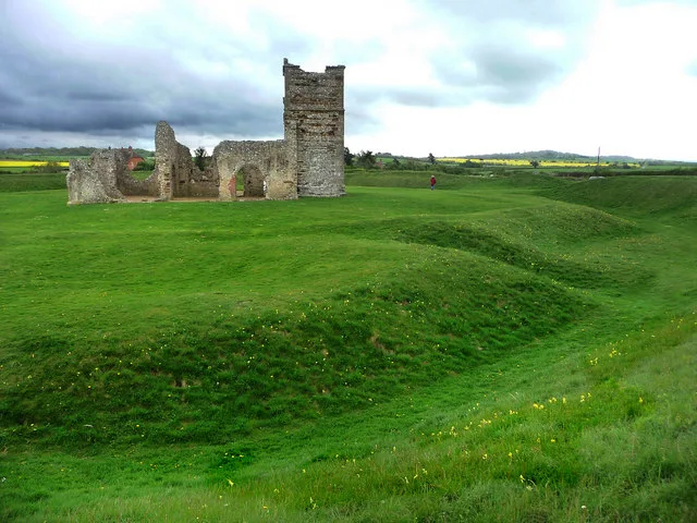
Medieval settlement at Brockington, immediately north east of Brockington Farm
In or near Gussage All Saints.
Medieval settlement at Brockington, immediately north east of Brockington Farm — a UK vineyard in england south east, producing English or Welsh wine from cool-climate grape varieties.

David Smith — CC BY-SA 2.0 via Wikimedia Commons licence

Plan your visit
- Typical visit
- 1 h–2 h
- Best time of year
- Late summer & autumn (Aug–Oct)
- Nearest railway station
- Kingsmere · 9.6 km
About
Medieval settlement at Brockington, immediately north east of Brockington Farm is one of Britain's growing number of vineyards, located in england south east. UK viticulture has expanded significantly since the 1980s, with English sparkling wines now winning international awards. Most British vineyards offer tours and tastings of their estate-grown wines. human settlement in Gussage All Saints, Dorset, England, UK
Photo gallery
Protected designations
- Site of Special Scientific Interest: River Avon System SSSI
- Area of Outstanding Natural Beauty: Dorset
- Area of Outstanding Natural Beauty: Cranborne Chase & West Wiltshire Downs
Designations sourced from Natural England open data under OGL v3.
Place summary
The Medieval settlement at Brockington, located immediately north-east of Brockington Farm in South-East England, is a vineyard known for its historical significance. This site offers visitors a chance to explore the remnants of a settlement from the medieval period while enjoying the vineyard's offerings. The setting combines agricultural heritage with the scenic landscape typical of the region. Expect a tranquil environment suited for leisurely walks and wine tasting experiences.
AI-generated from the structured facts on this page (operator, designation, listing, era). Not a substitute for visiting.
- Coordinates
- 50.8967, -1.9729
- District
- Dorset
- Parish
- Gussage All Saints
- Postcode
- BH21 5LT
- Parliamentary constituency
- North Dorset
- Nearest railway station
- Kingsmere — 9.6 km
Sources
- wikidata: Q17663968 (CC0)
Other places nearby
Medieval settlement 750m north west of Knowlton
Vineyards · 0.4 km

Knowlton Church
Historic houses · 0.6 km

Knowlton Church
Archaeological sites · 0.6 km
Knowlton Church and Earth Works
Archaeological sites · 0.6 km
Knowlton Circles
Hill forts · 0.6 km
Knowlton Rings
Archaeological sites · 0.7 km

St Giles House folly
Follies · 1.2 km

St Giles House
Manor houses · 1.5 km
St Giles House, Wimborne St Giles
Historic houses · 1.5 km
St Giles House Grotto
Follies · 1.6 km

Wimborne St Giles Village Signs
Public art & sculpture · 1.6 km

Wimborne St Giles
Villages · 1.6 km
Nearby
📷 5Vineyards · South West England
Medieval settlement 750m north west of Knowlton
Medieval settlement 750m north west of Knowlton — a UK vineyard in england south east, producing English or Welsh wine from cool-climate grape varieties.
📷 5Historic houses · South West England
Knowlton Church
Knowlton Church — a historic house in england-south-east, United Kingdom.
📷 5Archaeological sites · South West England
Knowlton Church
Knowlton Church — archaeological in england south east.
📷 5Archaeological sites · South West England
Knowlton Church and Earth Works
Knowlton Church and Earth Works — a archaeological in england-south-east, United Kingdom.
📷 5Hill forts · South West England
Knowlton Circles
Knowlton Circles — Neolithic henge monument.
📷 5Archaeological sites · South West England
Knowlton Rings
Knowlton Rings — a archaeological in england-south-east, United Kingdom.
Where to eat & stay near Medieval settlement at Brockington, immediately north east of Brockington Farm
Places to stay
 📷 5
📷 5Caravan parks · South West England
Lower Farm Caravan Site
Lower Farm Caravan Site — a caravan park in england south east.
 📷 5
📷 5 📷 4
📷 4Campsites · South West England
Riverside Lakes
Riverside Lakes — a campsite in england south east.
 📷 5
📷 5Campsites · South West England
Verwood Camping & Caravan Club site
Verwood Camping & Caravan Club site — a campsite in england south east.
 📷 5
📷 5 📷 5
📷 5Caravan parks · South West England
Dapplewood Caravan Site
Dapplewood Caravan Site — a caravan park in england south east.
Places to eat & drink
 📷 7
📷 7Historic pubs · South West England
The Man in the Wall
The Man in the Wall in England South West, United Kingdom.
 📷 5
📷 5Historic pubs · South West England
The Vine, Pamphill
The Vine, Pamphill in England South West, United Kingdom.
 📷 7
📷 7Historic pubs · South West England
The Green Man Inn
The Green Man Inn in England South West, United Kingdom.
 📷 5
📷 5Historic pubs · South West England
Albion Hotel And Chandlers Wine Shop
Albion Hotel And Chandlers Wine Shop in England South West, United Kingdom.
 📷 5
📷 5Historic pubs · South West England
The Rising Sun
The Rising Sun in England South West, United Kingdom.
 📷 5
📷 5Historic pubs · South East England
The Old Beams Inn
The Old Beams Inn in England South West, United Kingdom.
More places in this region
 📷 5
📷 5Vineyards · South West England
Castle Rings
Castle Rings — a UK vineyard in england south east, producing English or Welsh wine from cool-climate grape varieties.
 📷 5
📷 5Vineyards · South West England
Large univallate hillfort with a bowl barrow and pillow mounds 970m west of The Bungalow
Large univallate hillfort with a bowl barrow and pillow mounds 970m west of The Bungalow — a UK vineyard in england south east, producing English or Welsh wine from cool-climate grape varieties.

Vineyards · South West England
Hillfort on Banbury Hill
Hillfort on Banbury Hill — a UK vineyard in england south east, producing English or Welsh wine from cool-climate grape varieties.
 📷 5
📷 5Vineyards · South West England
Hillfort, two bowl barrows, medieval strip lynchets and a cross dyke on Cley Hill
Hillfort, two bowl barrows, medieval strip lynchets and a cross dyke on Cley Hill — a UK vineyard in england south east, producing English or Welsh wine from cool-climate grape varieties.
Frequently asked questions
- Where is Medieval settlement at Brockington, immediately north east of Brockington Farm?
- Medieval settlement at Brockington, immediately north east of Brockington Farm is in South-East England, United Kingdom (postcode BH21 5LT), in the parish of Gussage All Saints.
- What is Medieval settlement at Brockington, immediately north east of Brockington Farm?
- Medieval settlement at Brockington, immediately north east of Brockington Farm — a UK vineyard in england south east, producing English or Welsh wine from cool-climate grape varieties.
- How do I get to Medieval settlement at Brockington, immediately north east of Brockington Farm?
- The nearest railway station is Kingsmere, about 9.6 km away. Drivers can use postcode BH21 5LT.
- Is Medieval settlement at Brockington, immediately north east of Brockington Farm a protected site?
- Yes — Medieval settlement at Brockington, immediately north east of Brockington Farm is part of the River Avon System SSSI Site of Special Scientific Interest and the Dorset National Landscape (AONB).
- How do I get to Medieval settlement at Brockington, immediately north east of Brockington Farm?
- Drivers can navigate to postcode BH21 5LT. It sits within the North Dorset parliamentary constituency.