Reservoirs & lochs · North West England
Rivington
In or near Haigh.
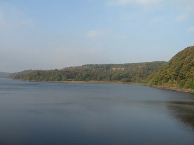
Rivington is a village and civil parish of the Borough of Chorley, Lancashire, England, occupying 2,538 acres (4.0 sq mi; 10.3 km2). It is about 6 miles (9.7 km) southeast of Chorley and about 8+1⁄2 m

David Dixon — CC BY-SA 2.0 via Wikimedia Commons licence
Plan your visit
- Typical visit
- 1 h–2.5 h
- Nearest railway station
- Adlington · 2.8 km
- Free entry
- Dog-friendly
Getting there & planning your visit
To visit Rivington, the nearest railway station is Adlington, located 2.8 km away. Entry to the reservoir is free.
About
Rivington is a village and civil parish of the Borough of Chorley, Lancashire, England, occupying 2,538 acres (4.0 sq mi; 10.3 km2). It is about 6 miles (9.7 km) southeast of Chorley and about 8+1⁄2 miles (13.7 km) northwest of Bolton. Rivington is a rural area consisting primarily of agricultural grazing land, moorland, with hill summits including Rivington Pike and Winter Hill within the West Pennine Moors. The area has a thriving tourist industry centred around reservoirs created to serve Liverpool in the Victorian era and Lever Park created as a public park by William Lever at the turn of the 20th century, with two converted barns, a replica of Liverpool Castle and open countryside. Rivington and Blackrod High School is located here. Rivington and its village had a population of 144 at the 2021 Census.
Photo gallery
See it from the streetimagery from 2024
Imagery © Mapillary contributors, CC BY-SA 4.0
Protected designations
- Site of Special Scientific Interest: West Pennine Moors SSSI
Designations sourced from Natural England open data under OGL v3.
From the Wikipedia article
Rivington is a village and civil parish of the Borough of Chorley, Lancashire, England, occupying 2,538 acres (4.0 sq mi; 10.3 km2). It is about 6 miles (9.7 km) southeast of Chorley and about 8+1⁄2 miles (13.7 km) northwest of Bolton. Rivington is a rural area consisting primarily of agricultural grazing land, moorland, with hill summits including Rivington Pike and Winter Hill within the West Pennine Moors. The area has a thriving tourist industry centred around reservoirs created to serve Liverpool in the Victorian era and Lever Park created as a public park by William Lever at the turn of the 20th century, with two converted barns, a replica of Liverpool Castle and open countryside. Rivington and Blackrod High School is located here. Rivington and its village had a population of 144 at the 2021 Census.
Excerpt from Wikipedia under CC BY-SA 4.0. See the source article linked in Sources below.
Background
History
A Neolithic or Bronze Age stone, with a cup and ring mark dating from between 2000 and 3000 BC, was found near the Lower Rivington Reservoir in 1999. It is possible that settlements have existed in the area around Rivington since the Bronze Age. In 2024 a neolithic axe head was found by a local man next to a footpath. It is possible that the name Coblowe on the eastern bank of the Lower Rivington Reservoir derives from the Old English hlaw, a hill, which denoted an ancient barrow or burial place. Evidence for the existence of a settlement here in Anglo-Saxon times is found in the Rivington and Coblowe names.
Sourced from Wikipedia under CC BY-SA 4.0.
- Coordinates
- 53.6255, -2.5664
- County
- Lancashire
- District
- Chorley
- Parish
- Rivington
- Postcode
- BL6 7SL
- Parliamentary constituency
- Chorley
- Nearest railway station
- Adlington — 2.8 km
Sources
- wikipedia: Rivington (CC BY-SA 4.0)
Other places nearby
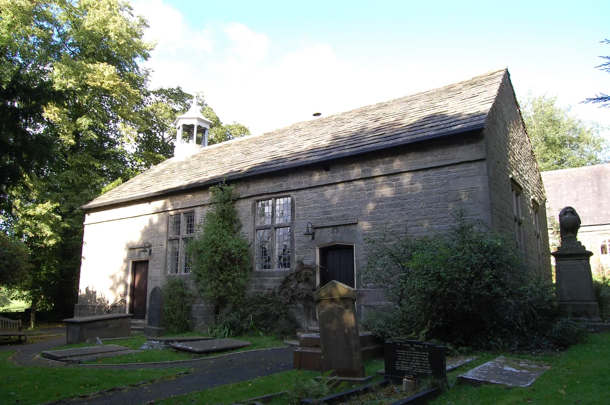
Rivington Unitarian Chapel
Historic churches · 0.1 km

Rivington Church
Historic churches · 0.1 km
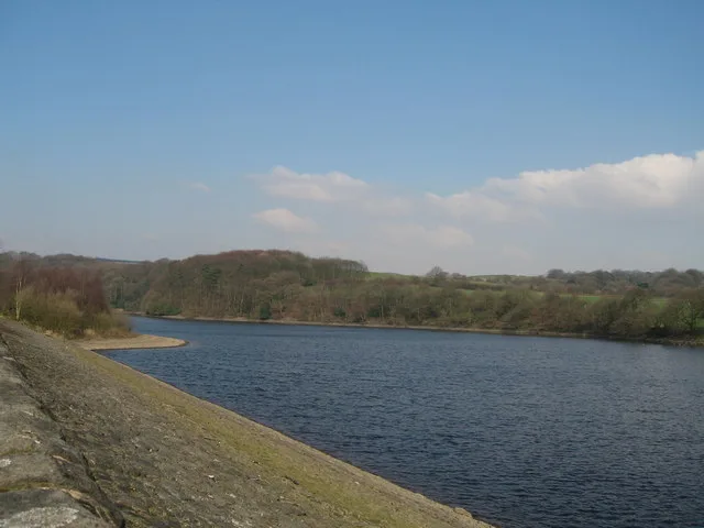
Upper Rivington Reservoir
Reservoirs & lochs · 0.6 km

Picnic Area near Go Ape
Natural landmarks · 0.7 km

Home Farm Caravan Site
Caravan parks · 0.7 km

Great House Barn
Historic houses · 0.7 km

Rivington Hall Barn
Gardens · 0.7 km

Rivington Pinetum
Natural landmarks · 0.8 km
Lower Rivington Reservoir
Reservoirs & lochs · 1.1 km

Lever Park
Parks · 1.1 km

The Street
Historic houses · 1.1 km
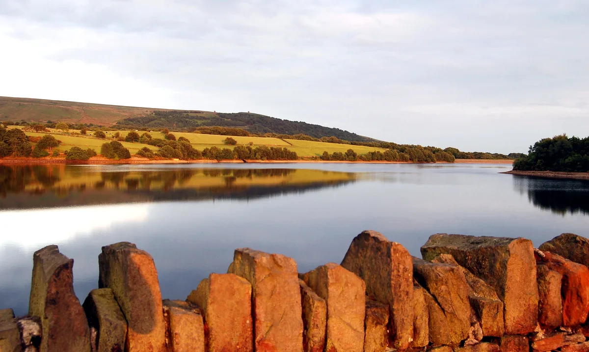
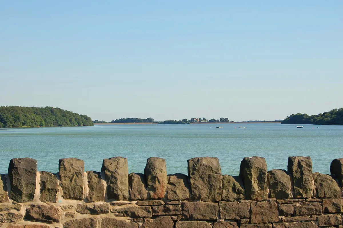
Yarrow Reservoir
Reservoirs & lochs · 1.2 km
Nearby
📷 4Historic churches · North West England
Rivington Unitarian Chapel
Rivington Unitarian Chapel — church in Rivington, Lancashire, England, UK.
📷 3Historic churches · North West England
Rivington Church
Rivington Church — church in Rivington, Lancashire, England, UK.
📷 3Reservoirs & lochs · North West England
Upper Rivington Reservoir
Upper Rivington Reservoir — reservoir in Lancashire, England, UK.
📷 3Natural landmarks · North West England
Picnic Area near Go Ape
Picnic Area near Go Ape — a other in england-north-west, United Kingdom.
📷 5Caravan parks · North West England
Home Farm Caravan Site
Home Farm Caravan Site — a caravan park in england north west.
📷 4Historic houses · North West England
Great House Barn
Great House Barn — a Grade II*-listed historic house in england-north-west, United Kingdom.
Where to eat & stay near Rivington
Places to stay
📷 5Caravan parks · North West England
Home Farm Caravan Site
Home Farm Caravan Site — a caravan park in england north west.
 📷 5
📷 5Caravan parks · North West England
Wilcocks Farm Caravan Park
Wilcocks Farm Caravan Park — a caravan park in england north west.
 📷 5
📷 5Campsites · North West England
Bibbys Farm Scout Camp
Bibbys Farm Scout Camp — a campsite in england north west.
 📷 5
📷 5Campsites · North West England
Primrose Cottage Camping
Primrose Cottage Camping — a campsite in england north west.
 📷 5
📷 5Hotels · North West England
Bolton Georgian House Hotel
Bolton Georgian House Hotel — a hotel in england north west.
 📷 7
📷 7Places to eat & drink
 📷 7
📷 7Historic pubs · North West England
Blundell Arms
Blundell Arms in England North West, United Kingdom.
 📷 5
📷 5Historic pubs · North West England
Bradley Hall Public House
Bradley Hall Public House in England North West, United Kingdom.
 📷 5
📷 5 📷 6
📷 6Historic pubs · North West England
Royal Oak Hotel
Royal Oak Hotel in England North West, United Kingdom.
 📷 7
📷 7Historic pubs · North West England
The Whitesmiths Arms
The Whitesmiths Arms in England North West, United Kingdom.
 📷 5
📷 5Historic pubs · North West England
The Pagefield Hotel
The Pagefield Hotel in England North West, United Kingdom.
More places in this region
Flagship📷 5Reservoirs & lochs · North West England
Yarrow Reservoir
Yarrow Reservoir — reservoir in Lancashire, England, UK.
.jpg?width=1200) 📷 3
📷 3Reservoirs & lochs · North West England
Abbey Village Reservoir
Abbey Village Reservoir — reservoir in Lancashire, England, UK.
 📷 3
📷 3Reservoirs & lochs · North West England
Anglezarke Reservoir
Anglezarke Reservoir — reservoir in Lancashire, England, UK.
 📷 3
📷 3Reservoirs & lochs · North West England
Ashworth Moor Reservoir
Ashworth Moor Reservoir — reservoir in Greater Manchester, England, UK.
Frequently asked questions
- Where is Rivington?
- Rivington is in Lancashire, North-West England, United Kingdom (postcode BL6 7SL), in the parish of Rivington.
- What is Rivington?
- Rivington is a village and civil parish of the Borough of Chorley, Lancashire, England, occupying 2,538 acres (4.0 sq mi; 10.3 km2). It is about 6 miles (9.7 km) southeast of Chorley and about 8+1⁄2 m
- How do I get to Rivington?
- The nearest railway station is Adlington, about 2.8 km away. Drivers can use postcode BL6 7SL.
- Is Rivington a protected site?
- Yes — Rivington is part of the West Pennine Moors SSSI Site of Special Scientific Interest.
- Is Rivington free to visit?
- Yes, Rivington is free to enter.
- How do I get to Rivington?
- The nearest railway station is Adlington, about 2.8 km away. Drivers can navigate to postcode BL6 7SL.