
Museums · Yorkshire & the Humber
River Trent
In or near Alkborough.
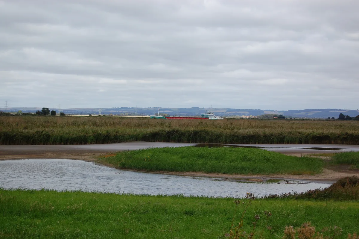
River Trent — a museum in england-yorkshire, United Kingdom.

JThomas — CC BY-SA 2.0 via Wikimedia Commons licence

Plan your visit
- Typical visit
- 1.5 h–3 h
- Best time of year
- Year-round
- Nearest railway station
- Broomfleet · 4.8 km
- Family-friendly
- Limited wheelchair access
About
River Trent is a museum in england-yorkshire, United Kingdom, listed in the Wikipedia register of British heritage and tourism sites. See the linked Wikipedia article for full details.
Photo gallery
Official information
The River Trent is a significant waterway in the UK, known for its ecological importance and historical significance. Visitors can explore various data related to river flow and hydrology through the National River Flow Archive.
Protected designations
- Site of Special Scientific Interest: Humber Estuary - 2000480 SSSI
- Ramsar wetland: Humber Estuary
Designations sourced from Natural England open data under OGL v3.
Place summary
The River Trent is a significant river located in Yorkshire. It is known for its historical importance and contributes to the region's landscape and ecology. The river has been central to various aspects of local industry and transport throughout its history.
AI-generated from the structured facts on this page (operator, designation, listing, era). Not a substitute for visiting.
Background
History
Nottingham seems to have been the ancient head of navigation until the Restoration, due partly to the difficult navigation of the Trent Bridge. Navigation was then extended to Wilden Ferry, near to the more recent Cavendish Bridge, as a result of the efforts of the Fosbrooke family of Shardlow. |}} | territorial_extent = England and Wales | royal_assent = 4 May 1699 | commencement = 6 December 1698 | repeal_date = | repealing_legislation = | related_legislation = | status = Current | original_text = https://www.british-history.ac.uk/statutes-realm/vol7/pp538-543 | collapsed = yes }} Later, in 1699, the baron William Paget (Lord Paget), who owned coal mines and land in the area, obtained an…
Description
| repeal_date = | repealing_legislation = | related_legislation = | status = Current | original_text = https://books.google.co.uk/books?id=WrmXQpgmfMAC&pg=PA318 | collapsed = yes }} The first improvement of the lower river was at Newark, where the channel splits into two. The residents of the town wanted to increase the use of the branch nearest to them, and so the (13 Geo. 3. c. 86) was obtained in December 1772 to authorise the work. Newark Navigation Commissioners were created, with powers to borrow money to fund the construction of two locks, and to charge tolls for boats using them. The work was completed by October 1773, and the separate tolls remained in force until 1783, when they…
Sourced from Wikipedia under CC BY-SA 4.0.
- Coordinates
- 53.7000, -0.7000
- District
- East Riding of Yorkshire
- Parish
- Blacktoft
- Postcode
- DN14 7YR
- Parliamentary constituency
- Goole and Pocklington
- Nearest railway station
- Broomfleet — 4.8 km
- Official site
- web.archive.org
Sources
- wikipedia: River Trent (CC BY-SA 4.0)
Other places nearby

River Ouse, Yorkshire
Museums · 0.4 km

Faxfleet
Villages · 0.8 km
Blacktoft Sands RSPB reserve
Wildlife reserves · 1.6 km

RSPB Blacktoft Sands
Forests & woodlands · 1.8 km
.jpg?width=1200)
Whitton Island
Forests & woodlands · 2.5 km
Whitton Island
Islands · 2.5 km

Julian's Bower
Archaeological sites · 2.7 km

Julian's Bower
Archaeological sites · 2.7 km

Weighton Lock
Canal locks · 2.7 km

Ousefleet
Villages · 2.7 km

Alkborough
Towns & cities · 2.8 km

College Farm Caravan Park
Caravan parks · 2.9 km
Nearby
📷 5Museums · Yorkshire & the Humber
River Ouse, Yorkshire
River Ouse, Yorkshire — a museum in england-yorkshire, United Kingdom.
📷 5📷 3Wildlife reserves · Yorkshire & the Humber
Blacktoft Sands RSPB reserve
Blacktoft Sands RSPB reserve — RSPB nature reserve in England.
📷 3Forests & woodlands · Yorkshire & the Humber
RSPB Blacktoft Sands
RSPB Blacktoft Sands is a forest or woodland in the United Kingdom.
📷 3Forests & woodlands · Yorkshire & the Humber
Whitton Island
Whitton Island is a forest or woodland in the United Kingdom.
📷 3Islands · Yorkshire & the Humber
Whitton Island
Whitton Island — island in Lincolnshire and the East Riding of Yorkshire, England, UK.
Where to eat & stay near River Trent
Places to stay
📷 5Caravan parks · Yorkshire & the Humber
College Farm Caravan Park
College Farm Caravan Park — a caravan park in england yorkshire.
 📷 5
📷 5Campsites · Yorkshire & the Humber
Whitgift Hall Caravan Site and Fishery
Whitgift Hall Caravan Site and Fishery — a campsite in england yorkshire.
 📷 5
📷 5 📷 5
📷 5Campsites · Yorkshire & the Humber
Normanby Park Camp Site
Normanby Park Camp Site — a campsite in england yorkshire.
 📷 5
📷 5 📷 5
📷 5Caravan parks · Yorkshire & the Humber
Brenda House Touring Caravan Park
Brenda House Touring Caravan Park — a caravan park in england yorkshire.
Places to eat & drink
 📷 5
📷 5Historic pubs · Yorkshire & the Humber
The Buccaneer Public House
The Buccaneer Public House in England Yorkshire, United Kingdom.
 📷 5
📷 5Historic pubs · Yorkshire & the Humber
The Cross Keys
The Cross Keys in England Yorkshire, United Kingdom.
 📷 7
📷 7Historic pubs · Yorkshire & the Humber
Fox And Coney Public House
Fox And Coney Public House in England Yorkshire, United Kingdom.
 📷 4
📷 4Historic pubs · Yorkshire & the Humber
The Royal
The Royal — Historic pub — listed building or notable heritage status.
 📷 7
📷 7Restaurants · Yorkshire & the Humber
The Lowther Hotel
The Lowther Hotel — a restaurant in england yorkshire.
 📷 7
📷 7Historic pubs · Yorkshire & the Humber
The Berkeley
The Berkeley in England Yorkshire, United Kingdom.
More museums in this region
 📷 3
📷 3Museums · Yorkshire & the Humber
Avro Heritage Museum
Avro Heritage Museum — aviation museum in England.
 📷 5
📷 5Museums · Yorkshire & the Humber
Hat Works
Hat Works — museum and former cotton mill Greater Manchester, England.
 📷 3
📷 3Museums · Yorkshire & the Humber
Anson Engine Museum
Anson Engine Museum — a museum in england-west-midlands, United Kingdom.
 📷 3
📷 3Museums · Yorkshire & the Humber
Portland Basin Museum
Portland Basin Museum — a museum in england-west-midlands, United Kingdom.
Frequently asked questions
- Where is River Trent?
- River Trent is in Yorkshire, United Kingdom (postcode DN14 7YR), in the parish of Blacktoft.
- What is River Trent?
- River Trent — a museum in england-yorkshire, United Kingdom.
- How do I get to River Trent?
- The nearest railway station is Broomfleet, about 4.8 km away. Drivers can use postcode DN14 7YR.
- Is River Trent a protected site?
- Yes — River Trent is part of the Humber Estuary - 2000480 SSSI Site of Special Scientific Interest and the Humber Estuary Ramsar wetland.
- How do I get to River Trent?
- The nearest railway station is Broomfleet, about 4.8 km away. Drivers can navigate to postcode DN14 7YR.