Beaches · Scottish Highlands
River Sgitheach
Also known as: Abhainn Sgitheach
In or near Evanton.
River Sgitheach in Scotland Islands, United Kingdom.

Karl and Ali — CC BY-SA 2.0 via Wikimedia Commons licence
Plan your visit
- Typical visit
- 1 h–3 h
- Best time of year
- Summer (Jun–Aug)
- Nearest railway station
- Alness · 5.9 km
- Free entry
- Family-friendly
- Dog-friendly
Getting there & planning your visit
To visit River Sgitheach, the nearest railway station is Alness, located 5.9 km away. Entry to the beach is free. The postcode for sat-nav is IV16 9UY.
About
River Sgitheach is a place of interest in Scotland Islands, United Kingdom — drawn from open-data sources for visitor reference. See the linked Wikipedia article for the full description.
Photo gallery
From the Wikipedia article
River Sgitheach also known as Skiach or Skiack, (Scottish Gaelic Abhainn Sgitheach, "Hawthorn River") (grid reference NH5162) is a river in Ross and Cromarty, Scotland. It rises on the southern slopes of Ben Wyvis, passes through Strath Sgitheach, passing Clare plantation, Swordale, the village of Evanton, and after about 13 miles (21 km) empties into the Cromarty Firth near the ruin of the old Kiltearn parish church. About a mile to the northeast, on the other side of Balconie Point, the Allt Graad also empties in the Firth. The ruin that lies on the beach between the two rivers is an old salmon fishing bothy of the Novar Estate. During the summer the water level falls but the river remains an obstacle and even at traditional fords it is difficulty to get across with dry feet. There are five bridges: an estate bridge in Strath Sgitheach; the B817 road bridge as the road enters Evanton; the railway bridge; the A9 main road bridge; and a wooden footbridge only 100 yards before the river meets the sea. Evanton waste water treatment plant is on the banks of the river between the A9 and the sea. The river was formerly anglicised as either "Skiach" or "Skiack", but the Gaelic spelling is used by the Ordnance Survey name and that of Highland Council. It is pronounced like SKEE-ach. The river game its name to the now-demolished Glenskiach distillery, which was near Milton of Katewell.
Excerpt from Wikipedia under CC BY-SA 4.0. See the source article linked in Sources below.
- Coordinates
- 57.6552, -4.3176
- District
- Highland
- Postcode
- IV16 9UY
- Parliamentary constituency
- Caithness, Sutherland and Easter Ross
- Nearest railway station
- Alness — 5.9 km
Sources
- wikidata: Q7337802 (CC0)
- wikipedia: River Sgitheach (CC BY-SA 4.0)
Other places nearby

Kiltearn Old Parish Church
Historic churches · 0.2 km
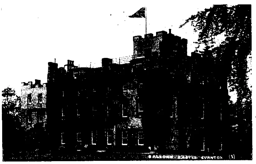
Balconie Castle
Castles · 0.6 km

Kiltearn Parish War Memorial
Memorials & monuments · 1.4 km

Evanton railway station
Heritage railway stations · 1.4 km

Kiltearn
Cemeteries · 1.4 km

HMS Fieldfare
Other places · 1.5 km

Evanton
Towns & cities · 1.5 km
Evanton Airfield Memorial
Memorials & monuments · 1.6 km

Black Rock Holiday Park
Campsites · 1.7 km

Castle Craig
Castles · 1.9 km
Castlecraig
Castles · 1.9 km
Castlecraig
Literary houses · 1.9 km
Nearby
📷 5Historic churches · Scottish Highlands
Kiltearn Old Parish Church
Kiltearn Old Parish Church — category B listed building-listed church in scotland-highlands, United Kingdom.
📷 3📷 3Memorials & monuments · Scottish Highlands
Kiltearn Parish War Memorial
Kiltearn Parish War Memorial — a memorial in scotland-highlands, United Kingdom.
📷 4Heritage railway stations · Scottish Highlands
Evanton railway station
Evanton railway station in Scotland Islands, United Kingdom.
📷 4📷 3Where to eat & stay near River Sgitheach
Places to stay
📷 5Campsites · Scottish Highlands
Black Rock Holiday Park
Black Rock Holiday Park — a campsite in scotland highlands.
 📷 5
📷 5Caravan parks · Scottish Highlands
Dingwall Camping and Caravanning Club
Dingwall Camping and Caravanning Club — a caravan park in scotland highlands.
 📷 5
📷 5Hotels · Scottish Highlands
Kincraig Castle Hotel
Kincraig Castle Hotel — a hotel in scotland highlands.
 📷 7
📷 7 📷 5
📷 5 📷 5
📷 5Campsites · Scottish Highlands
Rosemarkie Camping & Caravan Club Site
Rosemarkie Camping & Caravan Club Site — a campsite in scotland highlands.
Places to eat & drink
 📷 7
📷 7Historic pubs · Scottish Highlands
Commercial Bar, 84 High Street, Invergordon
Commercial Bar, 84 High Street, Invergordon in Scotland Highlands, United Kingdom.
 📷 5
📷 5Historic pubs · Scottish Highlands
Holly Lodge Hotel, Strathpeffer
Holly Lodge Hotel, Strathpeffer in Scotland Highlands, United Kingdom.
 📷 7
📷 7Historic pubs · Scottish Highlands
93-97 Academy Street, Inverness
93-97 Academy Street, Inverness in Scotland Highlands, United Kingdom.
 📷 5
📷 5Historic pubs · Scottish Highlands
67 Church Street, Inverness
67 Church Street, Inverness in Scotland Highlands, United Kingdom.
 📷 5
📷 5Historic pubs · Scottish Highlands
15-21 Queensgate, Inverness
15-21 Queensgate, Inverness in Scotland Highlands, United Kingdom.
 📷 7
📷 7Historic pubs · Scottish Highlands
Imperial Bar, 1-9 Academy Street, Inverness
Imperial Bar, 1-9 Academy Street, Inverness in Scotland Highlands, United Kingdom.
More beaches in this region
 📷 3
📷 3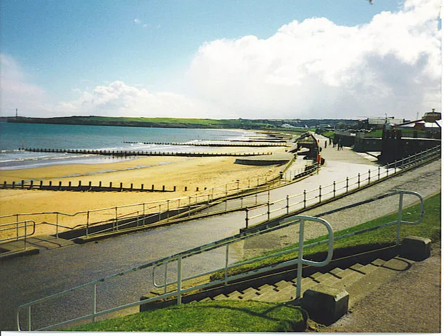 📷 3
📷 3Beaches · Scottish Highlands
Aberdeen Beach and Queens Links
Aberdeen Beach and Queens Links — beach in Aberdeen, Scotland, UK.
 📷 3
📷 3Beaches · Scottish Highlands
Achmelvich Beach
Achmelvich Beach is a beach in the United Kingdom.
 📷 3
📷 3Frequently asked questions
- Where is River Sgitheach?
- River Sgitheach is in the Scottish Highlands, United Kingdom (postcode IV16 9UY).
- What is River Sgitheach?
- River Sgitheach in Scotland Islands, United Kingdom.
- How do I get to River Sgitheach?
- The nearest railway station is Alness, about 5.9 km away. Drivers can use postcode IV16 9UY.
- Is River Sgitheach free to visit?
- Yes, River Sgitheach is free to enter.
- How do I get to River Sgitheach?
- The nearest railway station is Alness, about 5.9 km away. Drivers can navigate to postcode IV16 9UY.