
Other places · Scottish Highlands
HMS Fieldfare
In or near Evanton.
HMS Fieldfare in Scotland Islands, United Kingdom.

Julian Paren — CC BY-SA 2.0 via Wikimedia Commons licence

Plan your visit
- Typical visit
- 1 h–2 h
- Nearest railway station
- Alness · 4.6 km
Getting there & planning your visit
To visit HMS Fieldfare in the Scottish Highlands, the nearest railway station is Alness, located 4.6 km away. The postcode for sat-nav is IV16 9UH. Entry details and accessibility information are not provided.
About
HMS Fieldfare is a place of interest in Scotland Islands, United Kingdom — drawn from open-data sources for visitor reference. See the linked Wikipedia article for the full description.
Photo gallery
From the Wikipedia article
HMS Fieldfare, also known as RAF Landing Ground Novar, then RNAS Evanton and later as RAF Evanton, is a disused airfield in Ross and Cromarty, Scotland. It lies on the shore of the Cromarty Firth near the village of Evanton. In the 1934 edition of the loose-leaf publication 'The Air Pilot' (3rd edition) published by The Air Ministry the field is designated as 'R.A.F. Landing Ground (Seasonal) Novar'. The name Novar was later changed to Evanton.
Excerpt from Wikipedia under CC BY-SA 4.0. See the source article linked in Sources below.
Background
History
An airfield was established on the site in 1922 to support the Royal Navy's Home Fleet, which had one of its main bases nearby at Invergordon. (Before arriving in port, aircraft carriers must fly off their aircraft to a land base: it is difficult or impossible for fixed wing aircraft to operate from a carrier while the ship is at anchor.) Originally, the navy used a site at Delny, near Invergordon, but it could not be enlarged for larger planes. At first, the airfield was known as the Novar base, after the Novar estate which owned the land. At the time naval aviation was in the hands of "The Fleet Air Arm of the RAF" and HMS Fieldfare was serviced from RAF Leuchars. The dimensions of…
Visiting
Today the site is a large industrial estate with many of the hangars and buildings still in use today, parts of the X-shaped runways can still be seen. The site is split by the A9 trunk road and an oil pipeline company TechnipFMC has built a large Spoolbase and pier incorporating part of the runways as pipe storage racks. Some of the personnel housing is still in use since being sold by the MoD.
Sourced from Wikipedia under CC BY-SA 4.0.
- Coordinates
- 57.6670, -4.3070
- District
- Highland
- Postcode
- IV16 9UH
- Parliamentary constituency
- Caithness, Sutherland and Easter Ross
- Established
- 1922
- Nearest railway station
- Alness — 4.6 km
Sources
- wikidata: Q5632417 (CC0)
- wikipedia: HMS Fieldfare (CC BY-SA 4.0)
Other places nearby
Evanton Airfield Memorial
Memorials & monuments · 0.5 km

Evanton railway station
Heritage railway stations · 1.1 km
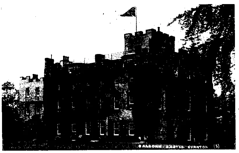
Balconie Castle
Castles · 1.2 km

River Sgitheach
Beaches · 1.5 km

Alness Bay
Natural landmarks · 1.5 km

Kiltearn Old Parish Church
Historic churches · 1.5 km

Kiltearn
Cemeteries · 1.7 km

Black Rock Holiday Park
Campsites · 1.8 km
.jpg?width=1200)
Novar House
Historic houses · 1.8 km

Evanton
Towns & cities · 1.9 km

Kiltearn Parish War Memorial
Memorials & monuments · 2.0 km

Fyrish
Historic houses · 2.7 km
Nearby
📷 3Memorials & monuments · Scottish Highlands
Evanton Airfield Memorial
Evanton Airfield Memorial — a memorial in scotland-highlands, United Kingdom.
📷 4Heritage railway stations · Scottish Highlands
Evanton railway station
Evanton railway station in Scotland Islands, United Kingdom.
📷 3📷 4Beaches · Scottish Highlands
River Sgitheach
River Sgitheach in Scotland Islands, United Kingdom.
📷 5Natural landmarks · Scottish Highlands
Alness Bay
Alness Bay — a natural feature in scotland highlands.
📷 5Historic churches · Scottish Highlands
Kiltearn Old Parish Church
Kiltearn Old Parish Church — category B listed building-listed church in scotland-highlands, United Kingdom.
Where to eat & stay near HMS Fieldfare
Places to stay
📷 5Campsites · Scottish Highlands
Black Rock Holiday Park
Black Rock Holiday Park — a campsite in scotland highlands.
 📷 5
📷 5Hotels · Scottish Highlands
Kincraig Castle Hotel
Kincraig Castle Hotel — a hotel in scotland highlands.
 📷 5
📷 5Caravan parks · Scottish Highlands
Dingwall Camping and Caravanning Club
Dingwall Camping and Caravanning Club — a caravan park in scotland highlands.
 📷 5
📷 5 📷 7
📷 7 📷 5
📷 5Campsites · Scottish Highlands
Rosemarkie Camping & Caravan Club Site
Rosemarkie Camping & Caravan Club Site — a campsite in scotland highlands.
Places to eat & drink
 📷 7
📷 7Historic pubs · Scottish Highlands
Commercial Bar, 84 High Street, Invergordon
Commercial Bar, 84 High Street, Invergordon in Scotland Highlands, United Kingdom.
 📷 5
📷 5Historic pubs · Scottish Highlands
Holly Lodge Hotel, Strathpeffer
Holly Lodge Hotel, Strathpeffer in Scotland Highlands, United Kingdom.
 📷 7
📷 7Historic pubs · Scottish Highlands
93-97 Academy Street, Inverness
93-97 Academy Street, Inverness in Scotland Highlands, United Kingdom.
 📷 5
📷 5Historic pubs · Scottish Highlands
67 Church Street, Inverness
67 Church Street, Inverness in Scotland Highlands, United Kingdom.
 📷 5
📷 5Historic pubs · Scottish Highlands
15-21 Queensgate, Inverness
15-21 Queensgate, Inverness in Scotland Highlands, United Kingdom.
 📷 7
📷 7Historic pubs · Scottish Highlands
Imperial Bar, 1-9 Academy Street, Inverness
Imperial Bar, 1-9 Academy Street, Inverness in Scotland Highlands, United Kingdom.
More places in this region
 📷 3
📷 3Other places · Scottish Highlands
The Eternal Present: Gneiss Granite Gabbro
The Eternal Present: Gneiss Granite Gabbro — Public artwork (sculpture) by Janet McEwan.
 📷 3
📷 3Other places · Scottish Highlands
The Gordon Highlanders
The Gordon Highlanders — Public artwork (statue) by Mark Richards.
 📷 4
📷 4Other places · Scottish Highlands
Central Library, Aberdeen
The Central Library is the principal public library for the city of Aberdeen, Scotland. It opened in 1892 and is operated by Aberdeen City Council as part of the Aberdeen City Libraries network.
 📷 3
📷 3Other places · Scottish Highlands
Craigendarroch Resort
The Craigendarroch Resort in Ballater, Scotland, is a resort complex close to the banks of the River Dee. It is located on a hillside just west of the village of Ballater, 42 miles west of Aberdeen an
Frequently asked questions
- Where is HMS Fieldfare?
- HMS Fieldfare is in the Scottish Highlands, United Kingdom (postcode IV16 9UH).
- What is HMS Fieldfare?
- HMS Fieldfare in Scotland Islands, United Kingdom.
- How do I get to HMS Fieldfare?
- The nearest railway station is Alness, about 4.6 km away. Drivers can use postcode IV16 9UH.
- When was HMS Fieldfare built?
- Built or established in 1922.
- Who owns HMS Fieldfare?
- HMS Fieldfare is owned by Royal Navy 1944-48<br />Royal Air Force.
- How do I get to HMS Fieldfare?
- The nearest railway station is Alness, about 4.6 km away. Drivers can navigate to postcode IV16 9UH.