Reservoirs & lochs · Scottish Highlands
River Meig
In or near Strathpeffer.
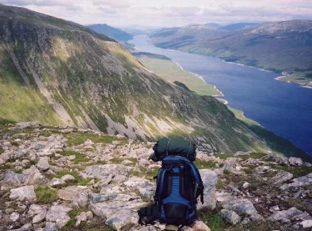
River Meig in Scotland Islands, United Kingdom.

Dave Fergusson — CC BY-SA 2.0 via Wikimedia Commons licence
Plan your visit
- Typical visit
- 1 h–2.5 h
- Nearest railway station
- Garve · 4.8 km
- Free entry
- Dog-friendly
Getting there & planning your visit
To visit River Meig, the nearest railway station is Garve, located 4.8 km away. The postcode for sat-nav is IV6 7QG, and entry to the reservoir is free. Accessibility details are not provided.
About
River Meig is a place of interest in Scotland Islands, United Kingdom — drawn from open-data sources for visitor reference. See the linked Wikipedia article for the full description.
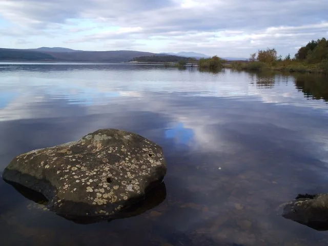
Photo gallery
From the Wikipedia article
The River Meig (Scottish Gaelic: Mìg) is a river in Easter Ross. It draws its source from the meeting of several allts in the forested hills north of Loch Monar, before flowing northeast through Loch Beannacharain and Loch Meig, before joining the River Conon at the small settlement of Little Scatwell, 2 km south of Loch Luichart. It drains into the Cromarty Firth on the east coast. The name of the river derives from an Old Gaelic root, minc, with cognates in Latin, Old Welsh, and Old English. It roughly translates to "pouring forth". Meig Dam was constructed on the River Meig in 1957 as part of the Conon Hydro Scheme, one of a series of post-war infrastructure projects led by the North of Scotland Hydro-Electric Board (NoSHEB). This led to the formation of a reservoir named after the river, Loch Meig. North of the river near the settlement of Scardroy is a memorial cairn from the late-20th century dedicated to a 'Colin Grant Sangster, 1930–1994'. Downstream of Loch Meig is Meig Gorge (Am Mòr-Ghil Mhìg), a popular location for local kayakers. The gorge is best kayaked in dry weather thanks to compensation flow from the nearby dam; it is potentially too dangerous after heavy rainfall. The main drop in the gorge is colloquially known as "Tea Cup Falls".
Excerpt from Wikipedia under CC BY-SA 4.0. See the source article linked in Sources below.
- Coordinates
- 57.5697, -4.6821
- District
- Highland
- Postcode
- IV6 7QG
- Parliamentary constituency
- Caithness, Sutherland and Easter Ross
- Nearest railway station
- Garve — 4.8 km
Sources
- wikidata: Q24639478 (CC0)
- wikipedia: River Meig (CC BY-SA 4.0)
Other places nearby

Falls of Conon
Waterfalls · 0.3 km

Carn na Buaile
Vineyards · 1.5 km

Carn na Buaile
Archaeological sites · 1.5 km

Great North Trail (Northern Highlands)
Mountain bike trails · 1.6 km
Falls of Conon
Waterfalls · 1.7 km

Loch Garve
Lakes · 1.8 km

Glenmarskie
Vineyards · 2.2 km

Torr a' Bhealaidh
Mountains & hills · 2.4 km
Creag a' Chaoruinn
Mountains & hills · 2.4 km
Creag a' Chaoruinn
Mountains & hills · 2.4 km

Carn Faire nan Con
Mountains & hills · 2.7 km
Càrn Faire nan Con
Mountains & hills · 2.7 km
Nearby
📷 5📷 2Vineyards · Scottish Highlands
Carn na Buaile
Carn na Buaile — a UK vineyard in scotland highlands, producing English or Welsh wine from cool-climate grape varieties.
📷 2Archaeological sites · Scottish Highlands
Carn na Buaile
Carn na Buaile — a archaeological in scotland-highlands, United Kingdom.
📷 2Mountain bike trails · Scottish Highlands
Great North Trail (Northern Highlands)
Great North Trail (Northern Highlands) — a mtb trail in scotland highlands.
📷 5Where to eat & stay near River Meig
Places to stay
 📷 5
📷 5Campsites · Scottish Highlands
Riverside Campsite
Riverside Campsite — a campsite in scotland highlands.
 📷 5
📷 5Hostels · Scottish Highlands
Fairburn Activity Centre
Fairburn Activity Centre — a hostel in scotland highlands.
 📷 5
📷 5B&Bs · Scottish Highlands
Holly Lodge
Holly Lodge — a bed-and-breakfast in scotland highlands.
 📷 5
📷 5 📷 7
📷 7 📷 7
📷 7Hotels · Scottish Highlands
The Cnoc Hotel
The Cnoc Hotel — a hotel in scotland highlands.
Places to eat & drink
📷 5Historic pubs · Scottish Highlands
Holly Lodge Hotel, Strathpeffer
Holly Lodge Hotel, Strathpeffer in Scotland Highlands, United Kingdom.
More places in this region
 Flagship📷 3
Reservoirs & lochs · Scottish Highlands
Loch Ericht
Loch Ericht — lake in Perth and Kinross, and Highland, Scotland, UK, outflows to River Ericht.
 Flagship📷 3
Reservoirs & lochs · Scottish Highlands
Loch Shin
Loch Shin — reservoir in Highland, Scotland, UK, outflows to the River Shin.
 📷 4
📷 4Reservoirs & lochs · Scottish Highlands
Backwater Reservoir
Backwater Reservoir — lake in Angus, Scotland, UK.
 📷 3
📷 3Reservoirs & lochs · Scottish Highlands
Blackwater Reservoir
Blackwater Reservoir — reservoir in Highland, Scotland, UK, outflows to the River Leven.
Frequently asked questions
- Where is River Meig?
- River Meig is in the Scottish Highlands, United Kingdom (postcode IV6 7QG).
- What is River Meig?
- River Meig in Scotland Islands, United Kingdom.
- How do I get to River Meig?
- The nearest railway station is Garve, about 4.8 km away. Drivers can use postcode IV6 7QG.
- Is River Meig free to visit?
- Yes, River Meig is free to enter.
- How do I get to River Meig?
- The nearest railway station is Garve, about 4.8 km away. Drivers can navigate to postcode IV6 7QG.