Museums · North West England
River Hodder
In or near Whalley.
The River Hodder is in Lancashire, England. It is a County Biological Heritage Site. It rises on White Hill and flows for approximately 23 miles to the River Ribble, of which it is the largest tributa

Alexander P Kapp — CC BY-SA 2.0 via Wikimedia Commons licence
Plan your visit
- Typical visit
- 1.5 h–3 h
- Best time of year
- Year-round
- Nearest railway station
- Whalley · 1.0 km
- Family-friendly
- Limited wheelchair access
Getting there & planning your visit
To visit the River Hodder, the nearest railway station is Whalley, located approximately 1 km away. The postcode for sat-nav is BB7 9GQ. Please note that wheelchair accessibility is limited.
About
The River Hodder is in Lancashire, England. It is a County Biological Heritage Site. It rises on White Hill and flows for approximately 23 miles to the River Ribble, of which it is the largest tributary. The Hodder drains much of the Forest of Bowland Area of Outstanding Natural Beauty and all but the last mile of its course is through this scenic area. The upper reaches of the river feed the large Stocks Reservoir, which provides water supply to the Fylde coast. After exiting the reservoir, the Hodder continues in a general southward direction. It collects many tributaries from the valleys of Bowland and, lower down, parts of the Ribble Valley. Most notable among the feeders of the Hodder are Croasdale Brook, Easington Brook, the River Dunsop, Langden Brook and the River Loud. Much of the land in the Hodder Valley further to the north is owned by the Crown as Duke of Lancaster, whilst further down, farming land on the Stonyhurst Estate is owned by Stonyhurst College and the Jesuits. The river runs close to the College and passes adjacent to the former preparatory school, Hodder Place. The river lends its name to the pre-preparatory department at Stonyhurst, "Hodder House" and also years three to five known collectively as "Hodder Playroom". The River Hodder eventually joins the River Ribble near Great Mitton, close to the River Calder. The relief of the river starts over 400 m above sea level and within a distance of 15 km it drops to 99 m above sea level. The Lower Hodder m
Photo gallery
Protected designations
- Area of Outstanding Natural Beauty: Forest Of Bowland
Designations sourced from Natural England open data under OGL v3.
From the Wikipedia article
The River Hodder is in Lancashire, England. It is a County Biological Heritage Site. It rises on White Hill and flows for approximately 23 miles to the River Ribble, of which it is the largest tributary. The Hodder drains much of the Forest of Bowland Area of Outstanding Natural Beauty and all but the last mile of its course is through this scenic area. The upper reaches of the river feed the large Stocks Reservoir, which provides water supply to the Fylde coast. After exiting the reservoir, the Hodder continues in a general southward direction. It collects many tributaries from the valleys of Bowland and, lower down, parts of the Ribble Valley. Most notable among the feeders of the Hodder are Croasdale Brook, Easington Brook, the River Dunsop, Langden Brook and the River Loud. Much of the land in the Hodder Valley further to the north is owned by the Crown as Duke of Lancaster, whilst further down, farming land on the Stonyhurst Estate is owned by Stonyhurst College and the Jesuits. The river runs close to the College and passes adjacent to the former preparatory school, Hodder Place. The river lends its name to the pre-preparatory department at Stonyhurst, "Hodder House" and also years three to five known collectively as "Hodder Playroom". The River Hodder eventually joins the River Ribble near Great Mitton, close to the River Calder. The relief of the river starts over 400 m above sea level and within a distance of 15 km it drops to 99 m above sea level. The Lower Hodder marks the historical county boundary between Lancashire and the West Riding of Yorkshire. It formed an important early feature in the development of the ancient Lordship of Bowland.
Excerpt from Wikipedia under CC BY-SA 4.0. See the source article linked in Sources below.
- Coordinates
- 53.8333, -2.4167
- County
- Lancashire
- District
- Ribble Valley
- Parish
- Whalley
- Postcode
- BB7 9GQ
- Parliamentary constituency
- Ribble Valley
- Nearest railway station
- Whalley — 1 km
Sources
- wikipedia: River Hodder (CC BY-SA 4.0)
Other places nearby
Great Britain
Islands · 0.0 km

Calderstones Bell
Memorials & monuments · 0.4 km

Forge Corner
Memorials & monuments · 1.3 km

Whalley War Memorial
Memorials & monuments · 1.3 km

Whalley
Towns & cities · 1.3 km
Church of St Mary and All Saints, Whalley
Historic churches · 1.5 km

Wiswell Shay Farm CC Site
Campsites · 1.5 km

Whalley Cistercian abbey
Abbeys & priories · 1.5 km
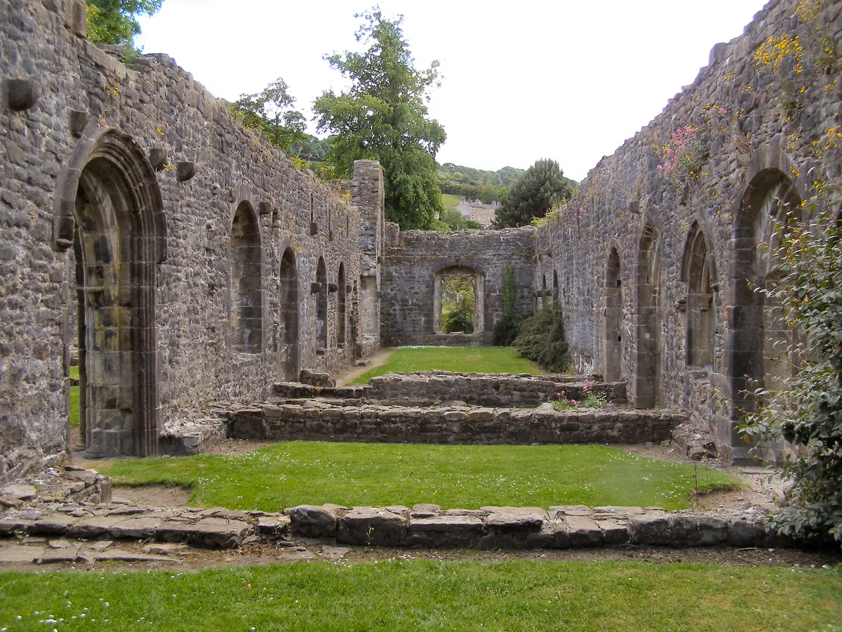
Whalley Abbey
Abbeys & priories · 1.5 km
Whalley Abbey
Cathedrals · 1.5 km

River Calder, Lancashire
Museums · 1.6 km

Mitton Bridge
Historic bridges · 1.6 km
Nearby
Flagship📷 3Islands · North West England
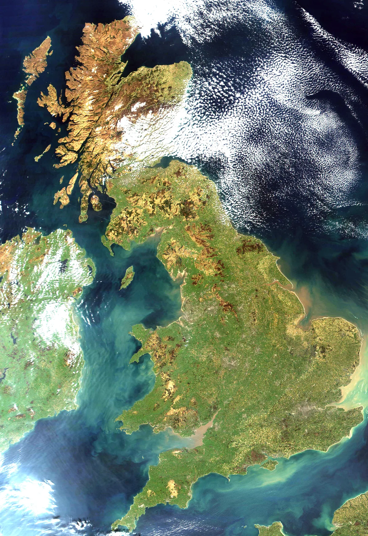
Great Britain
Great Britain — island in the North Atlantic Ocean off the northwest coast of continental Europe.
📷 3Memorials & monuments · North West England
Calderstones Bell
Calderstones Bell — a memorial in england-north-west, United Kingdom.
📷 3Memorials & monuments · North West England
Forge Corner
Forge Corner — a memorial in england-north-west, United Kingdom.
📷 3Memorials & monuments · North West England
Whalley War Memorial
Whalley War Memorial — Grade II listed building-listed memorial in england-north-west, United Kingdom.
Flagship📷 5Towns & cities · North West England
Whalley
Whalley — village and civil parish in Ribble Valley, Lancashire, UK.
📷 3Historic churches · North West England
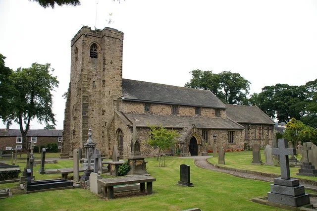
Church of St Mary and All Saints, Whalley
Church of St Mary and All Saints, Whalley — Grade I listed church in Whalley, Ribble Valley, Lancashire, England, UK.
Where to eat & stay near River Hodder
Places to stay
📷 5Campsites · North West England
Wiswell Shay Farm CC Site
Wiswell Shay Farm CC Site — a campsite in england north west.
 📷 5
📷 5 📷 5
📷 5 📷 5
📷 5Caravan parks · North West England
Clitheroe Camping and Caravanning Club Site
Clitheroe Camping and Caravanning Club Site — a caravan park in england north west.
📷 5Campsites · North West England
Clitheroe Camping & Caravanning Club
Clitheroe Camping & Caravanning Club — a campsite in england north west.
 📷 5
📷 5Campsites · North West England
Bowley International Scout Centre
Bowley International Scout Centre — a campsite in england north west.
Places to eat & drink
 📷 5
📷 5Restaurants · North West England
The Three Fishes
The Three Fishes — a restaurant in england north west.
 📷 5
📷 5Historic pubs · North West England
Swan with Two Necks
Swan with Two Necks in England North West, United Kingdom.
 📷 5
📷 5 📷 5
📷 5 📷 5📷 5
Restaurants · North West England
Fence Gate Inn
Fence Gate Inn — a restaurant in england north west.
More museums in this region
 📷 3
📷 3Museums · North West England
Cube Gallery
Cube Gallery — former architecture museum in Manchester, England.
 📷 3
📷 3Museums · North West England
Cuckooland Museum
Cuckooland Museum — horological museum in England, UK.
 📷 4
📷 4Museums · North West England
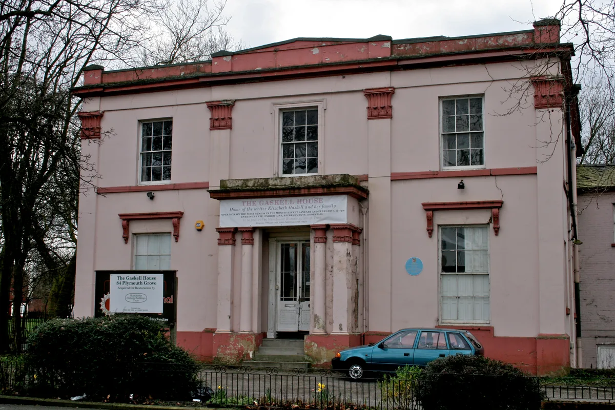
Elizabeth Gaskell's House
Elizabeth Gaskell's House — museum in Manchester.
 📷 3
📷 3Museums · North West England
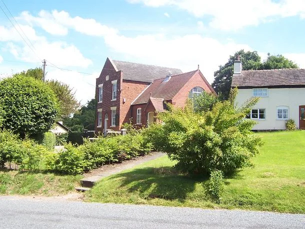
Englesea Brook Chapel and Museum of Primitive Methodism
Englesea Brook Chapel and Museum of Primitive Methodism — Primitive Methodist chapel and museum, United Kingdom.
Frequently asked questions
- Where is River Hodder?
- River Hodder is in Lancashire, North-West England, United Kingdom (postcode BB7 9GQ), in the parish of Whalley.
- What is River Hodder?
- The River Hodder is in Lancashire, England. It is a County Biological Heritage Site. It rises on White Hill and flows for approximately 23 miles to the River Ribble, of which it is the largest tributa
- How do I get to River Hodder?
- The nearest railway station is Whalley, about 1.0 km away. Drivers can use postcode BB7 9GQ.
- Is River Hodder a protected site?
- Yes — River Hodder is part of the Forest Of Bowland National Landscape (AONB).
- How do I get to River Hodder?
- The nearest railway station is Whalley, about 1.0 km away. Drivers can navigate to postcode BB7 9GQ.