Castles · South West England
River Frome, Stroud
In or near Eastington.
The River Frome, once also known as the Stroudwater, is a small river in Gloucestershire, England. It is to be distinguished from another River Frome in Gloucestershire, the Bristol Frome, and the ne

Dr Duncan Pepper — CC BY-SA 2.0 via Wikimedia Commons licence
Plan your visit
- Typical visit
- 1.5 h–3 h
- Nearest railway station
- Stonehouse · 7.7 km
- Family-friendly
- Limited wheelchair access
Getting there & planning your visit
To visit River Frome in Stroud, the nearest railway station is Stonehouse, which is 7.7 km away. The postcode for navigation is GL2 7LJ. Accessibility is limited for wheelchair users.
About
The River Frome, once also known as the Stroudwater, is a small river in Gloucestershire, England. It is to be distinguished from another River Frome in Gloucestershire, the Bristol Frome, and the nearby River Frome, Herefordshire. The river is approximately 25 miles (40 km) long. It flows broadly westwards, from its source high up on the Cotswold escarpment, initially through a narrow, steep-sided valley, which it shares with the Thames and Severn Canal and the Golden Valley line railway. Below Stroud, the main town on the river, it is swelled by flows from several tributaries, and the valley opens out, with the channel splitting into two before reuniting into a single channel. The river, as well as its tributaries, has been used for milling since the time of the Domesday Book. Some early mills were used for milling corn but subsequently the river was important for the woollen industry, until that experienced a series of depressions in the early 19th century. The area then became known for the production of walking sticks and umbrella sticks, an industry that lasted into the mid-20th century. Steam engines were installed from the 1810s onwards, but were often used to assist when water power was insufficient, rather than to replace water power. Despite the demise of milling, many mill buildings survive along the course of the river, a significant number of which are listed buildings, in recognition of their architecture. The river has undergone modification over the years,
Photo gallery
Protected designations
- Area of Outstanding Natural Beauty: Cotswolds
Designations sourced from Natural England open data under OGL v3.
From the Wikipedia article
The River Frome, once also known as the Stroudwater, is a small river in Gloucestershire, England. It is to be distinguished from another River Frome in Gloucestershire, the Bristol Frome, and the nearby River Frome, Herefordshire. The river is approximately 25 miles (40 km) long. It flows broadly westwards, from its source high up on the Cotswold escarpment, initially through a narrow, steep-sided valley, which it shares with the Thames and Severn Canal and the Golden Valley line railway. Below Stroud, the main town on the river, it is swelled by flows from several tributaries, and the valley opens out, with the channel splitting into two before reuniting into a single channel. The river, as well as its tributaries, has been used for milling since the time of the Domesday Book. Some early mills were used for milling corn but subsequently the river was important for the woollen industry, until that experienced a series of depressions in the early 19th century. The area then became known for the production of walking sticks and umbrella sticks, an industry that lasted into the mid-20th century. Steam engines were installed from the 1810s onwards, but were often used to assist when water power was insufficient, rather than to replace water power. Despite the demise of milling, many mill buildings survive along the course of the river, a significant number of which are listed buildings, in recognition of their architecture. The river has undergone modification over the years, not least to power the mills. There was an early attempt to make it navigable as far as Stroud, using cranes to move containers from boats at one level to those at another level, at places where a mill dam prevented through navigation. The scheme was abandoned before it was completed, due to the cost of construction and the time taken to tranship the containers. Communication was later provided by the Stroudwater Navigation, a separate canal which followed the route of the river from the River S
Excerpt from Wikipedia under CC BY-SA 4.0. See the source article linked in Sources below.
- Coordinates
- 51.7927, -2.3613
- County
- Gloucestershire
- District
- Stroud
- Parish
- Fretherne with Saul
- Postcode
- GL2 7LJ
- Parliamentary constituency
- Stroud
- Nearest railway station
- Stonehouse — 7.7 km
Sources
- wikipedia: River Frome, Stroud (CC BY-SA 4.0)
Other places nearby

Framilode
Villages · 0.8 km

Two Unidentified Monuments, Immediately West Of South Porch In Churchyard Of Church Of St James
Memorials & monuments · 1.2 km
Whitminster Church
Historic churches · 1.7 km

Barrow Hill
Mountains & hills · 2.2 km

Fretherne War Memorial
Memorials & monuments · 2.2 km

Unidentified Monument In The Churchyard Approximately 1 Metres South Of Monument To John Howsen To South-West Of Church Of St Lawrence
Memorials & monuments · 2.2 km
Pack Monument In The Churchyard Approximately 3 Metres West Of Monument To Sarah Howsen West Of Church Of St Lawrence
Memorials & monuments · 2.2 km
Unidentified Monument In The Churchyard Approximately 1.5 Metres South Of Dyer Monument To South Of South Porch To Church Of St Lawrence
Memorials & monuments · 2.3 km
Yealfe Monument In The Churchyard Approximately 6 Metres South West Of South Porch To Church Of St Lawrence
Memorials & monuments · 2.3 km
Dyer Monument In The Churchyard Approximately 6 Metres South Of South Porch To Church Of St Lawrence
Memorials & monuments · 2.3 km
Sims Monument In The Churchyard Approximately 2 Metres South East Of Dyer Monument To South Of South Porch To Church Of St Lawrence
Memorials & monuments · 2.3 km
Monument To Thomas Heywood In The Churchyard Approximately 3 Metres North East Of Dyer Monument To South Of South Porch To Church Of St Lawrence
Memorials & monuments · 2.3 km
Nearby
📷 5📷 3Memorials & monuments · South West England
Two Unidentified Monuments, Immediately West Of South Porch In Churchyard Of Church Of St James
Two Unidentified Monuments, Immediately West Of South Porch In Churchyard Of Church Of St James — Grade II listed building-listed memorial in england-west-midlands, United Kingdom.
📷 3Historic churches · South West England
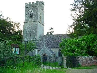
Whitminster Church
Whitminster Church — church in Whitminster, Stroud, Gloucestershire, England, UK.
📷 5Mountains & hills · South West England
Barrow Hill
Barrow Hill — a hill or mountain in england west midlands.
📷 3Memorials & monuments · South West England
Fretherne War Memorial
Fretherne War Memorial — Grade II listed building-listed memorial in england-west-midlands, United Kingdom.
📷 3Memorials & monuments · South West England
Unidentified Monument In The Churchyard Approximately 1 Metres South Of Monument To John Howsen To South-West Of Church Of St Lawrence
Unidentified Monument In The Churchyard Approximately 1 Metres South Of Monument To John Howsen To South-West Of Church Of St Lawrence — Grade II listed building-listed memorial in england-west-midlan
Where to eat & stay near River Frome, Stroud
Places to stay
 📷 7
📷 7 📷 5
📷 5Campsites · South West England
Gables Farm Caravan and Camping
Gables Farm Caravan and Camping — a campsite in england west midlands.
 📷 5
📷 5Caravan parks · South West England
Fromebridge Mill
Fromebridge Mill — a caravan park in england west midlands.
 📷 5📷 5
Caravan parks · South West England
Apple Tree Park
Apple Tree Park — a caravan park in england west midlands.
 📷 5
📷 5Campsites · South West England
Severn Valley Touring Caravan and Camping
Severn Valley Touring Caravan and Camping — a campsite in england west midlands.
Places to eat & drink
 📷 5
📷 5Historic pubs · South West England
The Red Hart (Public House)
The Red Hart (Public House) in England South East, United Kingdom.
 📷 7
📷 7Cafés · South West England
The Lazy Goose
The Lazy Goose — a café in england west midlands.
 📷 5
📷 5Historic pubs · South West England
The White Lion
The White Lion in England South East, United Kingdom.
 📷 5
📷 5Historic pubs · South West England
Berkeley Arms, Purton
Berkeley Arms, Purton in England South East, United Kingdom.
 📷 6
📷 6Historic pubs · South West England
The Yew Tree (Public House)
The Yew Tree (Public House) in England South East, United Kingdom.
 📷 7
📷 7Historic pubs · South West England
King's Head Hotel
King's Head Hotel in England South East, United Kingdom.
More castles in this region
 Flagship📷 10
Castles · South West England
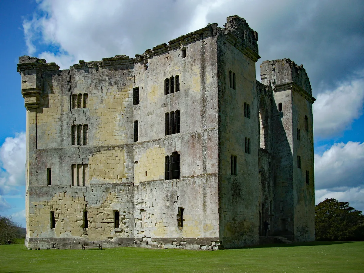
Old Wardour Castle
Old Wardour Castle — Grade I listed castle in Wardour, Wiltshire, England, UK.
 📷 5
📷 5Castles · South West England
Ballands Castle
Ballands Castle — former castle in Somerset, England, UK.
 📷 5
📷 5Castles · South West England
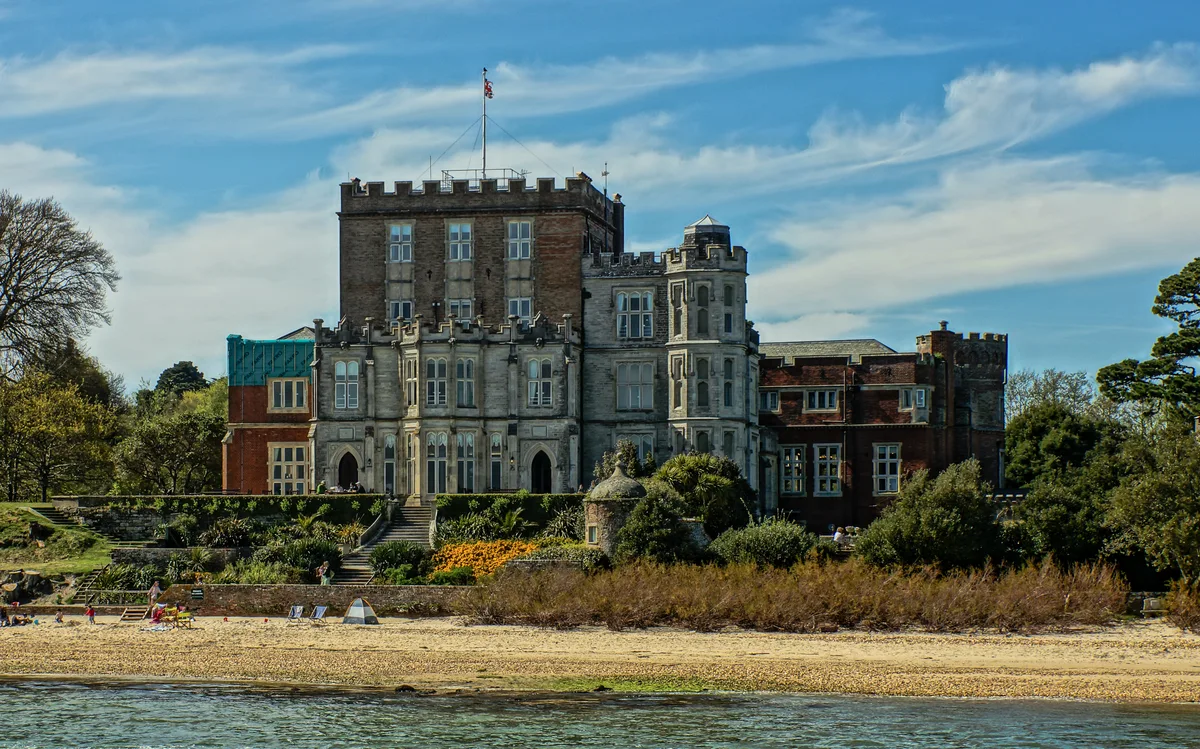
Brownsea Castle
Brownsea Castle — grade II listed Device Fort in Purbeck, United Kingdom.
 📷 5
📷 5Castles · South West England
Castle Hill
Castle Hill — castle in Mere, Wiltshire.
Frequently asked questions
- Where is River Frome, Stroud?
- River Frome, Stroud is in Gloucestershire, the West Midlands, United Kingdom (postcode GL2 7LJ), in the parish of Fretherne with Saul.
- What is River Frome, Stroud?
- The River Frome, once also known as the Stroudwater, is a small river in Gloucestershire, England. It is to be distinguished from another River Frome in Gloucestershire, the Bristol Frome, and the ne
- How do I get to River Frome, Stroud?
- The nearest railway station is Stonehouse, about 7.7 km away. Drivers can use postcode GL2 7LJ.
- Is River Frome, Stroud a protected site?
- Yes — River Frome, Stroud is part of the Cotswolds National Landscape (AONB).
- Does River Frome, Stroud charge admission?
- River Frome, Stroud typically charges admission. Check the official site for current ticket prices and opening hours.
- How do I get to River Frome, Stroud?
- The nearest railway station is Stonehouse, about 7.7 km away. Drivers can navigate to postcode GL2 7LJ.