
Museums · South West England
River Frome, Bristol
In or near Bristol.
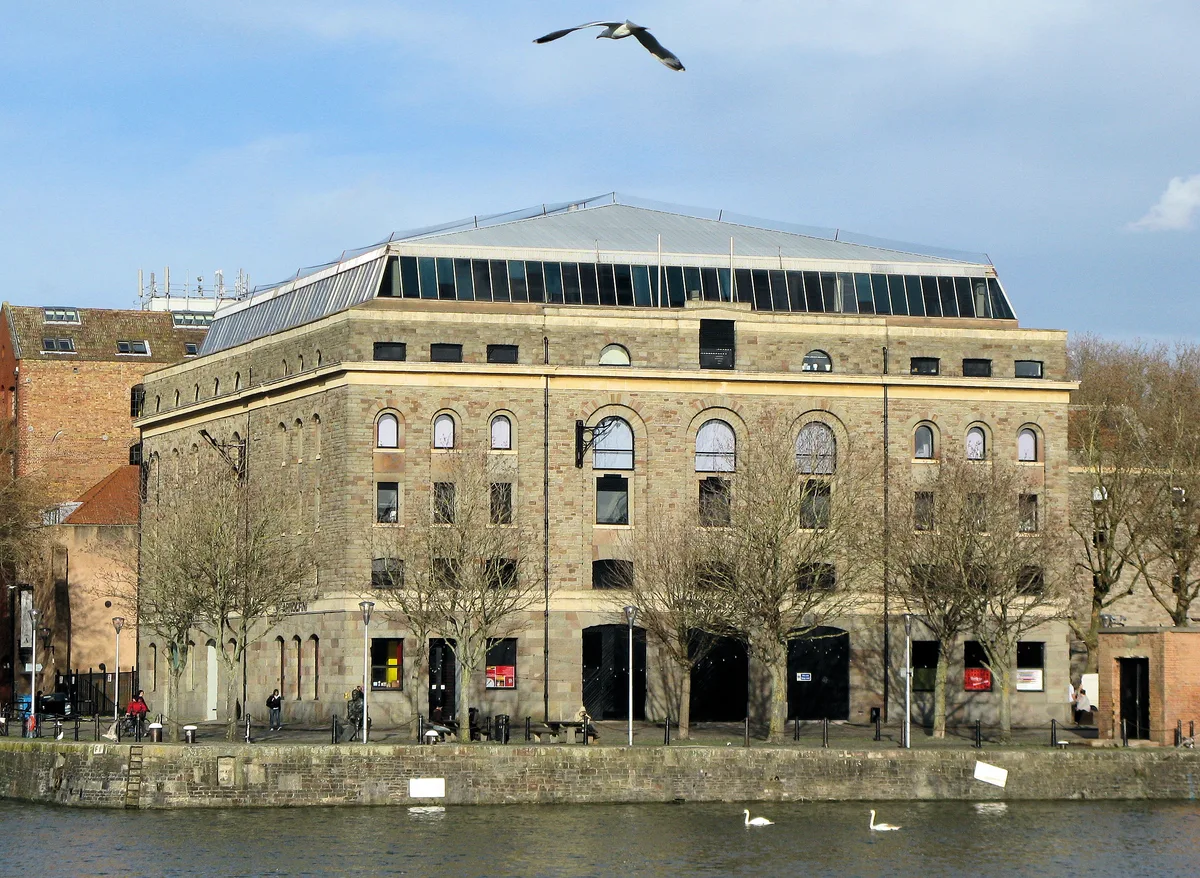
The Frome , historically the Froom, is a river that rises in Dodington Park, South Gloucestershire and flows southwesterly through Bristol to join the river Avon. It is approximately 20 miles (32 km)

Neil Owen — CC BY-SA 2.0 via Wikimedia Commons licence

Plan your visit
- Typical visit
- 1.5 h–3 h
- Best time of year
- Year-round
- Nearest railway station
- Princes Wharf · 0.1 km
- Family-friendly
- Limited wheelchair access
About
The Frome , historically the Froom, is a river that rises in Dodington Park, South Gloucestershire and flows southwesterly through Bristol to join the river Avon. It is approximately 20 miles (32 km) long, and the mean flow at Frenchay is 60 cubic feet per second (1.7 m3/s). The name Frome is shared with several other rivers in South West England and means 'fair, fine, brisk'. The river is known locally in east Bristol as the Danny. As with many urban rivers, the Frome has suffered from pollution, but several stretches run through parks and reserves that sustain a range of wildlife. The river's power was harnessed by many watermills, and the river mouth area was developed as shipyards by the eighteenth century. As the city of Bristol developed in the nineteenth and twentieth centuries, flooding became a major problem, remedied by the construction of storm drains and diversions.
Photo gallery
360° viewimagery from 2023
Imagery © Mapillary contributors, CC BY-SA 4.0
Protected designations
- Site of Special Scientific Interest: Severn Estuary SSSI
Designations sourced from Natural England open data under OGL v3.
From the Wikipedia article
The Frome , historically the Froom, is a river that rises in Dodington Park, South Gloucestershire and flows southwesterly through Bristol to join the river Avon. It is approximately 20 miles (32 km) long, and the mean flow at Frenchay is 60 cubic feet per second (1.7 m3/s). The name Frome is shared with several other rivers in South West England and means 'fair, fine, brisk'. The river is known locally in east Bristol as the Danny. As with many urban rivers, the Frome has suffered from pollution, but several stretches run through parks and reserves that sustain a range of wildlife. The river's power was harnessed by many watermills, and the river mouth area was developed as shipyards by the eighteenth century. As the city of Bristol developed in the nineteenth and twentieth centuries, flooding became a major problem, remedied by the construction of storm drains and diversions.
Excerpt from Wikipedia under CC BY-SA 4.0. See the source article linked in Sources below.
Background
History
showing the original path of the Frome. Samuel Seyer believed it flowed farther south (the white dashed line)]] Between Frenchay and Stapleton the river drops nearly 50 ft, and as a result there a number of corn and other mills were established to harness the water power. They were undershot mills with no mill ponds. Today a wheel at Snuff Mills is preserved and the mill buildings of Cleeve Mill survive as a private residence. The Frome originally flowed east of its present-day course from Stone Bridge (now under the paved concourse at the "bow" of Electricity House) with a probable moat along the line of St Stephen's Street (formerly called Fisher Lane and Pylle End) and the old curving…
Sourced from Wikipedia under CC BY-SA 4.0.
- Coordinates
- 51.4489, -2.5983
- District
- Bristol, City of
- Parish
- Bristol, City of, unparished area
- Postcode
- BS1 5EP
- Parliamentary constituency
- Bristol Central
- Nearest railway station
- Princes Wharf — 0.1 km
- Opening
- Fr,Sa 10:00-17:00
- Official site
- www.patreon.com
Sources
- wikipedia: River Frome, Bristol (CC BY-SA 4.0)
Other places nearby

John Cabot
Public art & sculpture · 0.0 km

Jonny Writes Words
Public art & sculpture · 0.1 km
Arnolfini
Galleries · 0.1 km

Arnolfini
Theatres · 0.1 km

Fire-float Pyronaut
Harbours & ports · 0.1 km

John King
Natural landmarks · 0.1 km
.jpg?width=1200)
Prince Street Bridge
Historic bridges · 0.1 km

Prince Street Bridge Engine House And Accumulator Tower
Historic bridges · 0.1 km

The Beaufort Lodge of Freemasons
Memorials & monuments · 0.1 km

YHA Bristol
Hostels · 0.1 km

Pyronaut
Natural landmarks · 0.1 km

Bill and Bob
Public art & sculpture · 0.1 km
Nearby
📷 4Public art & sculpture · South West England
John Cabot
John Cabot — a public art in england-south-west, United Kingdom.
📷 3Public art & sculpture · South West England
Jonny Writes Words
Jonny Writes Words — a public art in england-south-west, United Kingdom.
📷 5Galleries · South West England
Arnolfini
Arnolfini — arts centre and gallery in Bristol, UK.
📷 5Theatres · South West England
Arnolfini
Arnolfini in Wales South, United Kingdom.
📷 5Harbours & ports · South West England
Fire-float Pyronaut
Pyronaut (originally Bristol Phoenix II) is a specialised form of fireboat known as a fire-float. It was built in 1934 by Charles Hill & Sons Ltd., Albion Dock Bristol, Yard No. 208. Registered number
📷 3Natural landmarks · South West England
John King
John King — a other in england-south-west, United Kingdom.
Where to eat & stay near River Frome, Bristol
Places to stay
📷 5Hostels · South West England
YHA Bristol
YHA Bristol — a hostel in england south west.
 📷 5
📷 5Hostels · South West England
Harbourside Hostel Bristol
Harbourside Hostel Bristol — a hostel in england south west.
 📷 5
📷 5Hotels · South West England
The Bristol Hotel
The Bristol Hotel — a hotel in england south west.
 📷 5
📷 5Hotels · South West England
Ibis Bristol Centre
Ibis Bristol Centre — a hotel in wales south.
 📷 7
📷 7Hotels · South West England
Bristol Marriott Royal Hotel
Bristol Marriott Royal Hotel — a hotel in england south west.
 📷 5
📷 5Hotels · South West England
Radisson Hotel Blu
Radisson Hotel Blu — a hotel in england south west.
Places to eat & drink
 📷 7
📷 7Restaurants · South West England
Za Za Bazaar
Za Za Bazaar — a restaurant in england south west. Cuisine: regional. Brand: Za Za Bazaar.
 📷 5
📷 5Cafés · South West England
Mud Dock Cafe
Mud Dock Cafe — a café in england south west.
 📷 5
📷 5Historic pubs · South West England
The Louisiana Public House
The Louisiana Public House in Wales South, United Kingdom.
 📷 5
📷 5 📷 5
📷 5Restaurants · South West England
Harbour House
Harbour House — a restaurant in england south west.
 📷 5
📷 5Historic pubs · South West England
smallBAR
smallBAR — Historic pub — listed building or notable heritage status.
More museums in this region
 📷 5
📷 5Museums · South West England
Alexander Keiller Museum
Alexander Keiller Museum — museum in South West England, United Kingdom.
 📷 5
📷 5Museums · South West England
American Museum and Gardens
American Museum and Gardens — culture and arts museum near Bath, England, United Kingdom.
 📷 5
📷 5Museums · South West England
Atwell-Wilson Motor Museum
Atwell-Wilson Motor Museum — museum in Calne, England, UK.
 📷 5
📷 5Museums · South West England
Bath Abbey Heritage Vaults
Bath Abbey Heritage Vaults — museum in Bath Abbey, Bath, England, UK.
Frequently asked questions
- Where is River Frome, Bristol?
- River Frome, Bristol is in South-West England, United Kingdom (postcode BS1 5EP), in the parish of Bristol, City of, unparished area.
- What is River Frome, Bristol?
- The Frome , historically the Froom, is a river that rises in Dodington Park, South Gloucestershire and flows southwesterly through Bristol to join the river Avon. It is approximately 20 miles (32 km)
- How do I get to River Frome, Bristol?
- The nearest railway station is Princes Wharf, about 0.1 km away. Drivers can use postcode BS1 5EP.
- Is River Frome, Bristol a protected site?
- Yes — River Frome, Bristol is part of the Severn Estuary SSSI Site of Special Scientific Interest.
- How do I get to River Frome, Bristol?
- The nearest railway station is Princes Wharf, about 0.1 km away. Drivers can navigate to postcode BS1 5EP.