
Castles · South West England
River Fowey
Also known as: Fowy (dowr)
In or near Polruan.
The River Fowey ( FOY; Standard Written Form: Fowi) is a river in Cornwall, England, United Kingdom. Its source is at Fowey Well (originally Cornish: Fenten Fowi, meaning spring of the river Fowey) a

Mr Eugene Birchall — CC BY-SA 2.0 via Wikimedia Commons licence

Plan your visit
- Typical visit
- 1.5 h–3 h
- Nearest railway station
- Par · 5.4 km
- Free entry
- Family-friendly
- Limited wheelchair access
Getting there & planning your visit
To visit River Fowey, the nearest railway station is Par, located 5.4 km away. The postcode for your sat-nav is PL23 1PW. Accessibility is limited for wheelchair users.
About
The River Fowey ( FOY; Standard Written Form: Fowi) is a river in Cornwall, England, United Kingdom. Its source is at Fowey Well (originally Cornish: Fenten Fowi, meaning spring of the river Fowey) about 1 mile (1.6 km) north-west of Brown Willy on Bodmin Moor, not far from one of its tributaries rising at Dozmary Pool and Colliford Lake. The Fowey River passes Lanhydrock House, Restormel Castle and Lostwithiel, then broadens below Milltown before joining the English Channel at Fowey. The estuary is called Uzell (Cornish: Usel, meaning howling place). It is only navigable by larger craft for the last 7 miles (11 km). From Fowey, there is a passenger ferry to Polruan and a car ferry to Bodinnick. The first road crossing going upstream is in Lostwithiel. The river has seven tributaries, the largest being the River Lerryn. The section of the Fowey Valley between Doublebois and Bodmin Parkway railway station is known as the Glynn Valley (Cornish: Glyn, meaning deep wooded valley). The valley is the route of both the A38 trunk road and the railway line (built by the Cornwall Railway in 1859). The railway line is carried on eight stone viaducts along this stretch.
Photo gallery
Official information
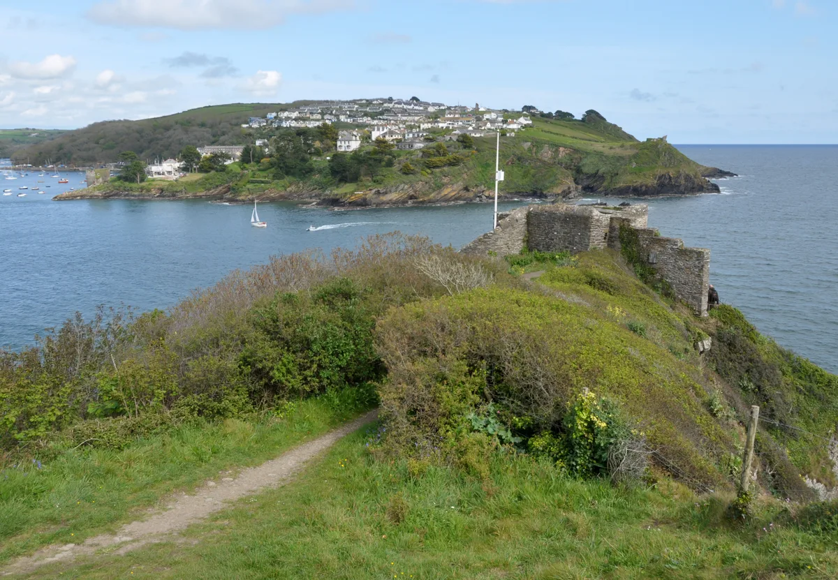
St Catherine's Castle is a historic artillery fort located at the mouth of the River Fowey, built by Henry VIII in the 1530s to protect the harbor. The site features remnants of its Tudor gun tower and defensive structures, reflecting its military significance through various historical periods, including the Crimean War and World War II.
Protected designations
- Area of Outstanding Natural Beauty: Cornwall
Designations sourced from Natural England open data under OGL v3.
From the Wikipedia article
The River Fowey ( FOY; Standard Written Form: Fowi) is a river in Cornwall, England, United Kingdom. Its source is at Fowey Well (originally Cornish: Fenten Fowi, meaning spring of the river Fowey) about 1 mile (1.6 km) north-west of Brown Willy on Bodmin Moor, not far from one of its tributaries rising at Dozmary Pool and Colliford Lake. The Fowey River passes Lanhydrock House, Restormel Castle and Lostwithiel, then broadens below Milltown before joining the English Channel at Fowey. The estuary is called Uzell (Cornish: Usel, meaning howling place). It is only navigable by larger craft for the last 7 miles (11 km). From Fowey, there is a passenger ferry to Polruan and a car ferry to Bodinnick. The first road crossing going upstream is in Lostwithiel. The river has seven tributaries, the largest being the River Lerryn. The section of the Fowey Valley between Doublebois and Bodmin Parkway railway station is known as the Glynn Valley (Cornish: Glyn, meaning deep wooded valley). The valley is the route of both the A38 trunk road and the railway line (built by the Cornwall Railway in 1859). The railway line is carried on eight stone viaducts along this stretch.
Excerpt from Wikipedia under CC BY-SA 4.0. See the source article linked in Sources below.
Background
History
(2007)]] Donyarth (), or Dungarth (died 875) was the last-recorded king of Cornwall. He is thought to be the 'Doniert' recorded on an inscription on King Doniert's Stone, a ninth-century cross shaft which stands in St Cleer parish in Cornwall, although he is not given any title in the inscription. According to the ', he drowned in 875. His death may have been an accident, but it was recorded in Ireland as a punishment for collaboration with the Vikings, who were harrying the West Saxons and briefly occupied Exeter in 876 before being driven out by Alfred the Great. Philip Payton states that one must imagine that he drowned in the River Fowey, near King Doniert's Stone.
Sourced from Wikipedia under CC BY-SA 4.0.
- Coordinates
- 50.3278, -4.6417
- District
- Cornwall
- Parish
- Lanteglos
- Postcode
- PL23 1PW
- Parliamentary constituency
- South East Cornwall
- Nearest railway station
- Par — 5.4 km
- Opening
- Open any reasonable time during daylight hours
- Official site
- www.english-heritage.org.uk
Sources
- wikipedia: River Fowey (CC BY-SA 4.0)
Other places nearby
St Catherine's Castle
Castles · 0.2 km

Saint Catherine's Castle
Castles · 0.2 km

St Saviour's Point
Viewpoints · 0.3 km
Readymoney Cove
Beaches · 0.3 km
Readymoney Cove Beach
Beaches · 0.3 km

Polruan Castle
Castles · 0.3 km

Polruan Castle
Archaeological sites · 0.3 km
.jpg?width=1200)
Methodist Chapel
Chapels · 0.4 km
St Catherine's Point light
Lighthouses · 0.4 km

St Saviour's Chapel
Historic houses · 0.4 km

St Saviour's Chapel
Archaeological sites · 0.4 km

Old Coal Wharf
Natural landmarks · 0.6 km
Nearby
📷 5Castles · South West England
St Catherine's Castle
St Catherine's Castle — castle in Fowey, Cornwall, England, UK.
📷 3Castles · South West England
Saint Catherine's Castle
Saint Catherine's Castle — a castle in england-south-west, United Kingdom.
📷 3Viewpoints · South West England
St Saviour's Point
St Saviour's Point is a viewpoint in the United Kingdom.
📷 5Beaches · South West England
Readymoney Cove
Readymoney Cove — beach and cove near Fowey, in Cornwall, England, UK.
📷 5Beaches · South West England
Readymoney Cove Beach
Readymoney Cove Beach is a beach in the United Kingdom.
📷 3Castles · South West England
Polruan Castle
Polruan Castle — a castle in england-south-west, United Kingdom.
Where to eat & stay near River Fowey
Places to stay
 📷 5
📷 5Hotels · South West England
Fowey Harbour Hotel
Fowey Harbour Hotel — a hotel in england south west.
 📷 5
📷 5 📷 5
📷 5Hotels · South West England
King of Prussia
King of Prussia — a hotel in england south west.
 📷 5
📷 5Campsites · South West England
Lambs Barn Camping Ground
Lambs Barn Camping Ground — a campsite in england south west.
 📷 5
📷 5Hotels · South West England
The Old Quay House Hotel
The Old Quay House Hotel — a hotel in england south west.
 📷 5
📷 5Caravan parks · South West England
Polruan Holiday Centre
Polruan Holiday Centre — a caravan park in england south west.
Places to eat & drink
 📷 7
📷 7Historic pubs · South West England
The Pack Horse Public House
The Pack Horse Public House in England South West, United Kingdom.
 📷 5
📷 5Restaurants · South West England
Pier House Hotel
Pier House Hotel — a restaurant in england south west.
 📷 7
📷 7Restaurants · South West England
The House on the Props
The House on the Props — a restaurant in england south west.
 📷 7
📷 7 📷 5
📷 5 📷 5
📷 5Historic pubs · South West England
The Fisherman's Arms
The Fisherman's Arms in England South West, United Kingdom.
More castles in this region
 Flagship📷 10
Castles · South West England
Old Wardour Castle
Old Wardour Castle — Grade I listed castle in Wardour, Wiltshire, England, UK.
 📷 5
📷 5Castles · South West England
Ballands Castle
Ballands Castle — former castle in Somerset, England, UK.
 📷 5
📷 5Castles · South West England
Brownsea Castle
Brownsea Castle — grade II listed Device Fort in Purbeck, United Kingdom.
 📷 5
📷 5Castles · South West England
Castle Hill
Castle Hill — castle in Mere, Wiltshire.
Frequently asked questions
- Where is River Fowey?
- River Fowey is in South-West England, United Kingdom (postcode PL23 1PW), in the parish of Lanteglos.
- What is River Fowey?
- The River Fowey ( FOY; Standard Written Form: Fowi) is a river in Cornwall, England, United Kingdom. Its source is at Fowey Well (originally Cornish: Fenten Fowi, meaning spring of the river Fowey) a
- How do I get to River Fowey?
- The nearest railway station is Par, about 5.4 km away. Drivers can use postcode PL23 1PW.
- Is River Fowey a protected site?
- Yes — River Fowey is part of the Cornwall National Landscape (AONB).
- Does River Fowey charge admission?
- River Fowey typically charges admission. Check the official site for current ticket prices and opening hours.
- How do I get to River Fowey?
- The nearest railway station is Par, about 5.4 km away. Drivers can navigate to postcode PL23 1PW.