Natural landmarks · North East England
River Deerness
In or near Brandon.
River Deerness in England North East, United Kingdom.

Eirian Evans — CC BY-SA 2.0 via Wikimedia Commons licence
Plan your visit
- Typical visit
- 1 h–2 h
- Nearest railway station
- Durham · 1.9 km
- Dog-friendly
Getting there & planning your visit
To visit the River Deerness, the nearest railway station is Durham, located 1.9 km away. The postcode for navigation is DH1 3RX. Entry to the site is free, and accessibility details are not provided.
About
River Deerness is a place of interest in England North East, United Kingdom — drawn from open-data sources for visitor reference. See the linked Wikipedia article for the full description.
Photo gallery
From the Wikipedia article
The River Deerness in County Durham, England is a tributary to the River Browney, which is itself a tributary the River Wear. It rises near Tow Law and descends through the Deerness Valley for a distance of 11.6 miles (18.7 km), passing the villages of Waterhouses, Ushaw Moor and Esh Winning. Its confluence with the River Browney is near Langley Moor. Its tributaries include Stanley Beck, Crow Gill, Cuddy Burn, Hedleyhope Burn, Rowley Burn, Holburn Beck and Red Burn. and its overall catchment area is 53 square kilometres (20 sq mi). Its name is pre-Celtic and means 'rushing or roaring river'. It may be the oldest place-name in County Durham. A recent restoration project has improved the water quality and reduced barriers to fish migration along the Deerness.
Excerpt from Wikipedia under CC BY-SA 4.0. See the source article linked in Sources below.
Background
History
Prior to the nineteenth century, the Deerness Valley was sparsely populated, with those who lived in the farms and small villages engaged in agriculture. There had been some small scale extraction of coal from the deposits in the valley, but in 1836 the first commercial coal mine opened at Hedleyhope, and by the end of the century, there were at least 20 mines in operation, served by the railway. Records for 1896 show that there were a total of 6,974 men and boys employed as miners in the valley, with 5,186 working underground and 1,788 working on the surface. In addition to seven types of coal, clay and fireclay were extracted, while at Ushaw Moor and New Brancepeth, deposits of witherite…
Sourced from Wikipedia under CC BY-SA 4.0.
- Coordinates
- 54.7667, -1.6000
- District
- County Durham
- Parish
- Brandon and Byshottles
- Postcode
- DH1 3RX
- Parliamentary constituency
- City of Durham
- Nearest railway station
- Durham — 1.9 km
Sources
- wikidata: Q24649274 (CC0)
- wikipedia: River Deerness (CC BY-SA 4.0)
Other places nearby
Lowes Barn
Memorials & monuments · 0.5 km
America
Public art & sculpture · 0.6 km
Italy
Public art & sculpture · 0.6 km
Neville House
Memorials & monuments · 0.6 km
China
Public art & sculpture · 0.6 km
Ustinov College
Memorials & monuments · 0.6 km

Neville's Cross
Memorials & monuments · 0.6 km
Durham Miners Heritage Centre
Museums · 0.7 km

Broompark Picnic Area
Natural landmarks · 0.8 km
Lanchester Valley Railway Path
Natural landmarks · 0.8 km
Two Oaks Walk
Public art & sculpture · 0.9 km
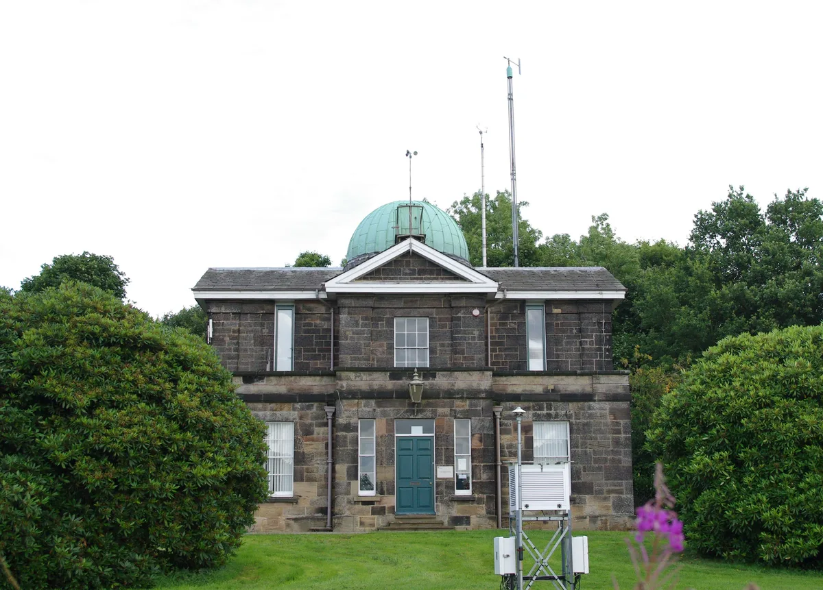
Durham University Observatory
Observatories · 0.9 km
Nearby
📷 3Memorials & monuments · North East England
Lowes Barn
Lowes Barn in England North East, United Kingdom.
📷 3Public art & sculpture · North East England
America
America — a public art in scotland-lowlands, United Kingdom.
📷 4Public art & sculpture · North East England
Italy
Italy — a public art in scotland-lowlands, United Kingdom.
📷 3Memorials & monuments · North East England
Neville House
Neville House — a memorial in scotland-lowlands, United Kingdom.
📷 4Public art & sculpture · North East England
China
China — a public art in scotland-lowlands, United Kingdom.
📷 4Memorials & monuments · North East England
Ustinov College
Ustinov College in England North East, United Kingdom.
Where to eat & stay near River Deerness
Places to stay
 📷 5
📷 5Caravan parks · North East England
Baxter Wood Farm Caravan Site
Baxter Wood Farm Caravan Site — a caravan park in scotland lowlands.
 📷 5
📷 5B&Bs · North East England
The Georgian Town House
The Georgian Town House — a bed-and-breakfast in scotland lowlands.
 📷 5
📷 5B&Bs · North East England
Castle View Guest House
Castle View Guest House — a bed-and-breakfast in scotland lowlands.
 📷 5
📷 5Hotels · North East England
Durham Marriott Hotel Royal County
Durham Marriott Hotel Royal County — a hotel in scotland lowlands.
 📷 5
📷 5Hotels · North East England
Radisson Blu
Radisson Blu — a hotel in scotland lowlands.
 📷 5
📷 5Hotels · North East England
Hotel Indigo Durham
Hotel Indigo Durham — a hotel in scotland lowlands.
Places to eat & drink
📷 3 📷 5
📷 5Historic pubs · North East England
Colpitts Hotel
Colpitts Hotel in England North East, United Kingdom.
 📷 5
📷 5Restaurants · North East England
Happiness 2 Barbeque
Happiness 2 Barbeque — a restaurant in scotland lowlands.
 📷 5
📷 5 📷 5
📷 5Cafés · North East England
Caffè Nero
Caffè Nero — a café in scotland lowlands. Cuisine: coffee shop. Brand: Caffè Nero.
 📷 7
📷 7Restaurants · North East England
Shaheen's Indian
Shaheen's Indian — a restaurant in scotland lowlands.
More natural landmarks in this region
 📷 4
📷 4Natural landmarks · North East England
Cleveland Way
109-mile horseshoe trail around the North York Moors and its sea cliffs.
 📷 3
📷 3Natural landmarks · North East England
The Hand Stone
The Hand Stone — a other in england-yorkshire, United Kingdom.
 📷 3
📷 3Natural landmarks · North East England
The Face Stone
The Face Stone — a other in england-yorkshire, United Kingdom.
 📷 3
📷 3Frequently asked questions
- Where is River Deerness?
- River Deerness is in North-East England, United Kingdom (postcode DH1 3RX), in the parish of Brandon and Byshottles.
- What is River Deerness?
- River Deerness in England North East, United Kingdom.
- How do I get to River Deerness?
- The nearest railway station is Durham, about 1.9 km away. Drivers can use postcode DH1 3RX.
- How do I get to River Deerness?
- The nearest railway station is Durham, about 1.9 km away. Drivers can navigate to postcode DH1 3RX.