
Castles · South West England
River Churn
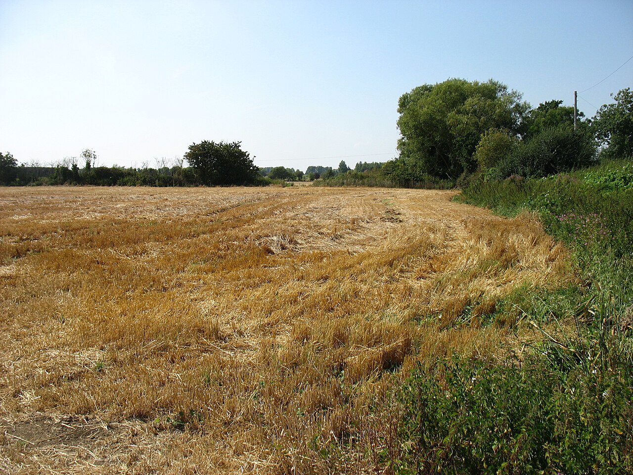
In or near Latton.
The River Churn is a tributary of the River Thames in central England. It rises at Seven Springs in Gloucestershire and flows south for approximately 37.3 km (23.2 mi) to meet the Thames at Cricklade

Brian Robert Marshall — CC BY-SA 2.0 via Wikimedia Commons licence

Plan your visit
- Typical visit
- 1.5 h–3 h
- Nearest railway station
- Hayes Knoll · 3.5 km
- Family-friendly
- Limited wheelchair access
About
The River Churn is a tributary of the River Thames in central England. It rises at Seven Springs in Gloucestershire and flows south for approximately 37.3 km (23.2 mi) to meet the Thames at Cricklade in Wiltshire. Its length from its source to the confluence with the Thames is greater than that of the Thames from Thames Head, but the Churn is regarded as a tributary, rather than the main river.
Photo gallery
Protected designations
- Site of Special Scientific Interest: Cotswold Water Park SSSI
- Area of Outstanding Natural Beauty: Cotswolds
- Area of Outstanding Natural Beauty: North Wessex Downs
Designations sourced from Natural England open data under OGL v3.
From the Wikipedia article
The River Churn is a tributary of the River Thames in central England. It rises at Seven Springs in Gloucestershire and flows south for approximately 37.3 km (23.2 mi) to meet the Thames at Cricklade in Wiltshire. Its length from its source to the confluence with the Thames is greater than that of the Thames from Thames Head, but the Churn is regarded as a tributary, rather than the main river.
Excerpt from Wikipedia under CC BY-SA 4.0. See the source article linked in Sources below.
Background
History
Much of the catchment basin of the Churn was a key Roman settlement in the 2nd to 4th centuries AD, as Corinium Dobunnorum rose to likely status of capital of a division of Britain. The Churn and the Thames feed the waters of a western bisection of the Cotswold Water Park, converted since the 1970s from redundant gravel beds between Cirencester and Cricklade. In 2006, the national government was engaged in a planning study to analyse methods of mitigating future flooding associated with the Churn. However, the river is known to stop flowing completely at times; in September 2011 the river bed was completely dry at Latton.
Description
The River Churn is the first tributary river of the River Thames. It rises in the Cotswolds at Seven Springs, south of Cheltenham, Gloucestershire, England and flows south across the Cotswold dip slope, passing through North Cerney and Cirencester, and joining the Thames in the parish of Cricklade in Wiltshire. Its length from source to confluence with the Thames is considerably greater than that of the Thames from Thames Head, and its flow is also more consistent than the winterbourne Thames, but the Churn is regarded as a tributary historically and therefore by most geography guides. The length of the Churn is approximately 37.3 km. It is classed as a main river and thus falls under the…
Sourced from Wikipedia under CC BY-SA 4.0.
- Coordinates
- 51.6450, -1.8533
- District
- Wiltshire
- Parish
- Cricklade
- Postcode
- SN6 6DG
- Parliamentary constituency
- South Cotswolds
- Nearest railway station
- Hayes Knoll — 3.5 km
Sources
- wikipedia: River Churn (CC BY-SA 4.0)
Other places nearby

Cricklade Town Bridge
Historic bridges · 0.1 km

Cricklade War Memorial
Memorials & monuments · 0.1 km
_(geograph_6346434).jpg?width=1200)
The Old Manor House
Historic houses · 0.2 km

Pair Of Monuments In Churchyard South West Of Tower, Church Of St Mary
Memorials & monuments · 0.2 km

The White Lion Public House
Historic pubs · 0.3 km
_(geograph_6343482).jpg?width=1200)
London House
Historic houses · 0.4 km

The Cricklade Club
Cafés · 0.4 km

Cricklade
Museums · 0.5 km

Cuss Monument, In Churchyard, 18 Metres North Of North West Corner Of Church Of St Sampson
Memorials & monuments · 0.6 km

23, High Street
Historic houses · 0.6 km

Group Of 5 Monuments In Churchyard 8 Metres West Of West Door. Church Of St Sampson
Memorials & monuments · 0.6 km

Group Of 3 Poulton Monuments In Churchyard, 4 Metres South Of South Trancept, Church Of St Sampson
Memorials & monuments · 0.6 km
Nearby
📷 4Historic bridges · South West England
Cricklade Town Bridge
Cricklade Town Bridge — a Grade II*-listed bridge in england-west-midlands, United Kingdom.
📷 3Memorials & monuments · South West England
Cricklade War Memorial
Cricklade War Memorial is a memorial in the United Kingdom.
📷 3Historic houses · South West England
The Old Manor House
The Old Manor House — house in Cricklade, Wiltshire, England, UK.
📷 3Memorials & monuments · South West England
Pair Of Monuments In Churchyard South West Of Tower, Church Of St Mary
Pair Of Monuments In Churchyard South West Of Tower, Church Of St Mary — Grade II listed building-listed memorial in england-west-midlands, United Kingdom.
📷 7Historic pubs · South West England
The White Lion Public House
The White Lion Public House in England South West, United Kingdom.
📷 3Historic houses · South West England
London House
London House — house in Cricklade, Wiltshire, England, UK.
Where to eat & stay near River Churn
Places to stay
 📷 5
📷 5Campsites · South East England
Second Chance Touring & Residential Park
Second Chance Touring & Residential Park — a campsite in england west midlands.
 📷 5
📷 5Caravan parks · South West England
Hoburne Cotswold
Hoburne Cotswold — a caravan park in england west midlands.
 📷 5
📷 5Hotels · South East England
Blunsdon House Hotel
Blunsdon House Hotel — a hotel in england west midlands.
 📷 5
📷 5Campsites · South East England
Kempsford Camping (July Only)
Kempsford Camping (July Only) — a campsite in england west midlands.
 📷 5
📷 5 📷 5
📷 5Campsites · South West England
Cotswold Lakes Camping
Cotswold Lakes Camping — a campsite in england west midlands.
Places to eat & drink
📷 7Historic pubs · South West England
The White Lion Public House
The White Lion Public House in England South West, United Kingdom.
📷 7Cafés · South West England
The Cricklade Club
The Cricklade Club — a café in england west midlands.
 📷 5
📷 5Historic pubs · South West England
Horse And Jockey Public House
Horse And Jockey Public House in England South West, United Kingdom.
 📷 5
📷 5Historic pubs · South West England
The Maltster Public House
The Maltster Public House in England South West, United Kingdom.
 📷 5
📷 5Historic pubs · South West England
The Southbrook Inn
The Southbrook Inn in England South West, United Kingdom.
 📷 6
📷 6Restaurants · South East England
Kushbo Indian Restaurant
Kushbo Indian Restaurant — a restaurant in england west midlands. Cuisine: indian.
More castles in this region
 Flagship📷 10
Castles · South West England
Old Wardour Castle
Old Wardour Castle — Grade I listed castle in Wardour, Wiltshire, England, UK.
 📷 5
📷 5Castles · South West England
Ballands Castle
Ballands Castle — former castle in Somerset, England, UK.
 📷 5
📷 5Castles · South West England
Brownsea Castle
Brownsea Castle — grade II listed Device Fort in Purbeck, United Kingdom.
 📷 5
📷 5Castles · South West England
Castle Hill
Castle Hill — castle in Mere, Wiltshire.
Frequently asked questions
- Where is River Churn?
- River Churn is in the West Midlands, United Kingdom (postcode SN6 6DG), in the parish of Cricklade.
- What is River Churn?
- The River Churn is a tributary of the River Thames in central England. It rises at Seven Springs in Gloucestershire and flows south for approximately 37.3 km (23.2 mi) to meet the Thames at Cricklade
- How do I get to River Churn?
- The nearest railway station is Hayes Knoll, about 3.5 km away. Drivers can use postcode SN6 6DG.
- Is River Churn a protected site?
- Yes — River Churn is part of the Cotswold Water Park SSSI Site of Special Scientific Interest and the Cotswolds National Landscape (AONB).
- Does River Churn charge admission?
- River Churn typically charges admission. Check the official site for current ticket prices and opening hours.
- How do I get to River Churn?
- The nearest railway station is Hayes Knoll, about 3.5 km away. Drivers can navigate to postcode SN6 6DG.