Mountains & hills · Scottish Lowlands
Rig of Clenrie
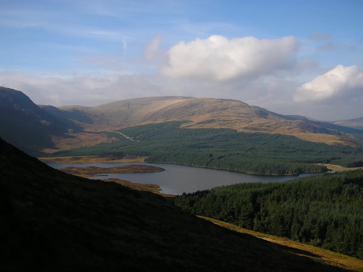
Rig of Clenrie — mountain in scotland lowlands. Elevation: 438 m.

Steven Brown — CC BY-SA 2.0 via Wikimedia Commons licence
Plan your visit
- Typical visit
- 3 h–8 h
- Best time of year
- Late spring – early autumn (May–Oct)
About
Rig of Clenrie is a mountain located in scotland lowlands. Elevation: 438 m. A named British peak recorded in OpenStreetMap. Peaks are typically named on Ordnance Survey 1:50k mapping.
Photo gallery
Place summary
Rig of Clenrie is a mountain located in the Scottish Lowlands. This area is characterised by its rolling hills and rugged terrain, offering a variety of outdoor activities. Visitors can expect scenic views and opportunities for hiking and exploration in a relatively remote setting. The natural landscape is typical of the region, providing a peaceful backdrop for those seeking to enjoy the outdoors.
AI-generated from the structured facts on this page (operator, designation, listing, era). Not a substitute for visiting.
- Coordinates
- 55.1173, -4.2941
Sources
- osm: n10166934816 (ODbL)
Other places nearby
Loading nearby places…
Nearby
 📷 5
📷 5Lakes · Scottish Lowlands
Loch Dungeon
Loch Dungeon — a lake in scotland lowlands.
 📷 5
📷 5Mountains & hills · Scottish Lowlands
Meikle Millyea
Meikle Millyea — mountain in scotland lowlands. Elevation: 746 m.
 📷 5
📷 5Mountains & hills · Scottish Lowlands
Drumbuie (An Druim Buidhe)
Drumbuie (An Druim Buidhe) — mountain in scotland lowlands. Elevation: 316 m.
 📷 5
📷 5Mountains & hills · Scottish Lowlands
Mid Hill
Mid Hill — mountain in scotland lowlands. Elevation: 341.4 m.
 📷 3
📷 3Natural landmarks · Scottish Lowlands
Loch Dungeon
Loch Dungeon — lake in Dumfries and Galloway, Scotland, UK, outflows north via a watercourse to Loch Minnoch.
 📷 5
📷 5Mountains & hills · Scottish Lowlands
Shinmount
Shinmount — a hill or mountain in scotland lowlands.
Where to eat & stay near Rig of Clenrie
Places to stay
 📷 5
📷 5Campsites · Scottish Lowlands
Otter Pool "Stay the night"
Otter Pool "Stay the night" — a campsite in scotland lowlands.
 📷 5
📷 5Campsites · Scottish Lowlands
Hensol Estate
Hensol Estate — a campsite in scotland lowlands.
 📷 5
📷 5Caravan parks · Scottish Lowlands
Glenlaggan
Glenlaggan — a caravan park in scotland lowlands.
 📷 5
📷 5Caravan parks · Scottish Lowlands
Loch Doon Caravan Park
Loch Doon Caravan Park — a caravan park in scotland lowlands.
 📷 5
📷 5Campsites · Scottish Lowlands
Glentrool Camping & Caravan Site
Glentrool Camping & Caravan Site — a campsite in scotland lowlands.
 📷 5
📷 5Campsites · Scottish Lowlands
Loch Ken Holiday Park
Loch Ken Holiday Park — a campsite in scotland lowlands.

More mountains in this region
 📷 3
📷 3Mountains & hills · Scottish Lowlands
Andrewhinney Hill
Andrewhinney Hill — Named summit at 677 m.
 📷 3
📷 3Mountains & hills · Scottish Lowlands
Arbory Hill
Arbory Hill — Named summit at 429 m.
 📷 3
📷 3Mountains & hills · Scottish Lowlands
Auchenton Hill ( East Mount Lowther)
Auchenton Hill ( East Mount Lowther) — Named summit at 631 m.
 📷 3
📷 3Mountains & hills · Scottish Lowlands
Bakestall
Bakestall — Named summit at 673.5 m.
Frequently asked questions
- Where is Rig of Clenrie?
- Rig of Clenrie is in the Scottish Lowlands, United Kingdom.
- What is Rig of Clenrie?
- Rig of Clenrie — mountain in scotland lowlands. Elevation: 438 m.
- How do I get to Rig of Clenrie?
- Its coordinates are 55.1173°, -4.2941°.