
Reservoirs & lochs · Scottish Highlands
Redpoint
Also known as: An Rubha Dearg
In or near Gairloch.
Redpoint in Scotland Islands, United Kingdom.

Wikimedia Commons licence
Plan your visit
- Typical visit
- 1 h–2.5 h
- Free entry
- Dog-friendly
About
Redpoint is a place of interest in Scotland Islands, United Kingdom — drawn from open-data sources for visitor reference. See the linked Wikipedia article for the full description.
Photo gallery
From the Wikipedia article
Redpoint (Scottish Gaelic: An Rubha Dearg, lit. 'the red headland') is a small settlement in the north west of Highland, Scotland. It takes its name from Red Point, a low promontory to the south, which marks a turn in the coastline from facing west to south east as it becomes Loch Torridon. Redpoint lies about 10 miles (16 km) south west of Gairloch, at the end of the B8056 road. A path leading from the road leads to a viewpoint from which it is possible (on a clear day) to see the Isle of Skye's Trotternish Ridge and also the Isle of Harris and Isle of Lewis. The villages of South Erradale, Opinan and Port Henderson are north along the B8056 coast road. Scottish electronic music band Boards of Canada released the album Geogaddi in 2002 that contains the track "The Beach at Redpoint".
Excerpt from Wikipedia under CC BY-SA 4.0. See the source article linked in Sources below.
- Coordinates
- 57.6522, -5.7828
- District
- Highland
- Postcode
- IV21 2AX
- Parliamentary constituency
- Inverness, Skye and West Ross-shire
Sources
- wikidata: Q3777107 (CC0)
- wikipedia: Redpoint, Highland (CC BY-SA 4.0)
Other places nearby

Redpoint Beach
Beaches · 1.7 km

South Erradale
Natural landmarks · 2.4 km

South Erradale
Villages · 2.7 km

Mesolithic Cave
Caves · 4.5 km

Loch Clàir
Lakes · 4.5 km

Uaimh an Òir
Caves · 4.6 km

Meall Bad a' Chrotha
Mountains & hills · 4.7 km
Rubh' Fhreacadain
Mountains & hills · 4.8 km

Port Henderson
Villages · 4.8 km

Port Henderson
Reservoirs & lochs · 5.2 km

Loch Bràigh Horrisdale
Reservoirs & lochs · 5.6 km

Craig
Villages · 5.6 km
Nearby
📷 3📷 5Natural landmarks · Scottish Highlands
South Erradale
South Erradale in Scotland Islands, United Kingdom.
📷 5📷 5📷 5📷 5Where to eat & stay near Redpoint
Places to stay
 📷 5
📷 5Hostels · Scottish Highlands
Gairloch Carn Dearg Youth Hostel
Gairloch Carn Dearg Youth Hostel — a hostel in scotland highlands.
 📷 5
📷 5Campsites · Scottish Highlands
Sands Caravan and Camping
Sands Caravan and Camping — a campsite in scotland highlands.
 📷 7
📷 7Hotels · Scottish Highlands
Myrtle Bank Hotel
Myrtle Bank Hotel — a hotel in scotland highlands.
 📷 5
📷 5Campsites · Scottish Highlands
Gairloch Caravan & Camp Site
Gairloch Caravan & Camp Site — a campsite in scotland highlands.
 📷 5
📷 5Campsites · Scottish Highlands
Shieldaig Camping and Cabins
Shieldaig Camping and Cabins — a campsite in scotland highlands.
 📷 5
📷 5Campsites · Scottish Highlands
Poolewe Caravan & Camping Club
Poolewe Caravan & Camping Club — a campsite in scotland highlands.
More places in this region
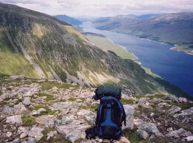 Flagship📷 3
Reservoirs & lochs · Scottish Highlands
Loch Ericht
Loch Ericht — lake in Perth and Kinross, and Highland, Scotland, UK, outflows to River Ericht.
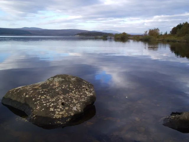 Flagship📷 3
Reservoirs & lochs · Scottish Highlands
Loch Shin
Loch Shin — reservoir in Highland, Scotland, UK, outflows to the River Shin.
 📷 4
📷 4Reservoirs & lochs · Scottish Highlands
Backwater Reservoir
Backwater Reservoir — lake in Angus, Scotland, UK.
 📷 3
📷 3Reservoirs & lochs · Scottish Highlands
Blackwater Reservoir
Blackwater Reservoir — reservoir in Highland, Scotland, UK, outflows to the River Leven.
Frequently asked questions
- Where is Redpoint?
- Redpoint is in the Scottish Highlands, United Kingdom (postcode IV21 2AX).
- What is Redpoint?
- Redpoint in Scotland Islands, United Kingdom.
- How do I get to Redpoint?
- The nearest town is Gairloch. Drivers can use postcode IV21 2AX.
- Is Redpoint free to visit?
- Yes, Redpoint is free to enter.
- How do I get to Redpoint?
- Drivers can navigate to postcode IV21 2AX. It sits within the Inverness, Skye and West Ross-shire parliamentary constituency.