
Campsites · South West England
Bracelands
In or near Symonds Yat.
Bracelands — a campsite in wales south.

David Martin — CC BY-SA 2.0 via Wikimedia Commons licence

Plan your visit
- Typical visit
- 1 h–2 h
- Nearest railway station
- Rookwood · 4.1 km
About
Bracelands is a campsite located in wales south. Address: Bracelands Drive, Coleford, GL16 7NP. Campsite listed with verified location and OSM metadata. Pitch availability, facilities (toilets, showers, electric hookup) and seasonal opening vary — confirm directly.
Photo gallery
Protected designations
- Site of Special Scientific Interest: River Wye SSSI
- Area of Outstanding Natural Beauty: Wye Valley
Designations sourced from Natural England open data under OGL v3.
Place summary
Bracelands is a campsite located in South Wales, postcode GL16. Set amidst natural scenery, it offers a range of facilities for outdoor enthusiasts. Visitors can expect a spacious environment suitable for tents and caravans, along with amenities to support camping activities. The site serves as a base for exploring the surrounding landscape.
AI-generated from the structured facts on this page (operator, designation, listing, era). Not a substitute for visiting.
- Coordinates
- 51.8171, -2.6426
- County
- Gloucestershire
- District
- Forest of Dean
- Parish
- English Bicknor
- Postcode
- GL16 7NP
- Parliamentary constituency
- Forest of Dean
- Phone
- +44 1594 837258
- Nearest railway station
- Rookwood — 4.1 km
Sources
- osm: w31249774 (ODbL)
Other places nearby

Braceland Bunkhouse
Hostels · 0.1 km

Staunton
Villages · 0.5 km
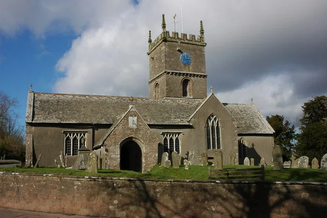
Church of All Saints
Historic churches · 1.0 km

Staunton Coleford Castle Field
Literary houses · 1.2 km

Biblins Bridge
Historic bridges · 1.4 km

Lady Park Wood
Forests & woodlands · 1.5 km

Biblins Youth Campsite
Campsites · 1.5 km
Lady Park Wood National Nature Reserve
Parks · 1.6 km

Merlin's Cave
Caves · 1.9 km
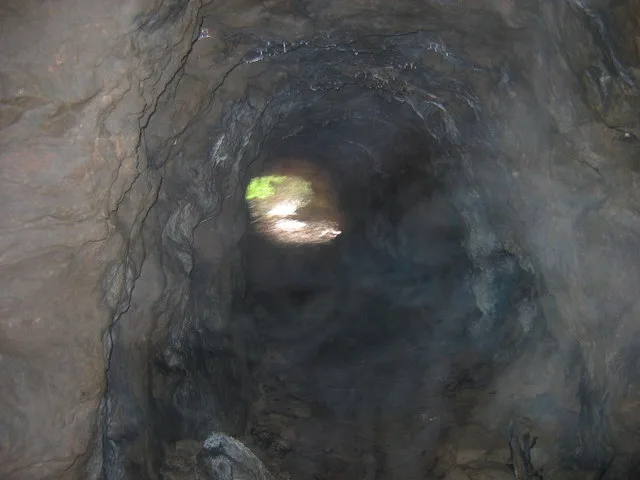
Merlin's Cave, Great Doward
Mountains & hills · 1.9 km

Buck Stone
Memorials & monuments · 2.0 km

Broadstone Park Camping and Fishery
Campsites · 2.3 km
Nearby
📷 5📷 5📷 3Historic churches · South Wales
Church of All Saints
Church of All Saints — Anglican church in Staunton, Gloucestershire, England, UK.
📷 5Literary houses · South Wales
Staunton Coleford Castle Field
Staunton Coleford Castle Field — a literary house museum in wales south.
📷 5Historic bridges · South Wales
Biblins Bridge
Biblins Bridge is a historic bridge in the United Kingdom.
📷 3Forests & woodlands · South Wales
Lady Park Wood
Lady Park Wood is a forest or woodland in the United Kingdom.
Where to eat & stay near Bracelands
Places to stay
📷 5📷 5Campsites · South Wales
Biblins Youth Campsite
Biblins Youth Campsite — a campsite in wales south.
📷 5Campsites · South Wales
Broadstone Park Camping and Fishery
Broadstone Park Camping and Fishery — a campsite in wales south.
 📷 5
Campsites · South West England
Greenacres Campsite
Greenacres Campsite — a campsite in wales south.
 📷 5
Campsites · South Wales
Doward Park Campsite
Doward Park Campsite — a campsite in wales south.
 📷 5
B&Bs · South West England
The Saracens Head
The Saracens Head — a bed-and-breakfast in wales south.
Places to eat & drink
 📷 5
 📷 7
 📷 5
 📷 6
Historic pubs · South Wales
Queens Head
Queens Head in Wales South, United Kingdom.
 📷 7
 📷 6
More places in this region
 📷 5
Campsites · South West England
Scout Adventures Buddens
Scout Adventures Buddens — a campsite in england south east.
 📷 5
Campsites · South West England
Brokerswood Holiday Park
Brokerswood Holiday Park — a campsite in england south east.
 📷 5
Campsites · South West England
Charris Car.& Camp. Park
Charris Car.& Camp. Park — a campsite in england south east.
 📷 5
Campsites · South West England
Merley Court Touring Park
Merley Court Touring Park — a campsite in england south east.
Frequently asked questions
- Where is Bracelands?
- Bracelands is in Gloucestershire, South-West England, United Kingdom (postcode GL16 7NP), in the parish of English Bicknor.
- What is Bracelands?
- Bracelands — a campsite in wales south.
- How do I get to Bracelands?
- The nearest railway station is Rookwood, about 4.1 km away. The nearest town is Symonds Yat. Drivers can use postcode GL16 7NP.
- Is Bracelands a protected site?
- Yes — Bracelands is part of the River Wye SSSI Site of Special Scientific Interest and the Wye Valley National Landscape (AONB).
- How do I get to Bracelands?
- The nearest railway station is Rookwood, about 4.1 km away. Drivers can navigate to postcode GL16 7NP.