
Historic bridges · South East England
Ratcliffe Bridge
In or near Merevale.
Ratcliffe Bridge — Grade II listed building-listed bridge in england-west-midlands, United Kingdom.

Andrew Tatlow — CC BY-SA 2.0 via Wikimedia Commons licence

Plan your visit
- Typical visit
- 15 min–30 min
- Nearest railway station
- Atherstone · 2.4 km
- Free entry
- Dog-friendly
Getting there & planning your visit
To visit Ratcliffe Bridge, the nearest railway station is Atherstone, located 2.4 km away. The postcode for navigation is CV9 3PE, and entry to the bridge is free.
About
Ratcliffe Bridge is a Grade II listed building-listed bridge in england-west-midlands, United Kingdom, registered on the National Heritage List for England (NHLE entry 1361316). Listed status protects buildings and structures of special architectural or historic interest. See the linked Wikipedia article for further details.
Photo gallery
Heritage listing
Details SP 39 NW WITHERLEY MAIN ROAD 8/131 Ratcliffe Euley Ratcliffe Bridge (that part in Witherley C.P.) II Bridge. C18. Red brick with stone cutwaters, parapet band and coping. 3 segmental arches, the centre one larger, carry Ratcliffe Lane over the River Spence. Triangular section cutwaters and plain parapet. The other half of Ratcliffe Bridge is listed under Sheepy C.P. Listing NGR: SP3215799640 Legacy The contents of this record have been generated from a legacy data system. Legacy System number: 188272 Legacy System: LBS
From the Historic England List Entry under OGL v3.
Place summary
Ratcliffe Bridge is a Grade II listed bridge located in the West Midlands. This structure is noted for its historical significance and architectural features, characteristic of the era in which it was built.
AI-generated from the structured facts on this page (operator, designation, listing, era). Not a substitute for visiting.
- Coordinates
- 52.5936, -1.5267
- County
- Leicestershire
- District
- Hinckley and Bosworth
- Parish
- Sheepy
- Postcode
- CV9 3PE
- Parliamentary constituency
- Hinckley and Bosworth
- Nearest railway station
- Atherstone — 2.4 km
Sources
- wikidata: Q26643319 (CC0)
Other places nearby

Church of All Saints
Historic churches · 0.6 km
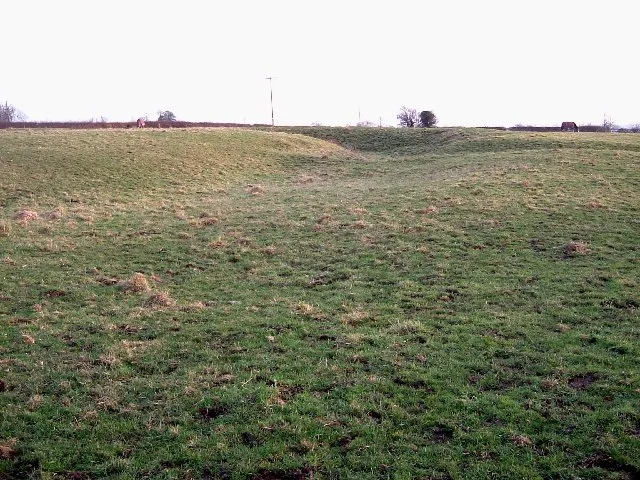
Ratcliffe Culey
Castles · 0.6 km

Atherstone Stables
Caravan parks · 0.7 km

Sheepy
Villages · 1.0 km

Fieldon Bridge
Historic bridges · 1.4 km

Church of All Saints
Historic churches · 1.7 km

Sheepy Magna War Memorial
Memorials & monuments · 1.8 km

Atherstone War Memorial
Memorials & monuments · 1.9 km

Witherley
Villages · 2.0 km

Atherstone
Museums · 2.1 km
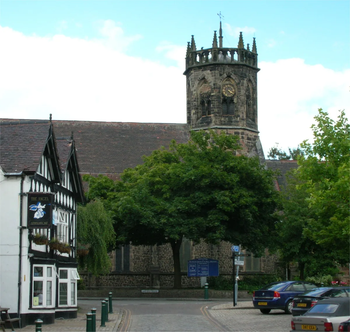
St. Mary's Church, Atherstone
Historic churches · 2.1 km

Market Tavern
Historic pubs · 2.2 km
Nearby
📷 3Historic churches · South East England
Church of All Saints
Church of All Saints — church in Witherley, Hinckley and Bosworth, Leicestershire, England, UK.
📷 3Castles · South East England
Ratcliffe Culey
Ratcliffe Culey — former castle in Witherley, Hinckley and Bosworth, Leicestershire, England.
📷 5Caravan parks · South East England
Atherstone Stables
Atherstone Stables — a caravan park in england west midlands.
📷 5📷 3Historic bridges · West Midlands
Fieldon Bridge
Fieldon Bridge — Grade II listed building-listed bridge in england-west-midlands, United Kingdom.
📷 3Historic churches · South East England
Church of All Saints
Church of All Saints — church in Sheepy Magna, Leicestershire, England, UK.
Where to eat & stay near Ratcliffe Bridge
Places to stay
📷 5Caravan parks · South East England
Atherstone Stables
Atherstone Stables — a caravan park in england west midlands.
 📷 5
📷 5 📷 7
📷 7 📷 5
📷 5Caravan parks · South East England
Upton Barn Caravan and Camping site
Upton Barn Caravan and Camping site — a caravan park in england west midlands.
 📷 5
📷 5Hostels · West Midlands
Manor Court Care Home
Manor Court Care Home — a hostel in england west midlands.
 📷 5
📷 5Caravan parks · West Midlands
Statfold
Statfold — a caravan park in england west midlands.
Places to eat & drink
📷 3Historic pubs · West Midlands
Market Tavern
Market Tavern — Historic pub — listed building or notable heritage status.
 📷 3
📷 3Historic pubs · West Midlands
New Swan Inn
New Swan Inn — Historic pub — listed building or notable heritage status.
 📷 3
📷 3Historic pubs · West Midlands
The Old Swan
The Old Swan — Historic pub — listed building or notable heritage status.
 📷 3
📷 3Historic pubs · South East England
Blue Lion
Blue Lion — Historic pub — listed building or notable heritage status.
 📷 3
📷 3Historic pubs · West Midlands
Bird in Hand
Bird in Hand — Historic pub — listed building or notable heritage status.
 📷 5
📷 5Historic pubs · West Midlands
Queen's Head Inn Public House
Queen's Head Inn Public House in England East Midlands, United Kingdom.
More bridges in this region
 📷 5
📷 5Historic bridges · South East England
Briary Hill Bridge east
Briary Hill Bridge east is a historic bridge in the United Kingdom.
 📷 5
📷 5Historic bridges · South East England
Briary Hill Bridge west
Briary Hill Bridge west is a historic bridge in the United Kingdom.
 📷 5
📷 5Historic bridges · South East England
Bridge 157 VIR (Bath Hard Road)
Bridge 157 VIR (Bath Hard Road) is a historic bridge in the United Kingdom.
 📷 5
📷 5Historic bridges · South East England
Dorking Arch Bridge
Dorking Arch Bridge is a historic bridge in the United Kingdom.
Frequently asked questions
- Where is Ratcliffe Bridge?
- Ratcliffe Bridge is in Leicestershire, the West Midlands, United Kingdom (postcode CV9 3PE), in the parish of Sheepy.
- What is Ratcliffe Bridge?
- Ratcliffe Bridge — Grade II listed building-listed bridge in england-west-midlands, United Kingdom.
- How do I get to Ratcliffe Bridge?
- The nearest railway station is Atherstone, about 2.4 km away. Drivers can use postcode CV9 3PE.
- Is Ratcliffe Bridge a listed building?
- Ratcliffe Bridge is officially recognised as Grade II listed building listed.
- Is Ratcliffe Bridge free to visit?
- Yes, Ratcliffe Bridge is free to enter.
- How do I get to Ratcliffe Bridge?
- The nearest railway station is Atherstone, about 2.4 km away. Drivers can navigate to postcode CV9 3PE.