
Museums · West Midlands
Atherstone
In or near Merevale.
Atherstone is a market town and civil parish in the North Warwickshire district of Warwickshire, England. Located in the far north of the county, Atherstone is on the A5 national route, and is adjace

Robin Stott — CC BY-SA 2.0 via Wikimedia Commons licence

Plan your visit
- Typical visit
- 1.5 h–3 h
- Best time of year
- Year-round
- Nearest railway station
- Atherstone · 0.4 km
- Free entry
- Family-friendly
- Limited wheelchair access
Getting there & planning your visit
To visit the Atherstone museum in the West Midlands, the nearest railway station is Atherstone, located 0.4 km away. The postcode for sat-nav is CV9 1HW. Please note that wheelchair accessibility is limited.
About
Atherstone is a market town and civil parish in the North Warwickshire district of Warwickshire, England. Located in the far north of the county, Atherstone is on the A5 national route, and is adjacent to the border with Leicestershire which is here formed by the River Anker. It is situated between the larger towns of Tamworth and Nuneaton. Atherstone is the administrative centre of the North Warwickshire district, with the offices of North Warwickshire Borough Council located in the town. Atherstone has had its own local tradition of holding an annual Shrove Tuesday Ball Game in the streets, which has been played annually for over 800 years since 1199. In the 2021 census the population of the civil parish of Atherstone was at 9,212. The population of the larger built-up area which includes the adjoining village of Mancetter was 11,259.
Photo gallery
Official information
Atherstone is a historic market town located in North Warwickshire, known for its charming center around St. Mary’s Church and the Market Square. The town has transitioned from its historical hatting industry to a mix of retail shops, pubs, and cafes, making it a popular stop along the Coventry Canal.
From the Wikipedia article
Atherstone is a market town and civil parish in the North Warwickshire district of Warwickshire, England. Located in the far north of the county, Atherstone is on the A5 national route, and is adjacent to the border with Leicestershire which is here formed by the River Anker. It is situated between the larger towns of Tamworth and Nuneaton. Atherstone is the administrative centre of the North Warwickshire district, with the offices of North Warwickshire Borough Council located in the town. Atherstone has had its own local tradition of holding an annual Shrove Tuesday Ball Game in the streets, which has been played annually for over 800 years since 1199. In the 2021 census the population of the civil parish of Atherstone was at 9,212. The population of the larger built-up area which includes the adjoining village of Mancetter was 11,259.
Excerpt from Wikipedia under CC BY-SA 4.0. See the source article linked in Sources below.
- Coordinates
- 52.5787, -1.5462
- County
- Warwickshire
- District
- North Warwickshire
- Parish
- Atherstone
- Postcode
- CV9 1HW
- Parliamentary constituency
- North Warwickshire and Bedworth
- Nearest railway station
- Atherstone — 0.4 km
- Official site
- www.atherstone-tc.gov.uk
Sources
- wikipedia: Atherstone (CC BY-SA 4.0)
Other places nearby
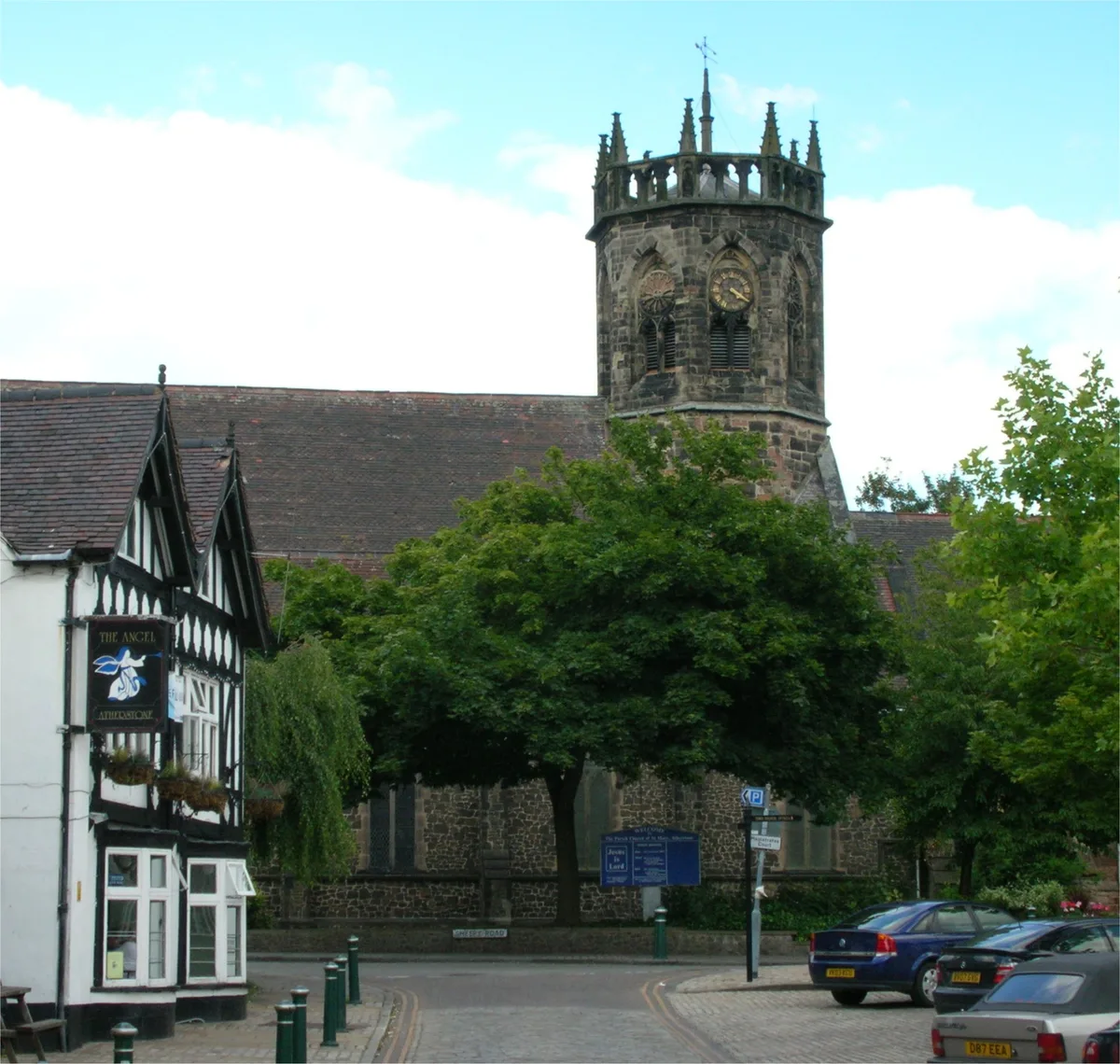
St. Mary's Church, Atherstone
Historic churches · 0.0 km

Market Tavern
Historic pubs · 0.1 km

New Swan Inn
Historic pubs · 0.1 km

We Are Here
Public art & sculpture · 0.1 km

North Warwickshire Museum and Community Hub
Museums · 0.2 km
Picturedrome Cinema
Theatres · 0.2 km

back-to-back housing
Historic houses · 0.2 km
North Warwickshire
Museums · 0.3 km

Atherstone Ball Game
Public art & sculpture · 0.3 km

Atherstone War Memorial
Memorials & monuments · 0.4 km

Atherstone railway station
Heritage railway stations · 0.4 km

The Old Swan
Historic pubs · 0.4 km
Nearby
📷 5Historic churches · West Midlands
St. Mary's Church, Atherstone
St. Mary's Church, Atherstone — church in Atherstone, North Warwickshire, England, UK.
📷 3Historic pubs · West Midlands
Market Tavern
Market Tavern — Historic pub — listed building or notable heritage status.
📷 3Historic pubs · West Midlands
New Swan Inn
New Swan Inn — Historic pub — listed building or notable heritage status.
📷 3Public art & sculpture · West Midlands
We Are Here
We Are Here — a public art in West Midlands, United Kingdom.
📷 3Museums · West Midlands
North Warwickshire Museum and Community Hub
North Warwickshire Museum and Community Hub — a museum in West Midlands, United Kingdom.
📷 3Theatres · South East England
Picturedrome Cinema
Picturedrome Cinema in England East Midlands, United Kingdom.
Where to eat & stay near Atherstone
Places to stay
 📷 5
📷 5Caravan parks · South East England
Atherstone Stables
Atherstone Stables — a caravan park in england west midlands.
 📷 7
📷 7 📷 5
📷 5Campsites · South East England
Etties Field
Etties Field — a campsite in england west midlands.
 📷 5
📷 5Caravan parks · South East England
Upton Barn Caravan and Camping site
Upton Barn Caravan and Camping site — a caravan park in england west midlands.
 📷 5
📷 5Hostels · West Midlands
Manor Court Care Home
Manor Court Care Home — a hostel in england west midlands.
 📷 5
📷 5Caravan parks · West Midlands
Griff Caravan Site
Griff Caravan Site — a caravan park in england west midlands.
Places to eat & drink
📷 3Historic pubs · West Midlands
Market Tavern
Market Tavern — Historic pub — listed building or notable heritage status.
📷 3Historic pubs · West Midlands
New Swan Inn
New Swan Inn — Historic pub — listed building or notable heritage status.
📷 3Historic pubs · West Midlands
The Old Swan
The Old Swan — Historic pub — listed building or notable heritage status.
 📷 3
📷 3Historic pubs · South East England
Blue Lion
Blue Lion — Historic pub — listed building or notable heritage status.
 📷 3
📷 3Historic pubs · West Midlands
Bird in Hand
Bird in Hand — Historic pub — listed building or notable heritage status.
 📷 5
📷 5Historic pubs · West Midlands
Queen's Head Inn Public House
Queen's Head Inn Public House in England East Midlands, United Kingdom.
More museums in this region
 📷 3
📷 3Museums · West Midlands
Redfern Cottage
Redfern Cottage — a museum in West Midlands, United Kingdom.
 📷 3
📷 3Museums · West Midlands
Museum of Cannock Chase
Museum of Cannock Chase — a museum in West Midlands, United Kingdom.
 📷 5
📷 5Museums · West Midlands
Cannock Chase District
Cannock Chase is a designated Area of Outstanding Natural Beauty and National Landscape in Staffordshire, England. It gives its name to Cannock Chase District, a non-metropolitan local government dist
 📷 5
📷 5Museums · West Midlands
Uttoxeter
Uttoxeter — a museum in england-east-midlands, United Kingdom.
Frequently asked questions
- Where is Atherstone?
- Atherstone is in Warwickshire, the West Midlands, United Kingdom (postcode CV9 1HW), in the parish of Atherstone.
- What is Atherstone?
- Atherstone is a market town and civil parish in the North Warwickshire district of Warwickshire, England. Located in the far north of the county, Atherstone is on the A5 national route, and is adjace
- How do I get to Atherstone?
- The nearest railway station is Atherstone, about 0.4 km away. The nearest town is Merevale. Drivers can use postcode CV9 1HW.
- Is Atherstone free to visit?
- Yes, Atherstone is free to enter.
- How do I get to Atherstone?
- The nearest railway station is Atherstone, about 0.4 km away. Drivers can navigate to postcode CV9 1HW.