
Beaches · North West England
Rampside
In or near Swarthmoor.
Rampside is a village in Cumbria, England. Historically in Lancashire, it is located a few miles south-east of the town of Barrow-in-Furness, in the north-western corner of Morecambe Bay on the Furnes

David Dixon — CC BY-SA 2.0 via Wikimedia Commons licence

Plan your visit
- Typical visit
- 1 h–3 h
- Best time of year
- Summer (Jun–Aug)
- Nearest railway station
- Roose · 4.0 km
- Free entry
- Family-friendly
- Dog-friendly
About
Rampside is a village in Cumbria, England. Historically in Lancashire, it is located a few miles south-east of the town of Barrow-in-Furness, in the north-western corner of Morecambe Bay on the Furness peninsula.
Photo gallery
Protected designations
- Site of Special Scientific Interest: Morecambe Bay SSSI
- Site of Special Scientific Interest: South Walney and Piel Channel Flats SSSI
- Ramsar wetland: Morecambe Bay
Designations sourced from Natural England open data under OGL v3.
From the Wikipedia article
Rampside is a village in Cumbria, England. Historically in Lancashire, it is located a few miles south-east of the town of Barrow-in-Furness, in the north-western corner of Morecambe Bay on the Furness peninsula.
Excerpt from Wikipedia under CC BY-SA 4.0. See the source article linked in Sources below.
Background
History
There is evidence that the village was inhabited as early as 1292, in the records of the monks of Furness Abbey, though Viking and Roman artefacts have been found in the village's church. As well as agriculture, the village acted as a small port, with shipping trade coming to Furness Abbey through Roa Island, which itself was defended by the fortified Piel Island, both around one mile south of Rampside. Thomas Lawson, a herbalist and botanist, was born at Rampside in 1630 and became minister at the village church. He invited George Fox to preach from the pulpit after one Sunday service, and subsequently became a Quaker himself in 1653. He published various religious works and died in 1691.…
Visiting
In recent years, Roa Island and Rampside have retained their close links to the sea, with sailing and windsurfing popular in the surrounding waters. Rampside is also home to the Rampside Gas Terminal and Roosecote Power Station, where gas from the Morecambe Bay and Irish Sea gasfields comes onshore. This, and commuting into Barrow, are the main sources of modern-day employment in Rampside.
Sourced from Wikipedia under CC BY-SA 4.0.
- Coordinates
- 54.0830, -3.1660
- District
- Westmorland and Furness
- Parish
- Barrow
- Postcode
- LA13 0PY
- Parliamentary constituency
- Barrow and Furness
- Nearest railway station
- Roose — 4 km
Sources
- wikipedia: Rampside (CC BY-SA 4.0)
Other places nearby

The Concle Public House
Historic pubs · 0.4 km

Rampside Lighthouse
Lighthouses · 0.5 km
Beacon Point Caravan Park
Caravan parks · 0.5 km

Rampside Hall
Historic houses · 0.5 km
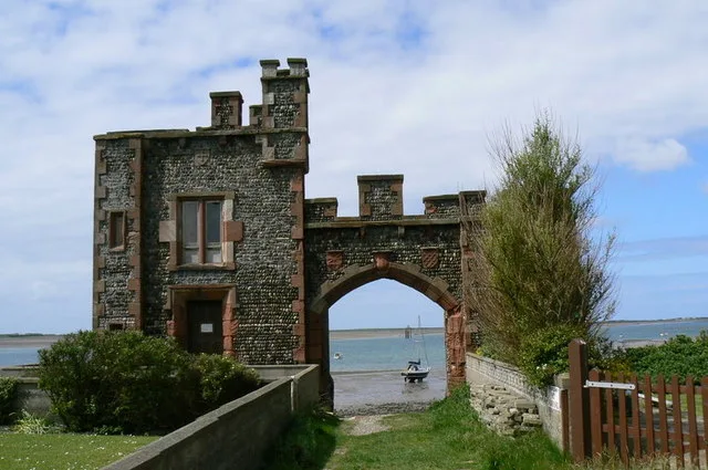
Roa Island
Islands · 0.9 km

Watch Tower
Castles · 1.2 km

White Hall Caravan Park Ltd
Caravan parks · 1.9 km

Foulney Island
Islands · 2.0 km
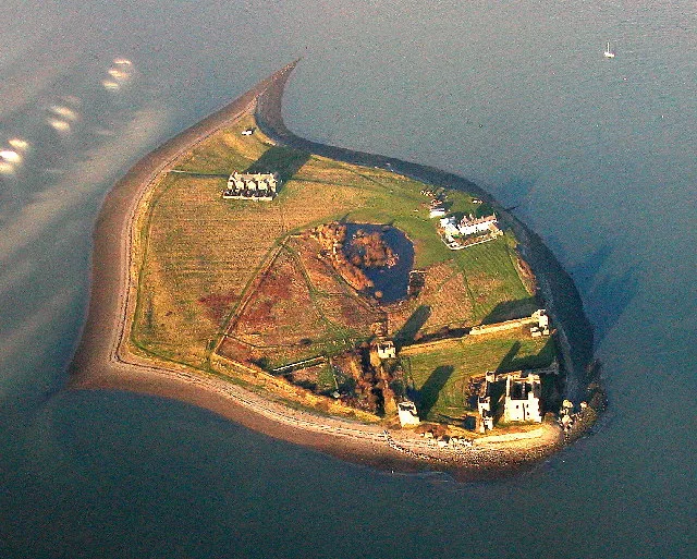
Piel Island
Islands · 2.2 km

Piel Harbour
Marinas · 2.2 km
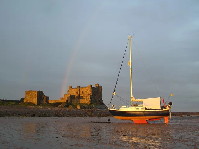
Piel Castle
Castles · 2.3 km

Meadowlands Caravan Park
Caravan parks · 2.3 km
Nearby
📷 5Historic pubs · North West England
The Concle Public House
The Concle Public House in England North West, United Kingdom.
📷 4Lighthouses · North West England
Rampside Lighthouse
Rampside Lighthouse — a Grade II-listed lighthouse in england-north-west, United Kingdom.
📷 5Caravan parks · North West England
Beacon Point Caravan Park
Beacon Point Caravan Park — a caravan park in england north west.
📷 3Historic houses · North West England
Rampside Hall
Rampside Hall — Grade I listed building in Barrow-in-Furness, Cumbria, England, UK.
Flagship📷 3Islands · North West England
Roa Island
Roa Island — island in Morecambe Bay, Cumbria, England, UK.
📷 5Where to eat & stay near Rampside
Places to stay
📷 5Caravan parks · North West England
Beacon Point Caravan Park
Beacon Point Caravan Park — a caravan park in england north west.
📷 5Caravan parks · North West England
White Hall Caravan Park Ltd
White Hall Caravan Park Ltd — a caravan park in england north west.
📷 5Caravan parks · North West England
Meadowlands Caravan Park
Meadowlands Caravan Park — a caravan park in england north west.
 📷 5
📷 5Caravan parks · North West England
South End Caravan Park
South End Caravan Park — a caravan park in england north west.
 📷 5
📷 5Caravan parks · North West England
High Farm Holiday Site
High Farm Holiday Site — a caravan park in england north west.
📷 5Caravan parks · North West England
Seacroft Caravan Park
Seacroft Caravan Park — a caravan park in england north west.
Places to eat & drink
📷 5Historic pubs · North West England
The Concle Public House
The Concle Public House in England North West, United Kingdom.
 📷 5
📷 5Historic pubs · North West England
Crofters Public House
Crofters Public House in England North West, United Kingdom.
 📷 5
📷 5Historic pubs · North West England
The Lord Ramsden Public House
The Lord Ramsden Public House in England North West, United Kingdom.
 📷 7
📷 7 📷 5
📷 5Historic pubs · North West England
Furness Abbey Hotel
Furness Abbey Hotel in England North West, United Kingdom.
 📷 5
📷 5Historic pubs · North West England
Chappells Tavern
Chappells Tavern in England North West, United Kingdom.
More beaches in this region
 📷 3
📷 3Beaches · North West England
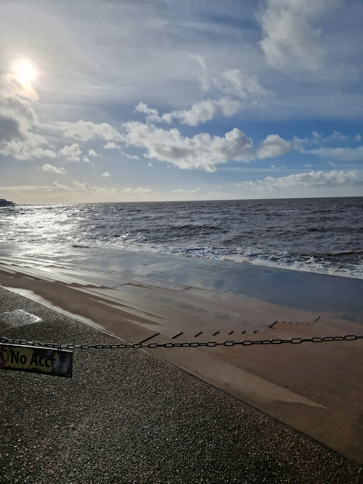
Blackpool Sands
Blackpool Sands — beach in Blackpool, Lancashire, England.
 📷 3
📷 3 📷 3
📷 3Beaches · North West England
Creek Beach North
Creek Beach North is a beach in the United Kingdom.
📷 3Beaches · North West England
Creek Beach South
Creek Beach South is a beach in the United Kingdom.
Frequently asked questions
- Where is Rampside?
- Rampside is in North-West England, United Kingdom (postcode LA13 0PY), in the parish of Barrow.
- What is Rampside?
- Rampside is a village in Cumbria, England. Historically in Lancashire, it is located a few miles south-east of the town of Barrow-in-Furness, in the north-western corner of Morecambe Bay on the Furnes
- How do I get to Rampside?
- The nearest railway station is Roose, about 4.0 km away. The nearest town is Swarthmoor. Drivers can use postcode LA13 0PY.
- Is Rampside a protected site?
- Yes — Rampside is part of the Morecambe Bay SSSI Site of Special Scientific Interest and the South Walney and Piel Channel Flats SSSI Site of Special Scientific Interest.
- Is Rampside free to visit?
- Yes, Rampside is free to enter.
- How do I get to Rampside?
- The nearest railway station is Roose, about 4.0 km away. Drivers can navigate to postcode LA13 0PY.