
Islands · Scottish Islands
RAF Aird Uig
RAF Aird Uig in Scotland Islands, United Kingdom.

Andy Waddington — CC BY-SA 2.0 via Wikimedia Commons licence

Plan your visit
- Typical visit
- 4 h–12 h
- Free entry
- Dog-friendly
About
RAF Aird Uig is a place of interest in Scotland Islands, United Kingdom — drawn from open-data sources for visitor reference. See the linked Wikipedia article for the full description.
Photo gallery
From the Wikipedia article
Royal Air Force Aird Uig was a Royal Air Force radar station located on the western edge of the Isle of Lewis in the Outer Hebrides, Scotland. The main masts and operations room were located north of the village of Aird Uig on Gallan Head, with a separate domestic site nearer to the village, five-eighths mile (one kilometre) further south. The station was originally constructed as part of the ROTOR programme and it was operated by the communications ground trades of the RAF between 1954 and 1974. After ROTOR, the site continued in RAF use as a communications station and radar site until 2000, when the responsibilities of the base were moved to RAF Buchan, near Peterhead in Aberdeenshire. The site was then taken over by NATO as a communications hub before being vacated completely by the military in 2010. In its later years, No. 112 Signals Unit at RAF Stornoway provided the staffing for the day-to-day operation of the site. The Guard House, which is at the entrance to the site, is asbestos contaminated, as are other various buildings on the site. There are plans to recondition the site and open it to the public as a tourist attraction, observatory and whale listening post.
Excerpt from Wikipedia under CC BY-SA 4.0. See the source article linked in Sources below.
Background
History
The site at Aird Uig is believed to have a been a look-out point going as far back as the time of the Viking invasions. During the First World War, a hut was placed on the site so that locals who were enlisted in the Auxiliary Coastguard Service could keep watch for enemy ships. The site was first identified by the Royal Air Force (RAF) in 1950 and construction started soon afterwards as part of the ROTOR 3 programme. The station was one of three in the ROTOR 3 programme that covered the north west of Scotland and were to be the first detection modules for the threat of low flying aircraft attacking from that direction. The other two in the system were located at Faraid Head in Sutherland…
Sourced from Wikipedia under CC BY-SA 4.0.
- Coordinates
- 58.2380, -7.0328
- District
- Na h-Eileanan Siar
- Postcode
- HS2 9JA
- Parliamentary constituency
- Na h-Eileanan an Iar
- Established
- 1954
Sources
- wikidata: Q39057590 (CC0)
- wikipedia: RAF Aird Uig (CC BY-SA 4.0)
Other places nearby

An Gallan Uigeach
Mountains & hills · 0.6 km

Àird Uig
Islands · 1.0 km

Rubha Mor
Mountains & hills · 1.6 km
Rudha Mòr
Mountains & hills · 1.6 km

Druim Mòr
Mountains & hills · 2.7 km

Forsnabhal
Mountains & hills · 3.2 km
Forsnabhal
Mountains & hills · 3.2 km

Traigh Bhorgaidh
Beaches · 3.9 km
Tràigh na Clibhe
Beaches · 4.1 km
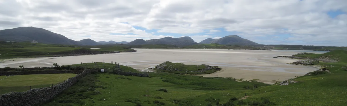
Camas Uig
Mountains & hills · 4.3 km

Uig Museum
Museums · 4.4 km
Timsgarry
Museums · 4.4 km
Nearby
📷 5Mountains & hills · Scottish Islands
An Gallan Uigeach
An Gallan Uigeach — a hill or mountain in scotland highlands.
📷 4📷 5📷 5Mountains & hills · Scottish Islands
Rudha Mòr
Rudha Mòr — mountain in scotland highlands. Elevation: 160 m.
📷 5Mountains & hills · Scottish Islands
Druim Mòr
Druim Mòr — mountain in scotland highlands. Elevation: 74 m.
📷 5Mountains & hills · Scottish Islands
Forsnabhal
Forsnabhal — a hill or mountain in scotland highlands.
Where to eat & stay near RAF Aird Uig
Places to stay
 📷 5
📷 5Campsites · Scottish Islands
Ardroil Sands Campsite
Ardroil Sands Campsite — a campsite in scotland highlands.
 📷 5
📷 5Campsites · Scottish Islands
Tràigh na Beirigh
Tràigh na Beirigh — a campsite in scotland highlands.
📷 5Caravan parks · Scottish Islands
Ardroil Caravan & Campervan Park
Ardroil Caravan & Campervan Park — a caravan park in scotland highlands.
📷 5 📷 5
📷 5Hostels · Scottish Islands
Otter Bunkhouse
Otter Bunkhouse — a hostel in scotland highlands.
 📷 5
📷 5Campsites · Scottish Islands
Eilean Fraoich Camp Site
Eilean Fraoich Camp Site — a campsite in scotland highlands.
More places in this region
 📷 5
📷 5Islands · Scottish Islands
Bac Beag
Bac Beag — Scottish island, part of the Treshnish Isles in the Inner Hebrides.
 📷 5
📷 5Islands · Scottish Islands
Bac Mòr
Bac Mòr — island in Argyll and Bute, Scotland, UK, one of the Treshnish Isles.
 Flagship📷 3
Islands · Scottish Islands
Baleshare
Baleshare — flat tidal island in the Outer Hebrides, Scotland, UK.
 Flagship📷 5
Islands · Scottish Islands
Barra
Barra — island in Outer Hebrides, Scotland, UK.
Frequently asked questions
- Where is RAF Aird Uig?
- RAF Aird Uig is in the Scottish Islands, United Kingdom (postcode HS2 9JA).
- What is RAF Aird Uig?
- RAF Aird Uig in Scotland Islands, United Kingdom.
- How do I get to RAF Aird Uig?
- Drivers can use postcode HS2 9JA.
- When was RAF Aird Uig built?
- Built or established in 1954.
- Who owns RAF Aird Uig?
- RAF Aird Uig is owned by Royal Air Force<br/>NATO.
- Is RAF Aird Uig free to visit?
- Yes, RAF Aird Uig is free to enter.
- How do I get to RAF Aird Uig?
- Drivers can navigate to postcode HS2 9JA. It sits within the Na h-Eileanan an Iar parliamentary constituency.