
Mountains & hills · North East England
Race Yate
In or near Gilmonby.
Race Yate — mountain in england north east. Elevation: 427.3 m.

Andy Waddington — CC BY-SA 2.0 via Wikimedia Commons licence

Plan your visit
- Typical visit
- 3 h–8 h
- Best time of year
- Late spring – early autumn (May–Oct)
- Dog-friendly
About
Race Yate is a mountain located in england north east. Elevation: 427.3 m. A named British peak recorded in OpenStreetMap. Peaks are typically named on Ordnance Survey 1:50k mapping.
Photo gallery
Protected designations
- Site of Special Scientific Interest: Cotherstone Moor SSSI
- Area of Outstanding Natural Beauty: North Pennines
Designations sourced from Natural England open data under OGL v3.
Place summary
Race Yate is a mountain located in North-East England. It is characterised by its rugged terrain and scenic views, making it a notable feature of the region. The area offers opportunities for outdoor activities such as hiking and climbing, appealing to both seasoned adventurers and casual walkers. Visitors can expect a natural landscape that showcases the region's geological features and diverse flora and fauna.
AI-generated from the structured facts on this page (operator, designation, listing, era). Not a substitute for visiting.
- Coordinates
- 54.5391, -2.0941
Sources
- osm: n433778454 (ODbL)
Other places nearby

Cotherstone Moor
Wildlife reserves · 1.1 km

Green How
Mountains & hills · 1.3 km

Hunder Beck Juniper
Wildlife reserves · 2.0 km

Goldsborough
Mountains & hills · 2.2 km

Lartington High Moor
Mountains & hills · 2.4 km

The Wilderness Company
Campsites · 2.4 km
Blackton Reservoir
Reservoirs & lochs · 2.5 km

Hannah's Meadows
Reservoirs & lochs · 2.6 km

Sun Dodd
Mountains & hills · 2.6 km

East Mere
Memorials & monuments · 2.7 km

Mere Beck Meadows
Forests & woodlands · 2.9 km
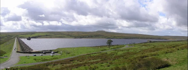
Balderhead Reservoir
Reservoirs & lochs · 3.1 km
Nearby
📷 4Wildlife reserves · North East England
Cotherstone Moor
Cotherstone Moor in England North East, United Kingdom.
📷 5Mountains & hills · North East England
Green How
Green How — mountain in england north east. Elevation: 374 m.
📷 3Wildlife reserves · North East England
Hunder Beck Juniper
Hunder Beck Juniper in England North East, United Kingdom.
📷 5📷 5Mountains & hills · North East England
Lartington High Moor
Lartington High Moor — mountain in england north east. Elevation: 469.1 m.
📷 5Campsites · North East England
The Wilderness Company
The Wilderness Company — a campsite in england north east.
Where to eat & stay near Race Yate
Places to stay
📷 5Campsites · North East England
The Wilderness Company
The Wilderness Company — a campsite in england north east.
 📷 5
Campsites · North East England
Ivy Hall Farm Campsite
Ivy Hall Farm Campsite — a campsite in england north east.
 📷 5
Campsites · North East England
The Old Armoury Campsite
The Old Armoury Campsite — a campsite in england north east.
 📷 5
Caravan parks · North East England
Doe Park Caravan Site
Doe Park Caravan Site — a caravan park in england north east.
 📷 5
Campsites · North East England
Newton Lodge campsite
Newton Lodge campsite — a campsite in scotland lowlands.
 📷 5
Campsites · North East England
Lonton South Farm
Lonton South Farm — a campsite in scotland lowlands.
Places to eat & drink
 📷 5
Historic pubs · North East England
Tan Hill Inn
Tan Hill Inn in England North East, United Kingdom.
 📷 5
Historic pubs · North East England
The White Swan Public House And Swan Cottage
The White Swan Public House And Swan Cottage in England North East, United Kingdom.
 📷 5
Historic pubs · North East England
Blue Bell Public House
Blue Bell Public House in England North East, United Kingdom.
 📷 6
Historic pubs · North East England
Commercial Hotel
Commercial Hotel in England North East, United Kingdom.
 📷 5
 📷 5
Historic pubs · North East England
Turk's Head Public House
Turk's Head Public House in England North East, United Kingdom.
More mountains in this region
 📷 5
Mountains & hills · North East England
Danby High Moor
Danby High Moor — a hill or mountain in england yorkshire.
 📷 5
Mountains & hills · North East England
Arndale Hill
Arndale Hill — mountain in england yorkshire. Elevation: 515.7 m.
 📷 5
Mountains & hills · North East England
Peat Hill
Peat Hill — mountain in england yorkshire. Elevation: 396 m.
 📷 5
Mountains & hills · North East England
Cocker Hill
Cocker Hill — mountain in england yorkshire. Elevation: 470 m.
Frequently asked questions
- Where is Race Yate?
- Race Yate is in North-East England, United Kingdom.
- What is Race Yate?
- Race Yate — mountain in england north east. Elevation: 427.3 m.
- How do I get to Race Yate?
- The nearest town is Gilmonby. Its coordinates are 54.5391°, -2.0941°.
- Is Race Yate a protected site?
- Yes — Race Yate is part of the Cotherstone Moor SSSI Site of Special Scientific Interest and the North Pennines National Landscape (AONB).