
Wildlife reserves · North East England
Cotherstone Moor
In or near Gilmonby.
Cotherstone Moor in England North East, United Kingdom.

Mick Garratt — CC BY-SA 2.0 via Wikimedia Commons licence

Plan your visit
- Typical visit
- 2 h–4 h
- Best time of year
- Autumn & winter (migration & wildfowl)
- Free entry
- Dog-friendly
About
Cotherstone Moor is a place of interest in England North East, United Kingdom — drawn from open-data sources for visitor reference. See the linked Wikipedia article for the full description.
Photo gallery
Official information
Cotherstone Moor is a Site of Special Scientific Interest (SSSI) located in County Durham, recognized for its biological interest. Visitors can explore the natural habitats and diverse wildlife within this protected area.
Protected designations
- Site of Special Scientific Interest: Cotherstone Moor SSSI
- Area of Outstanding Natural Beauty: North Pennines
Designations sourced from Natural England open data under OGL v3.
From the Wikipedia article
Cotherstone Moor is a Site of Special Scientific Interest in the Teesdale district in south-west County Durham, England. It is an extensive area of moorland which extends almost the entire length of Baldersdale, from the confluence of the River Balder with the Tees at Cotherstone. It runs parallel to Bowes Moor SSSI, which lies a short distance to the south. The area includes a variety of upland vegetation types, much of it blanket bog, including one area that is found nowhere else in County Durham and which is unusual for being transitional between northern upland and lowland bogs. Other habitats include dry heath, acid grassland, flushes, and rock and block scree. The area supports breeding populations of a number of species of birds that are listed in the United Kingdom's Red Data Book (Birds), including four that are listed in Annex 1 of the European Commission's Birds Directive as requiring special protection. The Pennine Way National Trail passes through the area.
Excerpt from Wikipedia under CC BY-SA 4.0. See the source article linked in Sources below.
- Coordinates
- 54.5486, -2.0936
- Established
- 1955
- Official site
- designatedsites.naturalengland.org.uk
Sources
- wikidata: Q5175356 (CC0)
- wikipedia: Cotherstone Moor (CC BY-SA 4.0)
Other places nearby

Race Yate
Mountains & hills · 1.1 km

Hunder Beck Juniper
Wildlife reserves · 1.1 km

The Wilderness Company
Campsites · 1.4 km
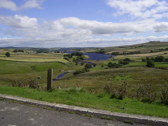
Blackton Reservoir
Reservoirs & lochs · 1.5 km

Goldsborough
Mountains & hills · 1.5 km

Hannah's Meadows
Reservoirs & lochs · 1.6 km

Mere Beck Meadows
Forests & woodlands · 2.0 km

Baldersdale
Castles · 2.1 km

Former limekiln
Archaeological sites · 2.3 km

Green How
Mountains & hills · 2.3 km
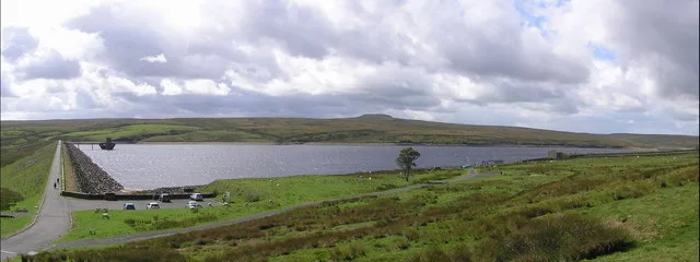
Balderhead Reservoir
Reservoirs & lochs · 2.4 km

Hury
Villages · 2.7 km
Nearby
📷 5Mountains & hills · North East England
Race Yate
Race Yate — mountain in england north east. Elevation: 427.3 m.
📷 3Wildlife reserves · North East England
Hunder Beck Juniper
Hunder Beck Juniper in England North East, United Kingdom.
📷 5Campsites · North East England
The Wilderness Company
The Wilderness Company — a campsite in england north east.
📷 3Reservoirs & lochs · North East England
Blackton Reservoir
Blackton Reservoir — reservoir in County Durham, England, UK.
📷 5📷 4Reservoirs & lochs · North East England
Hannah's Meadows
Hannah's Meadows in England North East, United Kingdom.
Where to eat & stay near Cotherstone Moor
Places to stay
📷 5Campsites · North East England
The Wilderness Company
The Wilderness Company — a campsite in england north east.
 📷 5
📷 5Campsites · North East England
Ivy Hall Farm Campsite
Ivy Hall Farm Campsite — a campsite in england north east.
 📷 5
📷 5Campsites · North East England
The Old Armoury Campsite
The Old Armoury Campsite — a campsite in england north east.
 📷 5
📷 5Campsites · North East England
Newton Lodge campsite
Newton Lodge campsite — a campsite in scotland lowlands.
 📷 5
📷 5Caravan parks · North East England
Doe Park Caravan Site
Doe Park Caravan Site — a caravan park in england north east.
 📷 5
📷 5Campsites · North East England
Lonton South Farm
Lonton South Farm — a campsite in scotland lowlands.
Places to eat & drink
 📷 5
📷 5Historic pubs · North East England
The White Swan Public House And Swan Cottage
The White Swan Public House And Swan Cottage in England North East, United Kingdom.
 📷 6
📷 6Historic pubs · North East England
Commercial Hotel
Commercial Hotel in England North East, United Kingdom.
 📷 5
📷 5Historic pubs · North East England
Blue Bell Public House
Blue Bell Public House in England North East, United Kingdom.
 📷 5
📷 5 📷 5
📷 5Historic pubs · North East England
Turk's Head Public House
Turk's Head Public House in England North East, United Kingdom.
 📷 6
📷 6Historic pubs · North East England
Cricketers' Arms Public House
Cricketers' Arms Public House in England North East, United Kingdom.
More places in this region
 📷 3
📷 3Wildlife reserves · North East England
Augill Pasture
Augill Pasture — nature reserve in Cumbria, England.
 📷 4
📷 4Wildlife reserves · North East England
Ash Fell Edge
Ash Fell Edge in England North East, United Kingdom.
 📷 4
📷 4Wildlife reserves · North East England
Sunbiggin Tarn
Sunbiggin Tarn in England North East, United Kingdom.
 📷 3
📷 3Wildlife reserves · North East England
Aules Hill Meadows
Aules Hill Meadows in England North East, United Kingdom.
Frequently asked questions
- Where is Cotherstone Moor?
- Cotherstone Moor is in North-East England, United Kingdom.
- What is Cotherstone Moor?
- Cotherstone Moor in England North East, United Kingdom.
- How do I get to Cotherstone Moor?
- The nearest town is Gilmonby. Its coordinates are 54.5486°, -2.0936°.
- When was Cotherstone Moor built?
- Built or established in 1955.
- Is Cotherstone Moor a protected site?
- Yes — Cotherstone Moor is part of the Cotherstone Moor SSSI Site of Special Scientific Interest and the North Pennines National Landscape (AONB).
- Is Cotherstone Moor free to visit?
- Yes, Cotherstone Moor is free to enter.
- Are dogs allowed at Cotherstone Moor?
- Most wildlife reserves allow dogs on lead only, with restrictions during ground-nesting bird season (March-July). Check signage at the reserve.