
Abbeys & priories · Central Scotland
Q1404409
Also known as: An Apainn
In or near Benderloch.
Q1404409 in Scotland Islands, United Kingdom.

The Carlisle Kid — CC BY-SA 2.0 via Wikimedia Commons licence

Plan your visit
- Typical visit
- 45 min–1.5 h
- Family-friendly
- Limited wheelchair access
About
Q1404409 is a place of interest in Scotland Islands, United Kingdom — drawn from open-data sources for visitor reference. See the linked Wikipedia article for the full description.
Photo gallery
360° viewimagery from 2024
Imagery © Mapillary contributors, CC BY-SA 4.0
From the Wikipedia article
Appin (Scottish Gaelic: An Apainn) is a coastal district of the Scottish West Highlands bounded to the west by Loch Linnhe, to the south by Loch Creran, to the east by the districts of Benderloch and Lorne, and to the north by Loch Leven. It lies northeast to southwest, and measures 23 by 11 kilometres (14 by 7 miles). The name, meaning "abbey land", in reference to Lismore Abbey, is derived from the Middle Irish apdaine. The district is mainly in Argyll and Bute, with a coastal strip to the north, along Loch Leven, within the Highland council area. The scenery of the district is a combination of seascapes with rugged and mountainous country inland. Appin forms part of the Lynn of Lorn National Scenic Area, one of 40 in Scotland. The principal hills are double peaks of Beinn a' Bheithir – 1,025 and 1,001 m (3,362 and 3,284 ft), respectively – and Creag Ghorm – 723 m (2,372 ft) – in the north, and Fraochaidh 879 m (2,883 ft), Meall Bàn 655 m (2,148 ft) and Beinn Mhic na Cèisich 638 m (2,093 ft) near the western flank of Glen Creran. The chief rivers are the Coe and Laroch, flowing into Loch Leven, the Duror and Salachan flowing into Loch Linnhe, and the Iola and Creran flowing into Loch Creran. The leading industries are forestry and tourism, with lead mining and slate quarrying being of former importance, but the Glensanda superquarry, in Morvern on the opposite bank of Loch Linnhe also provides local employment. Ballachulish, Duror, Portnacroish, Appin Village and Port Appin are the principal villages. Appin was the country of a distinct local branch of Clan Stewart. The A828 road runs along the coast of Appin. A passenger-only ferry to the island of Lismore runs from Port Appin. The district formerly had a railway, but the Caledonian Railway company's branch line from Connel to Ballachulish was closed in 1966. Appin is where the Appin Murder took place in 1752.
Excerpt from Wikipedia under CC BY-SA 4.0. See the source article linked in Sources below.
- Coordinates
- 56.5622, -5.3589
- District
- Argyll and Bute
- Postcode
- PA38 4DB
- Parliamentary constituency
- Argyll, Bute and South Lochaber
Sources
Other places nearby

Stewarts of Appin Culloden Memorial
Memorials & monuments · 0.3 km
Appin Parish Church
Historic churches · 0.3 km

Airds Hill
Mountains & hills · 1.1 km
Airds Hill
Mountains & hills · 1.3 km

Battle of Stalc Monument
Memorials & monuments · 1.5 km
Portnacroish Episcopal Church, Portnacroish
Historic churches · 1.5 km

Portnacroish
Villages · 1.6 km

Appin railway station
Reservoirs & lochs · 1.6 km

Castle Stalker viewpoint
Viewpoints · 1.8 km

Castle Stalker Jetty (private)
Piers · 1.9 km

A828 road
Natural landmarks · 1.9 km
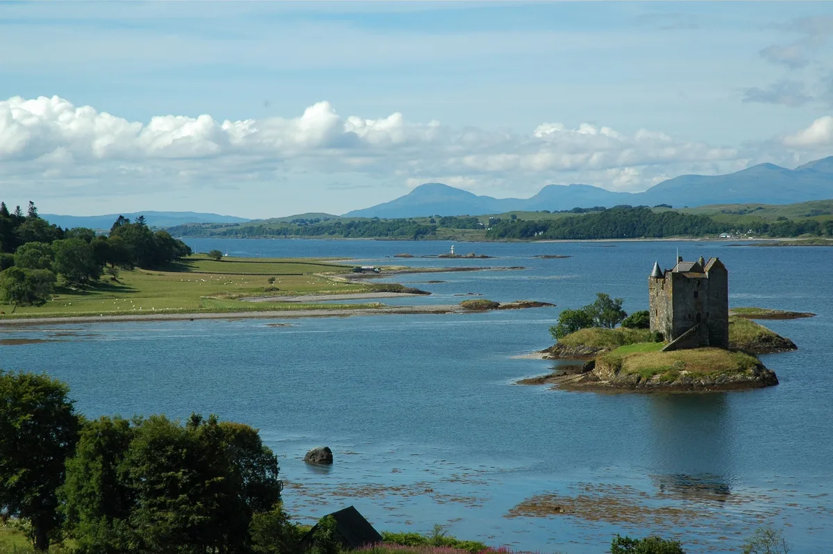
Castle Stalker
Castles · 2.0 km
Nearby
📷 3Memorials & monuments · Central Scotland
Stewarts of Appin Culloden Memorial
Stewarts of Appin Culloden Memorial — a memorial in scotland-highlands, United Kingdom.
📷 5Historic churches · Central Scotland
Appin Parish Church
Appin Parish Church — scheduled monument-listed church in scotland-highlands, United Kingdom.
📷 5Mountains & hills · Central Scotland
Airds Hill
Airds Hill — a hill or mountain in scotland highlands.
📷 5Mountains & hills · Central Scotland
Airds Hill
Airds Hill — mountain in scotland highlands. Elevation: 181 m.
📷 3Memorials & monuments · Central Scotland
Battle of Stalc Monument
Battle of Stalc Monument — a memorial in scotland-highlands, United Kingdom.
📷 5Historic churches · Central Scotland
Portnacroish Episcopal Church, Portnacroish
Portnacroish Episcopal Church, Portnacroish — category B listed building-listed church in scotland-highlands, United Kingdom.
Where to eat & stay near Q1404409
Places to stay
 📷 5
📷 5Caravan parks · Central Scotland
Creagan Station Tourers Camper Site
Creagan Station Tourers Camper Site — a caravan park in scotland highlands.
 📷 5
📷 5 📷 5
📷 5Caravan parks · Central Scotland
Oban Camping & Caravanning Club Site
Oban Camping & Caravanning Club Site — a caravan park in scotland highlands.
 📷 5
📷 5 📷 5
📷 5Caravan parks · Central Scotland
Elderberry Holiday Park
Elderberry Holiday Park — a caravan park in scotland highlands.
 📷 5
📷 5Caravan parks · Central Scotland
Tralee Bay Holidays
Tralee Bay Holidays — a caravan park in scotland highlands.
Places to eat & drink
 📷 7
📷 7 📷 7
📷 7Historic pubs · Central Scotland
King's Arms Flats, 28 George Street, Oban
King's Arms Flats, 28 George Street, Oban in Scotland Central, United Kingdom.
 📷 7
📷 7Historic pubs · Central Scotland
Caledonian Hotel, George Street, Oban
Caledonian Hotel, George Street, Oban in Scotland Central, United Kingdom.
 📷 4
📷 4Historic pubs · Scottish Highlands
Clachaig Inn
Clachaig Inn in Scotland Islands, United Kingdom.
More abbeys in this region
 📷 4
📷 4 📷 4
📷 4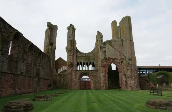 ★ Iconic📷 3
Abbeys & priories · Central Scotland
Arbroath Abbey
Arbroath Abbey — abbey in Arbroath, Scotland, United Kingdom.
 📷 4
📷 4Abbeys & priories · Central Scotland
Gartocharn
Gartocharn in Scotland Islands, United Kingdom.
Frequently asked questions
- Where is Q1404409?
- Q1404409 is in the Scottish Highlands, United Kingdom (postcode PA38 4DB).
- What is Q1404409?
- Q1404409 in Scotland Islands, United Kingdom.
- How do I get to Q1404409?
- Drivers can use postcode PA38 4DB.
- How do I get to Q1404409?
- Drivers can navigate to postcode PA38 4DB. It sits within the Argyll, Bute and South Lochaber parliamentary constituency.