
Towns & cities · West Midlands
Princethorpe
Princethorpe — village in Warwickshire, England, UK.

Wikimedia Commons licence
Plan your visit
- Typical visit
- 3 h–6 h
- Nearest railway station
- Midgeway · 8.1 km
- Free entry
- Family-friendly
- Dog-friendly
Getting there & planning your visit
Princethorpe is located in the West Midlands, with the nearest railway station being Midgeway, approximately 8.1 km away. Entry to the town is free. The postcode for sat-nav is CV23.
About
Princethorpe is a town, city, village or settlement in the United Kingdom. It covers approximately 432 km². Recent population estimates put it at around 376 people. Address: CV23. Wikidata describes it as: "village in Warwickshire, England, UK". Coordinates: 52.3266°, -1.4145°.
Photo gallery
From the Wikipedia article
Princethorpe is a village and civil parish in the Rugby district of Warwickshire, England. In the 2011 census the parish had a population 376, increasing to 429 at the 2021 census. Princethorpe is located roughly halfway between the towns of Rugby 6.5 miles (10.5 km) to the north-east, and Leamington Spa 6 miles (9.7 km) to the south-west. It is at the centre of a busy junction between the A423 (Coventry to Banbury), B4453 (Rugby to Leamington) and B4455 (Fosse Way) roads. The village once had a pub called the Three Horseshoes, which was in business continuously from at least 1816 until it closed in 2023. Situated on Leamington Road in the village is Our Lady's Primary School. It is a primary school with around 100 children between the ages of 4 and 11. Just outside the village is Princethorpe College, a Roman Catholic school. The school incorporates the buildings of the former St. Mary's Priory, which was founded by French Benedictine nuns from Montargis who sought asylum from the French Revolution in 1792. After several moves, they settled in Princethorpe in 1832, and established a priory and school. In 1966 it was purchased by the Missionaries of the Sacred Heart who established it into its present form. The village has a history extending to at least the Roman period, related to the fact that the Fosse Way, an old Roman road ran through it. Two Roman settlements existed just south of the current village. In the 1950s, a number of Roman coins were found in Princethorpe. Its name likely derived from an Anglo-Saxon farmer called Pren. It was first mentioned in 1275–6. In the reign of Henry VI it came into the possession of the Hugford family of Emscote and stayed in that family until the reign of Henry VII when John Hugford sold it to Sir William Compton. Princethorpe was originally in the parish of Wolston but was made, for convenience, a separate parish with Stretton by an Act of Parliament in 1694 the reign of William III. Princethorpe is today still part of…
Excerpt from Wikipedia under CC BY-SA 4.0. See the source article linked in Sources below.
- Coordinates
- 52.3266, -1.4145
- County
- Warwickshire
- District
- Rugby
- Parish
- Princethorpe
- Postcode
- CV23
- Parliamentary constituency
- Kenilworth and Southam
- Population
- 376
- Nearest railway station
- Midgeway — 8.1 km
Sources
- wikidata: Q546248 (CC0)
- wikipedia: Princethorpe (CC BY-SA 4.0)
Other places nearby

Ryton Pools Country Park mountain bike route
Mountain bike trails · 0.5 km
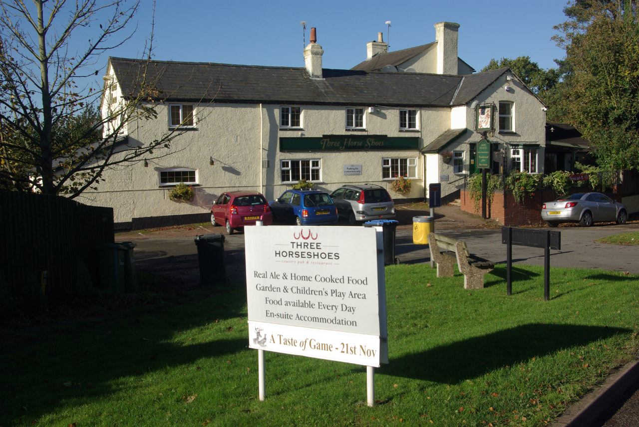
Princethorpe
Villages · 0.7 km

River Itchen, Warwickshire
Museums · 1.1 km

Marton Bridge
Historic bridges · 1.1 km
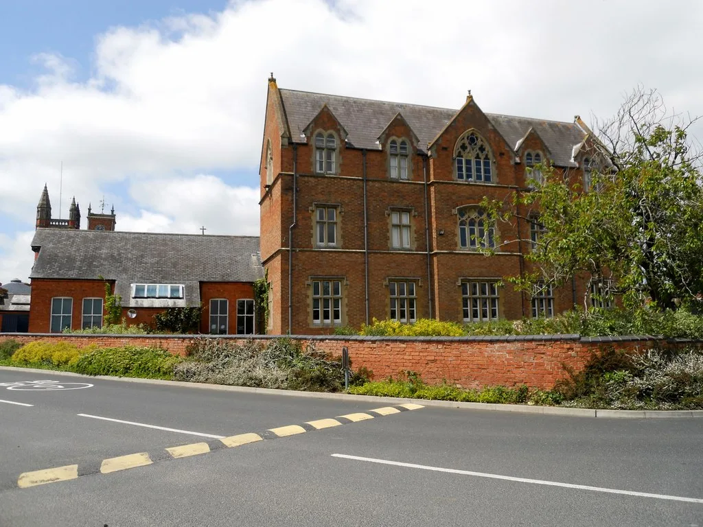
Princethorpe College
Abbeys & priories · 1.1 km

Bridge Over River Itchen At Sp4054 6881 (That Part Within Marton Civil Parish)
Historic bridges · 1.3 km

Marton
Villages · 1.4 km

The Museum of Country Bygones
Museums · 1.5 km

Wappenbury camp univallate hillfort and medieval settlement remains
Vineyards · 2.4 km

Frankton
Villages · 2.5 km

Hunningham Bridge
Historic bridges · 3.1 km

School House
Historic houses · 3.5 km
Princethorpe is a town in Warwickshire, located within the West Midlands region. Visitors can explore the historic Princethorpe College, which was originally an abbey, and cross the scenic Marton Bridge. The area also offers the opportunity to view the Church of Saint Michael in Weston under Wetherley.
At a glance
- Population
- 376
- Administrative county
- Warwickshire
- Constituency
- Kenilworth and Southam
- Top categories near here
Things to see in Princethorpe
13 attractions within 12 km. Full guide: things to do in Princethorpe →
★ Iconic📷 3Abbeys & priories · West Midlands
Princethorpe College
Princethorpe College — school building, formerly convent in Princethorpe, Warwickshire, England, UK.
📷 3Museums · West Midlands
The Museum of Country Bygones
The Museum of Country Bygones — a museum in West Midlands, United Kingdom.
📷 3Historic bridges · West Midlands
Marton Bridge
Marton Bridge — a Grade II-listed bridge in england-west-midlands, United Kingdom.
📷 3Historic bridges · West Midlands
Hunningham Bridge
Hunningham Bridge — a Grade II-listed bridge in england-west-midlands, United Kingdom.
 📷 3
📷 3Historic churches · West Midlands
Church of Saint Michael, Weston under Wetherley
Church of Saint Michael, Weston under Wetherley — Grade I listed building-listed church in england-west-midlands, United Kingdom.
📷 3Historic bridges · West Midlands
Bridge Over River Itchen At Sp4054 6881 (That Part Within Marton Civil Parish)
Bridge Over River Itchen At Sp4054 6881 (That Part Within Marton Civil Parish) — Grade II listed building-listed bridge in england-west-midlands, United Kingdom.
 📷 3
📷 3Historic bridges · West Midlands
Hunningham Railway Bridge
Hunningham Railway Bridge — Grade II* listed building-listed bridge in england-west-midlands, United Kingdom.
 📷 3
📷 3Public art & sculpture · West Midlands
Eileen Sheridan & Dave Moorcroft
Eileen Sheridan & Dave Moorcroft — a public art in West Midlands, United Kingdom.
📷 5Museums · West Midlands
River Itchen, Warwickshire
The River Itchen flows through east Warwickshire in England. It is a small river, about 18 miles (29 km) long, and its general course is from south to north.
📷 5Mountain bike trails · West Midlands
Ryton Pools Country Park mountain bike route
Ryton Pools Country Park mountain bike route — a mtb trail in england west midlands.
📷 5Vineyards · West Midlands
Wappenbury camp univallate hillfort and medieval settlement remains
Wappenbury camp univallate hillfort and medieval settlement remains — a UK vineyard in england west midlands, producing English or Welsh wine from cool-climate grape varieties.
📷 5📷 5Nearby
📷 5Mountain bike trails · West Midlands
Ryton Pools Country Park mountain bike route
Ryton Pools Country Park mountain bike route — a mtb trail in england west midlands.
📷 5📷 5Museums · West Midlands
River Itchen, Warwickshire
The River Itchen flows through east Warwickshire in England. It is a small river, about 18 miles (29 km) long, and its general course is from south to north.
📷 3Historic bridges · West Midlands
Marton Bridge
Marton Bridge — a Grade II-listed bridge in england-west-midlands, United Kingdom.
★ Iconic📷 3Abbeys & priories · West Midlands
Princethorpe College
Princethorpe College — school building, formerly convent in Princethorpe, Warwickshire, England, UK.
📷 3Historic bridges · West Midlands
Bridge Over River Itchen At Sp4054 6881 (That Part Within Marton Civil Parish)
Bridge Over River Itchen At Sp4054 6881 (That Part Within Marton Civil Parish) — Grade II listed building-listed bridge in england-west-midlands, United Kingdom.
Where to eat & stay near Princethorpe
Places to stay
 📷 5
📷 5 📷 5
📷 5Caravan parks · West Midlands
Manor Farm Caravan Site
Manor Farm Caravan Site — a caravan park in england west midlands.
 📷 7
📷 7Hotels · West Midlands
The Angel Hotel
The Angel Hotel — a hotel in england west midlands.
 📷 6
📷 6Hotels · West Midlands
The Regent Hotel
The Regent Hotel — a hotel in england west midlands.
 📷 5
📷 5Caravan parks · West Midlands
Churchlands Farm
Churchlands Farm — a caravan park in england west midlands.
 📷 5
📷 5Places to eat & drink
 📷 5
📷 5Historic pubs · West Midlands
The Malt Shovel
The Malt Shovel — Historic pub — listed building or notable heritage status.
 📷 3
📷 3Historic pubs · West Midlands
The Stag at Offchurch
The Stag at Offchurch — Historic pub — listed building or notable heritage status.
 📷 7
📷 7Historic pubs · West Midlands
The Bowling Green Public House
The Bowling Green Public House in England West Midlands, United Kingdom.
 📷 7
📷 7Historic pubs · West Midlands
The Old Mint Public House
The Old Mint Public House in England West Midlands, United Kingdom.
 📷 5
📷 5Historic pubs · West Midlands
The Black Dog Public House
The Black Dog Public House in England West Midlands, United Kingdom.
 📷 5
📷 5Historic pubs · West Midlands
The Biggin Hall
The Biggin Hall — Historic pub — listed building or notable heritage status.
More towns in this region
 📷 5
📷 5Towns & cities · West Midlands
Colton
Colton — village and civil parish in Lichfield District, Staffordshire, England.
 📷 3
📷 3Towns & cities · West Midlands
Hoar Cross
Hoar Cross — village in Staffordshire, England, UK.
 Flagship📷 3
 Flagship📷 3
Frequently asked questions
- Where is Princethorpe?
- Princethorpe is in Warwickshire, the West Midlands, United Kingdom (postcode CV23), in the parish of Princethorpe.
- What is Princethorpe?
- Princethorpe — village in Warwickshire, England, UK.
- How do I get to Princethorpe?
- The nearest railway station is Midgeway, about 8.1 km away. Drivers can use postcode CV23.
- Is Princethorpe free to visit?
- Yes, Princethorpe is free to enter.
- How do I get to Princethorpe?
- Drivers can navigate to postcode CV23. It sits within the Kenilworth and Southam parliamentary constituency.