
Museums · South East England
Princes Risborough
In or near Horsenden.
Princes Risborough () is a market town and civil parish in Buckinghamshire, England; it is located about 8 miles (13 km) south of Aylesbury, 9 miles (14 km) northwest of High Wycombe, and 7 miles (11

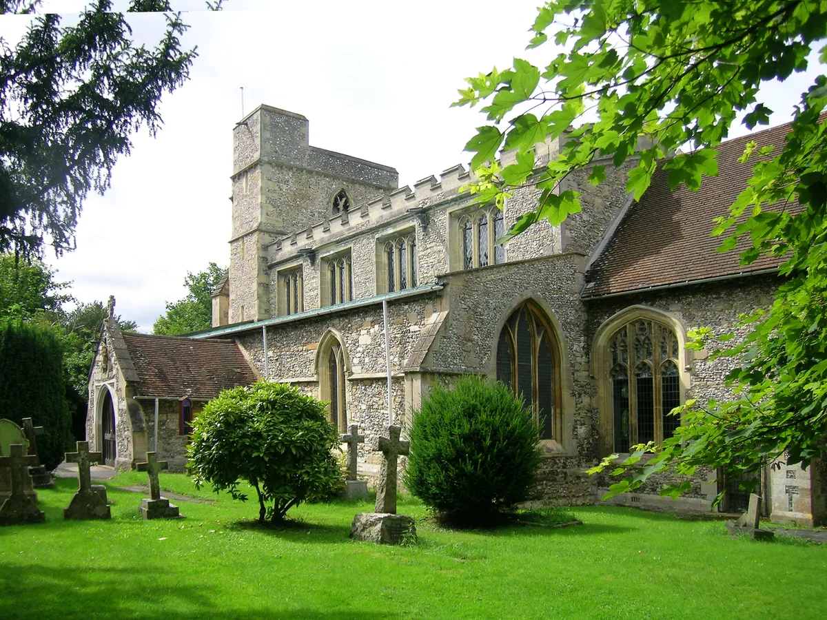
Stephen McKay — CC BY-SA 2.0 via Wikimedia Commons licence

Plan your visit
- Typical visit
- 1.5 h–3 h
- Best time of year
- Year-round
- Nearest railway station
- Princes Risborough · 0.9 km
- Family-friendly
- Limited wheelchair access
Getting there & planning your visit
To visit the museum in Princes Risborough, the nearest railway station is Princes Risborough, located 0.9 km away. The postcode for the location is HP27 9AA. Please note that wheelchair accessibility is limited.
About
Princes Risborough () is a market town and civil parish in Buckinghamshire, England; it is located about 8 miles (13 km) south of Aylesbury, 9 miles (14 km) northwest of High Wycombe, and 7 miles (11 km) south of Thame. It lies at the foot of the Chiltern Hills, at the north end of a gap or pass through the Chilterns; the south end of which is at West Wycombe. The A4010 road follows this route from West Wycombe through the town and then on to Aylesbury. Historically, it was both a manor and an ecclesiastical parish, of the same extent as the manor, which comprised the present ecclesiastical parish of Princes Risborough (excluding Ilmer) and also the present ecclesiastical parish of Lacey Green, which became a separate parish in the 19th century. It was long and narrow (a "strip parish"), taking in land below the Chiltern scarp, the slope of the scarp itself and also land above the scarp extending into the Chiltern hills. The manor and the parish extended from Longwick in the north through Alscot, the town of Princes Risborough, Loosley Row and Lacey Green to Speen and Walters Ash in the south. Since 1934, the civil parish of Princes Risborough (formerly the same as the ecclesiastical parish) has included the town of Princes Risborough, the village of Monks Risborough (but not the outlying parts) and part of Horsenden but has excluded Longwick. It is within the Wycombe district of Buckinghamshire and operates as a town council within Wycombe district. The town is overlooked by
Photo gallery
Protected designations
- Area of Outstanding Natural Beauty: Chilterns
Designations sourced from Natural England open data under OGL v3.
From the Wikipedia article
Princes Risborough () is a market town and civil parish in Buckinghamshire, England; it is located about 8 miles (13 km) south of Aylesbury, 9 miles (14 km) northwest of High Wycombe, and 7 miles (11 km) south of Thame. It lies at the foot of the Chiltern Hills, at the north end of a gap or pass through the Chilterns; the south end of which is at West Wycombe. The A4010 road follows this route from West Wycombe through the town and then on to Aylesbury. Historically, it was both a manor and an ecclesiastical parish, of the same extent as the manor, which comprised the present ecclesiastical parish of Princes Risborough (excluding Ilmer) and also the present ecclesiastical parish of Lacey Green, which became a separate parish in the 19th century. It was long and narrow (a "strip parish"), taking in land below the Chiltern scarp, the slope of the scarp itself and also land above the scarp extending into the Chiltern hills. The manor and the parish extended from Longwick in the north through Alscot, the town of Princes Risborough, Loosley Row and Lacey Green to Speen and Walters Ash in the south. Since 1934, the civil parish of Princes Risborough (formerly the same as the ecclesiastical parish) has included the town of Princes Risborough, the village of Monks Risborough (but not the outlying parts) and part of Horsenden but has excluded Longwick. It is within the Wycombe district of Buckinghamshire and operates as a town council within Wycombe district. The town is overlooked by the Whiteleaf Cross, a chalk cross carved into the hillside that's just northeast of the town. Though the cross itself lies just above the village with the same name, the landmark is located within the area of Monks Risborough.
Excerpt from Wikipedia under CC BY-SA 4.0. See the source article linked in Sources below.
- Coordinates
- 51.7240, -0.8344
- District
- Buckinghamshire
- Parish
- Princes Risborough
- Postcode
- HP27 9AA
- Parliamentary constituency
- Mid Buckinghamshire
- Nearest railway station
- Princes Risborough — 0.9 km
- Official site
- www.neighbourhood.statistics.gov.uk
Sources
- wikipedia: Princes Risborough (CC BY-SA 4.0)
Other places nearby
I Am The Way
Public art & sculpture · 0.0 km

Church of St Mary
Historic churches · 0.0 km

Radhuni
Restaurants · 0.1 km

St Scholastica's Retreat
Memorials & monuments · 0.3 km

Art in the Park
Public art & sculpture · 0.3 km

Monks Risborough
Villages · 1.0 km
Church of St Dunstan
Historic churches · 1.2 km

Monks Risborough War Memorial
Memorials & monuments · 1.2 km

Horsenden Manor
Manor houses · 1.4 km

Horsenden
Towns & cities · 1.4 km

Brush Hill Local Nature Reserve
Wildlife reserves · 1.4 km
Brush Hill Local Nature Reserve
Forests & woodlands · 1.6 km
Nearby
📷 3Public art & sculpture · South East England
I Am The Way
I Am The Way — a public art in South East England, United Kingdom.
📷 3Historic churches · South East England
Church of St Mary
Church of St Mary — church in Princes Risborough, Buckinghamshire, England, UK.
📷 5📷 3Memorials & monuments · South East England
St Scholastica's Retreat
St Scholastica's Retreat — a memorial in South East England, United Kingdom.
📷 3Public art & sculpture · South East England
Art in the Park
Art in the Park — a public art in South East England, United Kingdom.
📷 5Where to eat & stay near Princes Risborough
Places to stay
 📷 5
📷 5Campsites · South East England
Orchard View Farm
Orchard View Farm — a campsite in england west midlands.
 📷 5
📷 5 📷 5
📷 5Hotels · South East England
Bel & The Dragon at the Red Lion
Bel & The Dragon at the Red Lion — a hotel in england west midlands. Brand: Fuller's.
 📷 7
📷 7 📷 5
📷 5Campsites · South East England
Hill Farm Campsite
Hill Farm Campsite — a campsite in england west midlands.
 📷 5
📷 5Campsites · South East England
Cholsey Grange CARAVAN Certificated Location
Cholsey Grange CARAVAN Certificated Location — a campsite in england west midlands.
Places to eat & drink
📷 5 📷 7
📷 7Historic pubs · South East England
The Three Crowns
The Three Crowns in England South East, United Kingdom.
📷 7Restaurants · South East England
Coco Tamarind
Coco Tamarind — a restaurant in england west midlands.
 📷 5
📷 5Historic pubs · South East England
Sir Charles Napier Inn
Sir Charles Napier Inn in England South East, United Kingdom.
 📷 7
📷 7Historic pubs · South East England
King And Queen Public House
King And Queen Public House in England South East, United Kingdom.
 📷 5
📷 5Historic pubs · South East England
The White Swan
The White Swan — Historic pub — listed building or notable heritage status.
More museums in this region
 📷 5
📷 5Museums · South East England
Coldrum Long Barrow
Coldrum Long Barrow — neolithic chambered long barrow near Trottiscliffe, Kent, England, UK.
 📷 5
📷 5Museums · South East England
Guildford House
Guildford House — house in Guildford, Surrey, England, UK.
 📷 5
📷 5Museums · South East England
Huguenot Museum
Huguenot Museum — museum in Rochester, England, UK.
 📷 5
📷 5Museums · South East England
Medway megaliths
Medway megaliths — group of long barrows in Kent, England.
Frequently asked questions
- Where is Princes Risborough?
- Princes Risborough is in South-East England, United Kingdom (postcode HP27 9AA), in the parish of Princes Risborough.
- What is Princes Risborough?
- Princes Risborough () is a market town and civil parish in Buckinghamshire, England; it is located about 8 miles (13 km) south of Aylesbury, 9 miles (14 km) northwest of High Wycombe, and 7 miles (11
- How do I get to Princes Risborough?
- The nearest railway station is Princes Risborough, about 0.9 km away. The nearest town is Horsenden. Drivers can use postcode HP27 9AA.
- Is Princes Risborough a protected site?
- Yes — Princes Risborough is part of the Chilterns National Landscape (AONB).
- How do I get to Princes Risborough?
- The nearest railway station is Princes Risborough, about 0.9 km away. Drivers can navigate to postcode HP27 9AA.