
Forests & woodlands · South West England
Priddy Mineries
In or near Wells.
Priddy Mineries is a forest or woodland in the United Kingdom.

Wikimedia Commons licence
Plan your visit
- Typical visit
- 1 h–3 h
- Free entry
- Family-friendly
- Dog-friendly
About
Priddy Mineries is a named forest, woodland or nature reserve in the United Kingdom. Coordinates: 51.2578°, -2.6528°. This entry is part of The Great Britain Guide, a free, ad-free, open-data tourist directory.
Photo gallery
Protected designations
- Site of Special Scientific Interest: Priddy Caves SSSI
- Site of Special Scientific Interest: Priddy Pools SSSI
- National Nature Reserve: MENDIP
- Area of Outstanding Natural Beauty: Mendip Hills
Designations sourced from Natural England open data under OGL v3.
From the Wikipedia article
Priddy Mineries (grid reference ST547515) is a nature reserve previously run by the Somerset Wildlife Trust. It is in the village of Priddy, on the Mendip Hills in Somerset. The reserve lies 3 miles north of Wells and 1.5 miles east of the village of Priddy. It is a site of 50 ha (123 acres) and is part of the Priddy Pools Site of Special Scientific Interest (SSSI). It is mostly grassland / heather mosaic with an area of valley mire and some nutrient-poor pools. The site is one of the beauty spots of Mendip partly due to these pools with the changing colours of the vegetation and the pines and the heather slopes. It is adjacent to Stock Hill woodland, and one of the paths form part of the long distance national footpath, the Monarch's Way. There are wide range of plant and small animal species. More than 20 species of dragonflies have been recorded, most of them breeding on site. In particular this is the only site in the Mendips for the Downy Emerald. There are numerous species of water bug including Water stick-insect (Ranatra linearis) and also all British species of amphibian, except for the Natterjack Toad, in good breeding numbers. The site was worked for lead for many centuries, probably 2000 years until 1908, and the earlier workings were obliterated by those of the Victorians which left a legacy of pools, mounds and spoil heaps. The buddle pits and condensation flues are the remains of the Waldegrave lead works of that time. The site is of great interest to industrial archaeologists and also to cavers on account of the existence of Waldegrave swallet (opened 1934) and the possible rediscovery of Five Buddles Sink or Thomas Bushell’s Swallet (named after the man who first discovered it). A barrow or Tumulus can be found in the northern part of the Reserve.
Excerpt from Wikipedia under CC BY-SA 4.0. See the source article linked in Sources below.
- Coordinates
- 51.2578, -2.6528
- District
- Somerset
- Parish
- Chewton Mendip
- Postcode
- BA5 3AS
- Parliamentary constituency
- Wells and Mendip Hills
Sources
- osm: w1122477462 (ODbL)
- wikipedia: Priddy Mineries (CC BY-SA 4.0)
Other places nearby

Spoil heaps
Archaeological sites · 0.3 km
The Headless Goose
Public art & sculpture · 0.4 km
Priddy Mineries
Wildlife reserves · 0.4 km

Stock Hill
Archaeological sites · 0.5 km

North Hill
Mountains & hills · 0.6 km
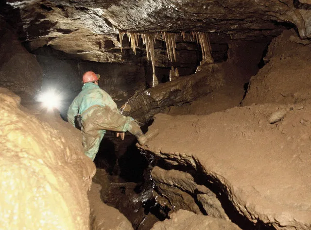
St Cuthbert's Swallet
Mountains & hills · 0.7 km

Priddy Nine Barrows
Archaeological sites · 0.7 km

St. Cuthbert's Swallet
Caves · 0.7 km

Priddy Caves
Caves · 0.9 km

Sludge Pit Hole
Caves · 0.9 km

Eastwater Cavern
Caves · 0.9 km
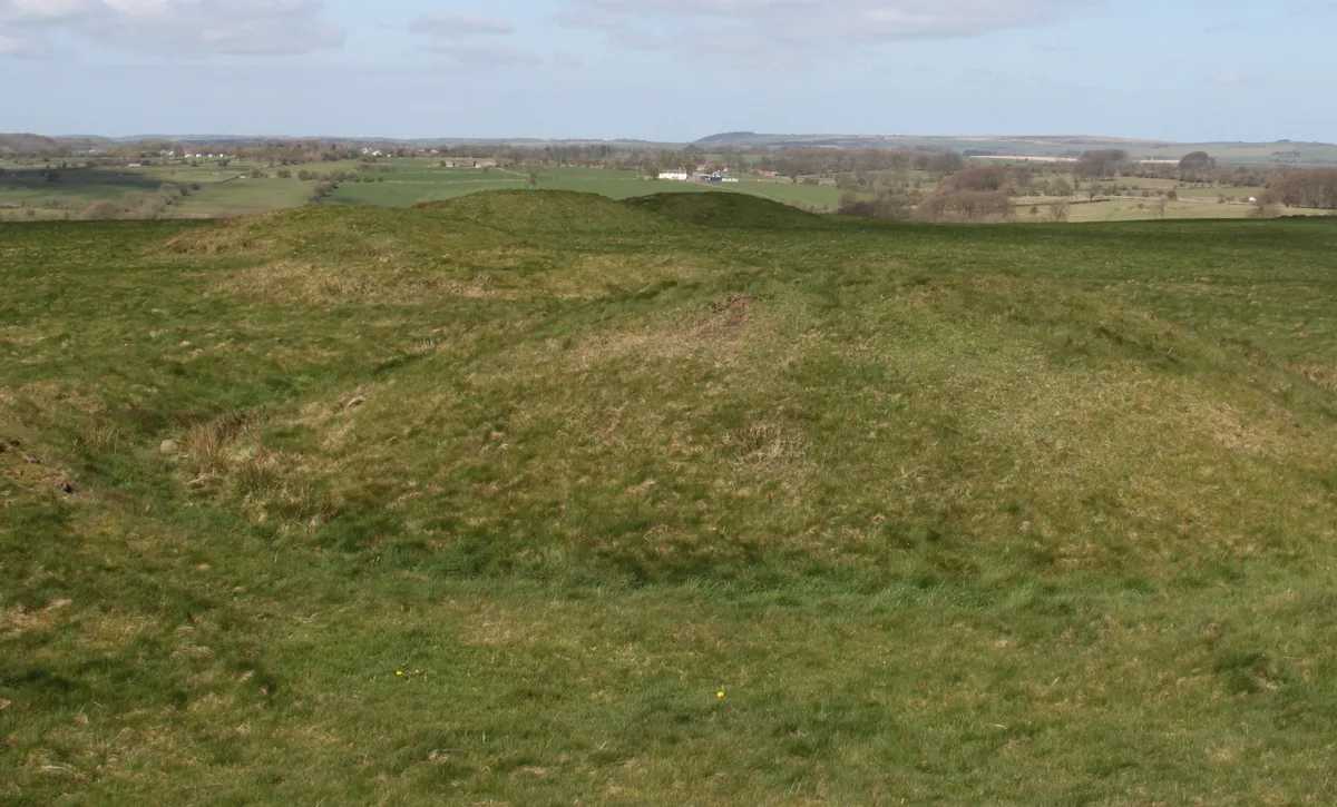
Priddy Nine Barrows and Ashen Hill Barrow Cemeteries
Hill forts · 0.9 km
Nearby
📷 3Archaeological sites · South West England
Spoil heaps
Spoil heaps — a archaeological in england-south-west, United Kingdom.
📷 3Public art & sculpture · South West England
The Headless Goose
The Headless Goose — a public art in england-south-west, United Kingdom.
📷 5Wildlife reserves · South West England
Priddy Mineries
Priddy Mineries — nature reserve in Somerset, England.
📷 3Archaeological sites · South West England
Stock Hill
Stock Hill — Forestry Commission plantation in Chewton Mendip, Somerset, UK.
📷 5Mountains & hills · South West England
North Hill
North Hill — a hill or mountain in england south west.
📷 3Mountains & hills · South West England
St Cuthbert's Swallet
St Cuthbert's Swallet — cave in the Mendip Hills, Somerset, England.
Where to eat & stay near Priddy Mineries
Places to stay
 📷 5
📷 5Campsites · South West England
Ebborways Camping
Ebborways Camping — a campsite in england south west.
 📷 5
📷 5Campsites · South West England
Cheddar Mendip Heights Campsite
Cheddar Mendip Heights Campsite — a campsite in england south west.
 📷 5
📷 5Campsites · South West England
Nettwood Country Breaks
Nettwood Country Breaks — a campsite in england south west.
 📷 5
📷 5Campsites · South West England
Lower Milton Caravan And Camping Site
Lower Milton Caravan And Camping Site — a campsite in england south west.
 📷 5
📷 5Hotels · South West England
Ancient Gate House Hotel
Ancient Gate House Hotel — a hotel in england south west.
 📷 5
📷 5Caravan parks · South West England
Wells Holiday Park
Wells Holiday Park — a caravan park in england south west.
Places to eat & drink
 📷 5
📷 5Restaurants · South West England
Bekynton Brasserie
Bekynton Brasserie — a restaurant in england south west.
 📷 5
📷 5 📷 7
📷 7Historic pubs · South West England
The Bull Terrier
The Bull Terrier in England South West, United Kingdom.
 📷 7
📷 7 📷 7
📷 7Historic pubs · South West England
The Wine Vaults, Public House
The Wine Vaults, Public House in England South West, United Kingdom.
 📷 7
📷 7Historic pubs · South West England
Knatchbull Arms
Knatchbull Arms in England South West, United Kingdom.
More forests in this region
 📷 5
📷 5Forests & woodlands · South West England
Avebury Stone Circle
Avebury Stone Circle is a forest or woodland in the United Kingdom.
 📷 5
📷 5Forests & woodlands · South West England
Bowerchalke Downs SSSI
Bowerchalke Downs SSSI is a forest or woodland in the United Kingdom.
 📷 5
📷 5Forests & woodlands · South West England
Broadcroft Quarry Butterfly Reserve
Broadcroft Quarry Butterfly Reserve is a forest or woodland in the United Kingdom.
 📷 5
📷 5Forests & woodlands · South West England
Chickengrove Bottom SSSI
Chickengrove Bottom SSSI is a forest or woodland in the United Kingdom.
Frequently asked questions
- Where is Priddy Mineries?
- Priddy Mineries is in South-West England, United Kingdom (postcode BA5 3AS), in the parish of Chewton Mendip.
- What is Priddy Mineries?
- Priddy Mineries is a forest or woodland in the United Kingdom.
- How do I get to Priddy Mineries?
- Drivers can use postcode BA5 3AS.
- Is Priddy Mineries a protected site?
- Yes — Priddy Mineries is part of the Priddy Caves SSSI Site of Special Scientific Interest and the Priddy Pools SSSI Site of Special Scientific Interest.
- Is Priddy Mineries free to visit?
- Yes, Priddy Mineries is free to enter.
- How do I get to Priddy Mineries?
- Drivers can navigate to postcode BA5 3AS. It sits within the Wells and Mendip Hills parliamentary constituency.