
Abbeys & priories · Central Scotland
Pow Water
In or near Muthill.
Pow Water in Scotland Islands, United Kingdom.

M J Richardson — CC BY-SA 2.0 via Wikimedia Commons licence

Plan your visit
- Typical visit
- 45 min–1.5 h
- Nearest railway station
- Gleneagles · 8.7 km
- Free entry
- Family-friendly
- Limited wheelchair access
Getting there & planning your visit
To visit Pow Water, the nearest railway station is Gleneagles, located 8.7 km away. Entry is free, but please note that wheelchair accessibility is limited. The postcode for navigation is PH5 2BJ.
About
Pow Water is a place of interest in Scotland Islands, United Kingdom — drawn from open-data sources for visitor reference. See the linked Wikipedia article for the full description.
Photo gallery
Summary from the official site
Innerpeffray is Scotland’s first free public lending library, established in 1680, and offers visitors a chance to explore its rare book collection and the historical significance of the site. The library is complemented by a medieval chapel and a heritage trail that narrates the area's rich history. Visitors can also enjoy the scenic grounds and participate in guided tours.
Read more on the official property page.
From the Wikipedia article
The Pow of Inchaffray (also known as the Pow Water) is a drainage ditch in Strathearn, Scotland. It is approximately 9 miles (14 km) long and drains 3.2 square miles (8.3 km2) of fertile agricultural land. The Pow dates back to the Middle Ages and was dug on the orders of the canons of the nearby Inchaffray Abbey; it was expanded under permissions granted by Robert the Bruce. A drainage commission became responsible for the Pow in 1696 under an act of the Parliament of Scotland. This body, the only local drainage commission in Scotland, continues to maintain the Pow and collect revenue from local landowners. A modernised act to govern the commission was passed in 2019.
Excerpt from Wikipedia under CC BY-SA 4.0. See the source article linked in Sources below.
Background
History
Pow is a Scots language term that dates to the Early Middle Ages and means an artificial ditch. The Pow was first dug on the orders of the canons of the Augustinian Inchaffray Abbey. The abbey, one of the largest in Scotland at the time, was located on an island in marshland and the Pow was intended to help drain the surroundings. Abbot Maurice of Inchaffray was chaplain to Robert the Bruce and prior to the 1314 Battle of Bannockburn claimed to have witnessed a miracle whereby the arm bone of Saint Fillan appeared in a previously empty reliquary. Robert the Bruce credited the miracle with providing his subsequent victory on the battlefield. In thanks to Maurice he granted the abbey…
Description
The Pow starts at Methven Moss and runs in a south-westerly direction for 9 mi until it meets the River Earn near to Innerpeffray, about 2.5 mi to the south-east of Crieff. The Pow's drainage basin is 2,047 acres which includes 79 residential properties, 21 agricultural properties and 2 commercial properties. It has ten major tributaries which total approximately 4.7 mi of watercourse. The Pow's purpose is disputed with some claiming it to be for the drainage of groundwater and others that it is a flood prevention measure.
Sourced from Wikipedia under CC BY-SA 4.0.
- Coordinates
- 56.3467, -3.7852
- District
- Perth and Kinross
- Postcode
- PH5 2BJ
- Parliamentary constituency
- Perth and Kinross-shire
- Phone
- 01764 652 819
- Nearest railway station
- Gleneagles — 8.7 km
- Opening
- Wednesday to Saturday 10am – 5pm; Sundays 2pm – 5pm, March-October
Sources
- wikidata: Q60750139 (CC0)
- wikipedia: Pow of Inchaffray (CC BY-SA 4.0)
Other places nearby
The Library of Innerpeffray
Museums · 0.5 km
Innerpeffray Library
Other places · 0.5 km
Innerpeffray
Natural landmarks · 0.5 km

Strageath
Memorials & monuments · 0.5 km

Faichney Monument
Memorials & monuments · 0.5 km
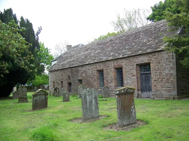
Innerpeffray Collegiate Church of the Blessed Virgin
Historic churches · 0.5 km

Innerpeffray Castle
Castles · 1.0 km

Innerpeffray Castle
Literary houses · 1.0 km
South Mains, Innerpeffray
Vineyards · 1.1 km

Dornoch Mill
Archaeological sites · 1.3 km

Millhills
Archaeological sites · 1.3 km
Millhills House
Castles · 1.4 km
Nearby
📷 3Museums · Central Scotland
The Library of Innerpeffray
The Library of Innerpeffray — a museum in scotland-central, United Kingdom.
📷 4Other places · Central Scotland
Innerpeffray Library
Innerpeffray Library in Scotland Islands, United Kingdom.
📷 4Natural landmarks · Central Scotland
Innerpeffray
Innerpeffray in Scotland Islands, United Kingdom.
📷 4Memorials & monuments · Central Scotland
Strageath
Strageath in Scotland Islands, United Kingdom.
📷 5Memorials & monuments · Central Scotland
Faichney Monument
Faichney Monument — part of a Scheduled Monument-listed memorial in scotland-central, United Kingdom.
📷 3Historic churches · Central Scotland
Innerpeffray Collegiate Church of the Blessed Virgin
Innerpeffray Collegiate Church of the Blessed Virgin — church building in Crieff parish, Perth and Kinross, Scotland, UK.
Where to eat & stay near Pow Water
Places to stay
 📷 5
📷 5Caravan parks · Central Scotland
Braidhaugh Holiday Park
Braidhaugh Holiday Park — a caravan park in scotland central.
 📷 5
📷 5Caravan parks · Central Scotland
Grand Eagles Luxury Lodge Park
Grand Eagles Luxury Lodge Park — a caravan park in scotland central.
 📷 5
📷 5Caravan parks · Central Scotland
Islabank CAMC CL
Islabank CAMC CL — a caravan park in scotland central.
 📷 5📷 5
Hostels · Central Scotland
Comrie Croft Farmhouse
Comrie Croft Farmhouse — a hostel in scotland central.
📷 5Hostels · Central Scotland
Comrie Croft Steading
Comrie Croft Steading — a hostel in scotland central.
Places to eat & drink
 📷 7
📷 7Historic pubs · Central Scotland
Johnstone Arms Hotel, 48 Stirling Street, Alva
Johnstone Arms Hotel, 48 Stirling Street, Alva in Scotland Central, United Kingdom.
 📷 6
📷 6Historic pubs · Central Scotland
Westerton Arms, 34 Henderson Street, Bridge of Allan
Westerton Arms, 34 Henderson Street, Bridge of Allan in Scotland Central, United Kingdom.
More abbeys in this region
 📷 4
📷 4 📷 4
📷 4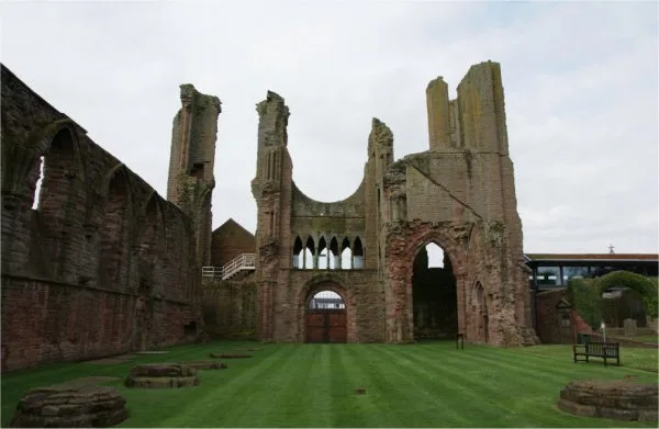 ★ Iconic📷 3
Abbeys & priories · Central Scotland
Arbroath Abbey
Arbroath Abbey — abbey in Arbroath, Scotland, United Kingdom.
 📷 4
📷 4Abbeys & priories · Central Scotland
Gartocharn
Gartocharn in Scotland Islands, United Kingdom.
Frequently asked questions
- Where is Pow Water?
- Pow Water is in central Scotland, United Kingdom (postcode PH5 2BJ).
- What is Pow Water?
- Pow Water in Scotland Islands, United Kingdom.
- How do I get to Pow Water?
- The nearest railway station is Gleneagles, about 8.7 km away. The nearest town is Muthill. Drivers can use postcode PH5 2BJ.
- Is Pow Water free to visit?
- Yes, Pow Water is free to enter.
- How do I get to Pow Water?
- Drivers can navigate to postcode PH5 2BJ. It sits within the Perth and Kinross-shire parliamentary constituency.