
Castles · South West England
Post-medieval pottery kiln 360m NNE of the Castle
In or near Dunster.
Post-medieval pottery kiln 360m NNE of the Castle — castle in Dunster, Somerset, England, UK.

Wikimedia Commons contributors — see linked file page for photographer and licence licence

Plan your visit
- Typical visit
- 1.5 h–3 h
- Nearest railway station
- Dunster · 1.0 km
- Family-friendly
- Limited wheelchair access
Getting there & planning your visit
To visit the post-medieval pottery kiln located 360m NNE of the Castle, the nearest railway station is Dunster, which is 1 km away. The postcode for navigation is TA24 6AS, and please note that wheelchair accessibility is limited.
About
Post-medieval pottery kiln 360m NNE of the Castle is a castle in South-West England. Officially recognised as scheduled monument. The site is a designated Site of Special Scientific Interest. It sits within the Tiverton and Minehead parliamentary constituency. The nearest railway station is Dunster, about 1.0 km away. Postcode area TA24.
Photo gallery
See it from the streetimagery from 2025
Imagery © Mapillary contributors, CC BY-SA 4.0
Heritage listing
Details The monument includes a partly restored, standing, stone-built pottery kiln of mid-18th century date. The kiln is located in the north east quarter of Dunster just behind the High Street and within the Castle grounds. The circular kiln, which is of a type known in Somerset as a `pinnacle kiln' after the shape of its roof, once formed part of a pottery established by the local family, the Luttrells of Dunster Castle. It is of the simple updraft type and is rubble-built of local stone, comprising a substructure, ware chamber, and straight-sided conical chimney; it was fired from two opposing coal-fired fire-boxes. The kiln is 4.3m in diameter and about 4.5m in total height, the upper 1.5m being the height of the conical corbelled roof. This roof is much restored with matched hand made bricks and with an opening at the apex for the venting of smoke but capped with lead in modern times. Evenly spaced around the circumference of the building and just below the level of the corbelled roof, are four brick-lined apertures each about 0.6m wide and 0.7m high which could be blocked or opened dependant upon the temperature required for the controlled firing of the kiln. Entrance into the kiln was by way of an arched brick-framed doorway, about 0.7m wide, on its south side with the sill cut away to create a full height of 1.7m. The kiln was loaded through this doorway at ground level and the doorway bricked up before firing. The heat from two opposing arched fire-boxes entered the kiln through brick-lined apertures which have subsequently been blocked. The original floor of the kiln has been removed but a substructure of three roughly circular and concentric flues of brick survive; these served to distribute the heat under the floor of the ware chamber where the pottery was
From the Historic England List Entry under OGL v3.
Protected designations
- Site of Special Scientific Interest: Dunster Park and Heathlands SSSI
Designations sourced from Natural England open data under OGL v3.
Place summary
The Post-medieval pottery kiln, located 360m NNE of Dunster Castle in South-West England, is designated as a scheduled monument. It lies within the Dunster Park and Heathlands SSSI, highlighting its historical and environmental significance.
AI-generated from the structured facts on this page (operator, designation, listing, era). Not a substitute for visiting.
- Coordinates
- 51.1851, -3.4433
- District
- Somerset
- Parish
- Dunster
- Postcode
- TA24 6AS
- Parliamentary constituency
- Tiverton and Minehead
- Nearest railway station
- Dunster — 1 km
- Official site
- www.nationaltrust.org.uk
Sources
- wikidata: Q17677449 (CC0)
- commons: Dunster Kiln.jpg (CC BY-SA 4.0)
Other places nearby

Luttrell Arms
Historic pubs · 0.1 km
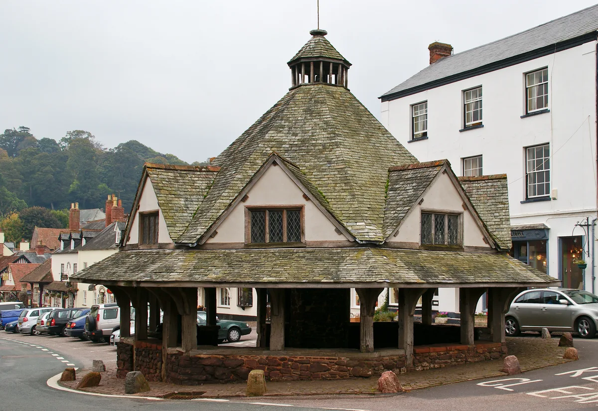
Yarn Market, Dunster
Mines & mining heritage · 0.1 km

Yarn Market
Natural landmarks · 0.1 km

Cobblestones
Cafés · 0.1 km

The Olde House
B&Bs · 0.1 km

Castle Coffee House
Cafés · 0.2 km

The Dunster Castle Hotel
Hotels · 0.2 km

Tithe Barn, Dunster
Abbeys & priories · 0.2 km

Conygar Tower
Follies · 0.2 km
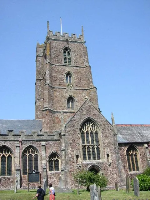
Priory Church of St George, Dunster
Abbeys & priories · 0.3 km

Priory Church of St George, Dunster
Cathedrals · 0.3 km

Dunster
Towns & cities · 0.3 km
Nearby
📷 5Historic pubs · South West England
Luttrell Arms
Luttrell Arms in England South West, United Kingdom.
📷 5Mines & mining heritage · South West England
Yarn Market, Dunster
Yarn Market, Dunster — Grade I listed building in West Somerset, England, UK.
📷 3Natural landmarks · South West England
Yarn Market
Yarn Market — a place in South West England, United Kingdom.
📷 7📷 7B&Bs · South West England
The Olde House
The Olde House — a bed-and-breakfast in england south west.
📷 7Cafés · South West England
Castle Coffee House
Castle Coffee House — a café in england south west.
Where to eat & stay near Post-medieval pottery kiln 360m NNE of the Castle
Places to stay
📷 7B&Bs · South West England
The Olde House
The Olde House — a bed-and-breakfast in england south west.
📷 5Hotels · South West England
The Dunster Castle Hotel
The Dunster Castle Hotel — a hotel in england south west.
 📷 7
📷 7B&Bs · South West England
Stags Head Inn
Stags Head Inn — a bed-and-breakfast in england south west.
📷 5B&Bs · South West England
Exmoor House
Exmoor House — a bed-and-breakfast in england south west.
 📷 5
📷 5Hostels · South West England
YHA Minehead
YHA Minehead — a hostel in england south west.
 📷 5
📷 5Caravan parks · South West England
Minehead Caravan and Motorhome Club
Minehead Caravan and Motorhome Club — a caravan park in england south west.
Places to eat & drink
📷 5Historic pubs · South West England
Luttrell Arms
Luttrell Arms in England South West, United Kingdom.
📷 7📷 7Cafés · South West England
Castle Coffee House
Castle Coffee House — a café in england south west.
📷 7 📷 7
📷 7Historic pubs · South West England
The Butchers Arms
The Butchers Arms in England South West, United Kingdom.
 📷 5
📷 5Historic pubs · South West England
Queens Hall, Minehead
Queens Hall, Minehead in England South West, United Kingdom.
More castles in this region
 Flagship📷 10
Castles · South West England
Old Wardour Castle
Old Wardour Castle — Grade I listed castle in Wardour, Wiltshire, England, UK.
 📷 5
📷 5Castles · South West England
Ballands Castle
Ballands Castle — former castle in Somerset, England, UK.
 📷 5
📷 5Castles · South West England
Brownsea Castle
Brownsea Castle — grade II listed Device Fort in Purbeck, United Kingdom.
 📷 5
📷 5Frequently asked questions
- Where is Post-medieval pottery kiln 360m NNE of the Castle?
- Post-medieval pottery kiln 360m NNE of the Castle is in South-West England, United Kingdom (postcode TA24 6AS), in the parish of Dunster.
- What is Post-medieval pottery kiln 360m NNE of the Castle?
- Post-medieval pottery kiln 360m NNE of the Castle — castle in Dunster, Somerset, England, UK.
- How do I get to Post-medieval pottery kiln 360m NNE of the Castle?
- The nearest railway station is Dunster, about 1.0 km away. The nearest town is Dunster. Drivers can use postcode TA24 6AS.
- Is Post-medieval pottery kiln 360m NNE of the Castle a listed building?
- Post-medieval pottery kiln 360m NNE of the Castle is officially recognised as scheduled monument listed.
- Is Post-medieval pottery kiln 360m NNE of the Castle a protected site?
- Yes — Post-medieval pottery kiln 360m NNE of the Castle is part of the Dunster Park and Heathlands SSSI Site of Special Scientific Interest.
- Does Post-medieval pottery kiln 360m NNE of the Castle charge admission?
- Post-medieval pottery kiln 360m NNE of the Castle typically charges admission. Check the official site for current ticket prices and opening hours.
- How do I get to Post-medieval pottery kiln 360m NNE of the Castle?
- The nearest railway station is Dunster, about 1.0 km away. Drivers can navigate to postcode TA24 6AS.