Harbours & ports · London
Port of Tilbury
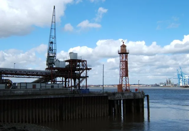
Port of Tilbury is a harbour in the United Kingdom.

Wikimedia Commons contributors — see linked file page for photographer and licence licence
Plan your visit
- Typical visit
- 45 min–1.5 h
- Nearest railway station
- Tilbury Town · 0.7 km
- Family-friendly
- Dog-friendly
About
Port of Tilbury is a harbour in the United Kingdom. Coordinates: 51.4600°, 0.3450°. This entry is part of The Great Britain Guide, a free, ad-free, open-data tourist directory.
Photo gallery
From the Wikipedia article
The Port of Tilbury is a port located on the River Thames at Tilbury in Essex, England. It serves as the principal port for London, as well as being the main United Kingdom port for handling the importation of paper. There are extensive facilities for shipping containers, grain, and other bulk cargoes. There are also facilities for the importation of cars. It forms part of the wider Port of London.
Excerpt from Wikipedia under CC BY-SA 4.0. See the source article linked in Sources below.
Background
Architecture
, 1939]] The original docks of London, all built close to the City, were opened in stages by what was to become the East and West India Docks Company (E&WIDC) at the beginning of the 19th century. With the coming of the railways and increasing ship size, proximity to the centre of London became less important than access to deep water, unrestricted sites and reduction in time spent traveling up the winding Thames. The company had long been in competition with its rival, the London and St Katherine Dock Company (L&StKDC). The opening of the Royal Albert Dock by the , with its deepwater quayage, in 1880 had given access to the Thames at Gallions Reach, 11 mi by river below London Bridge and…
Sourced from Wikipedia under CC BY-SA 4.0.
- Coordinates
- 51.4600, 0.3450
- District
- Thurrock
- Parish
- Thurrock, unparished area
- Postcode
- RM18 7HA
- Parliamentary constituency
- Thurrock
- Established
- 1886
- Nearest railway station
- Tilbury Town — 0.7 km
- Official site
- www.forthports.co.uk
Sources
- wikidata: Q1419586 (CC0)
- wikipedia: Port of Tilbury (CC BY-SA 4.0)
- commons: Carpathia Unloading at Tilbury docks - geograph.org.uk - 2091919.jpg (CC BY-SA 4.0)
Other places nearby
Loading nearby places…
Nearby
 📷 5
📷 5Museums · London
Tilbury
Tilbury — a museum in england-london, United Kingdom.
 📷 5
📷 5Theatres · South East England
Tilbury Dock Working Men's Club and Institute
Tilbury Dock Working Men's Club and Institute in England South East, United Kingdom.
📷 5Memorials & monuments · London
Tilbury War Memorial
Tilbury War Memorial — Grade II listed building-listed memorial in england-london, United Kingdom.
📷 5Memorials & monuments · London
War Memorial & Clock
War Memorial & Clock — a memorial in england-london, United Kingdom.
 📷 5
📷 5Lighthouses · London
Northfleet Lower Lighthouse
Northfleet Lower Lighthouse — lighthouse in Gravesham, Kent, England, UK.
 📷 5
📷 5Memorials & monuments · London
Bevans War Memorial
Bevans War Memorial is a memorial in the United Kingdom.
More places in this region
 📷 5
📷 5Harbours & ports · London
London Gateway
London Gateway is a harbour in the United Kingdom.
 📷 5
📷 5Harbours & ports · London
Port of London
Port of London — port along the banks of the River Thames.
_geograph-2159099.jpg?width=1200) 📷 5
📷 5Harbours & ports · London
Rochester
Rochester — Port in Kent, United Kingdom.
 📷 5
📷 5Harbours & ports · London
St Katharine Docks
St Katharine Docks — docks in the East End of London.
Frequently asked questions
- Where is Port of Tilbury?
- Port of Tilbury is in London, United Kingdom (postcode RM18 7HA), in the parish of Thurrock, unparished area.
- When was Port of Tilbury built?
- Built or established in 1886.
- Who owns Port of Tilbury?
- Port of Tilbury is owned by Forth Ports.
- How do I get to Port of Tilbury?
- The nearest railway station is Tilbury Town, about 0.7 km away. Drivers can navigate to postcode RM18 7HA.