
Harbours & ports · London
Port of London
In or near City of London.
Port of London — port along the banks of the River Thames.

Wikimedia Commons contributors — see linked file page for photographer and licence licence

Plan your visit
- Typical visit
- 45 min–1.5 h
- Nearest railway station
- London City Airport · 0.4 km
- Family-friendly
- Dog-friendly
Getting there & planning your visit
To visit the Port of London, the nearest railway station is London City Airport, which is 0.4 km away. The postcode for the area is E16 2HL. Entry details are not specified.
About
Port of London is a harbour in the United Kingdom. Wikidata describes it as: "port along the banks of the River Thames". Coordinates: 51.5000°, 0.0500°.
Photo gallery
From the Wikipedia article
The Port of London is that part of the River Thames in England lying between Teddington Lock and the defined boundary (since 1968, a line drawn from Foulness Point in Essex via Gunfleet Old Lighthouse to Warden Point in Kent) with the North Sea and including any associated docks. Once the largest port in the world, it was the United Kingdom's largest port as of 2020. Usage is largely governed by the Port of London Authority ("PLA"), a public trust established in 1908; while mainly responsible for coordination and enforcement of activities, it also has some minor operations of its own. The port can handle cruise liners, roll-on roll-off ferries and cargo of all types at the larger facilities in its eastern extent. As with many similar historic European ports, such as Antwerp and Rotterdam, many activities have steadily moved downstream towards the open sea as ships have grown larger and the land upriver taken over for other uses.
Excerpt from Wikipedia under CC BY-SA 4.0. See the source article linked in Sources below.
Background
History
, Tower Hill]] The Port of London has been central to the economy of London since the founding of the city in the 1st century and was a major contributor to the growth and success of the city. In the 18th and 19th centuries, it was the busiest port in the world, with wharves extending continuously along the Thames for 11 mi, and over 1,500 cranes handling 60,000 ships per year. It was a prime target for Nazi German bomber aircraft during World War II (the Blitz).
Description
The first evidence of a reasonable sized trading port in London can be seen during Roman control of Britain, at which time the Romans built the original harbour. The construction involved expanding the waterfront using wooden frames filled with dirt. Once these were in place, the wharf was built in four stages moving downstream from London Bridge. The port began to rapidly grow and prosper during the 2nd and 3rd centuries, and saw its final demise in the early 5th century with the decline in trade activity due to the Roman departure from Britain. The changes made to the banks along the port made by the Romans are so substantial and long-lasting that it was hard to tell where the natural…
Sourced from Wikipedia under CC BY-SA 4.0.
- Coordinates
- 51.5000, 0.0500
- District
- Newham
- Parish
- Newham, unparished area
- Postcode
- E16 2HL
- Parliamentary constituency
- West Ham and Beckton
- Nearest railway station
- London City Airport — 0.4 km
- Official site
- www.portoflondon.co.uk
Sources
- wikidata: Q1545354 (CC0)
- wikipedia: Port of London (CC BY-SA 4.0)
- commons: Upper Pool 1.jpg (CC BY-SA 4.0)
Other places nearby

Newham Trackside Wall
Public art & sculpture · 0.2 km

North Woolwich
Chapels · 0.6 km

War memorial at former St Mark's Church (Brick Lane Music Hall)
Memorials & monuments · 0.6 km
Brick Lane Music Hall Mural
Public art & sculpture · 0.6 km

Barrier Gardens Pier
Piers · 0.7 km

Woolwich Ferry North Pier
Marinas · 0.8 km

Structural Steel Design Award
Memorials & monuments · 0.8 km

Oasis Academy Silvertown
Natural landmarks · 0.8 km

Roly Poly
Public art & sculpture · 0.8 km

Athena
Heritage railway stations · 0.9 km
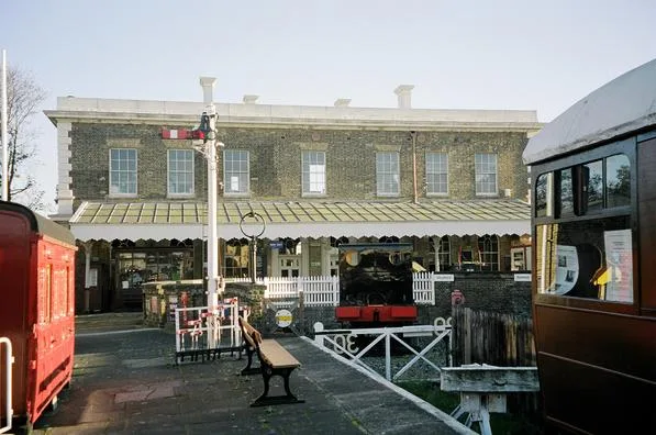
North Woolwich Old Station Museum
Museums · 0.9 km

North Woolwich railway station
Heritage railway stations · 0.9 km
Nearby
📷 5Public art & sculpture · London
Newham Trackside Wall
Newham Trackside Wall — a public art in London, United Kingdom.
📷 5Chapels · London
North Woolwich
North Woolwich — a methodist chapel in england-london, United Kingdom.
📷 5Memorials & monuments · London
War memorial at former St Mark's Church (Brick Lane Music Hall)
War memorial at former St Mark's Church (Brick Lane Music Hall) — Grade II listed building-listed memorial in england-london, United Kingdom.
📷 5Public art & sculpture · London
Brick Lane Music Hall Mural
Brick Lane Music Hall Mural — a public art in London, United Kingdom.
📷 5📷 5Where to eat & stay near Port of London
Places to stay
 📷 6
📷 6 📷 5
📷 5Hotels · London
Hampton by Hilton London Docklands
Hampton by Hilton London Docklands — a hotel in england london. 3-star. Brand: Hampton.
 📷 7
📷 7Hotels · London
DoubleTree by Hilton Hotel London ExCeL
DoubleTree by Hilton Hotel London ExCeL — a hotel in england london. 4-star. Brand: DoubleTree.
 📷 5
📷 5 📷 7
📷 7 📷 5
📷 5Places to eat & drink
.jpg?width=1200) 📷 5
📷 5Historic pubs · London
Fox@Connaught
Fox@Connaught — Historic pub — listed building or notable heritage status.
 📷 6
📷 6Historic pubs · London
Sun in the Sands
Sun in the Sands in England London, United Kingdom.
 📷 7
📷 7Historic pubs · London
The Boleyn
The Boleyn — Historic pub — listed building or notable heritage status.
 📷 7
📷 7Historic pubs · London
Denmark Arms
Denmark Arms in England London, United Kingdom.
 📷 5
📷 5Cafés · London
Ignatius Sancho Café
Ignatius Sancho Café — a café in england london.
 📷 5
📷 5More places in this region
 📷 5
📷 5Harbours & ports · London
St Katharine Docks
St Katharine Docks — docks in the East End of London.
 📷 5
📷 5 📷 5
📷 5Frequently asked questions
- Where is Port of London?
- Port of London is in London, United Kingdom (postcode E16 2HL), in the parish of Newham, unparished area.
- What is Port of London?
- Port of London — port along the banks of the River Thames.
- How do I get to Port of London?
- The nearest railway station is London City Airport, about 0.4 km away. The nearest town is City of London. Drivers can use postcode E16 2HL.
- Who owns Port of London?
- Port of London is owned by Port of London Authority.
- How do I get to Port of London?
- The nearest railway station is London City Airport, about 0.4 km away. Drivers can navigate to postcode E16 2HL.