
Archaeological sites · South West England
Porlock Stone Circle
In or near Porlock.
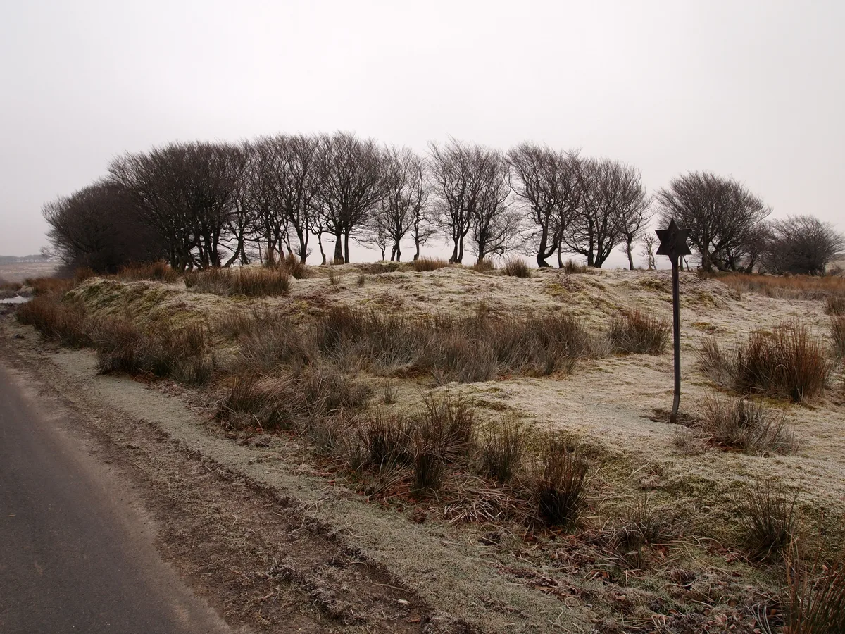
Porlock Stone Circle — stone circle in Porlock, Somerset West and Taunton, England, UK.

Wikimedia Commons contributors — see linked file page for photographer and licence licence

Plan your visit
- Typical visit
- 45 min–1.5 h
- Free entry
- Dog-friendly
About
Porlock Stone Circle is an archaeological site in the United Kingdom. Heritage designation: scheduled monument. Wikidata describes it as: "stone circle in Porlock, Somerset West and Taunton, England, UK". Coordinates: 51.1894°, -3.6538°.
Photo gallery
Protected designations
- Site of Special Scientific Interest: North Exmoor SSSI
- National Nature Reserve: DUNKERY & HORNER WOOD
Designations sourced from Natural England open data under OGL v3.
From the Wikipedia article
Porlock Stone Circle is a stone circle located on Exmoor, near the village of Porlock in the south-western English county of Somerset. The Porlock ring is part of a tradition of stone circle construction that spread throughout much of Britain, Ireland, and Brittany during the Late Neolithic and Early Bronze Age, over a period between 3300 and 900 BCE. The purpose of such monuments is unknown, although archaeologists speculate that the stones represented supernatural entities for the circles' builders. Although Exmoor witnessed the construction of many monuments during the Bronze Age, only two stone circles survive in this area, the other being Withypool Stone Circle. The Porlock circle is about 24 metres (79 feet) in diameter and contains thirteen green micaceous sandstone rocks; there may originally have been more. Directly to the north-east of the circle is a cairn connected to a linear stone row. No evidence has been found that allows for absolute dating of the monument's construction, although archaeologists have suggested that the cairn dates from the Early Bronze Age, the circle being a Middle Bronze Age addition. A small lead wheel found inside Porlock Stone Circle suggests that the site was visited during the Romano-British period. The site was rediscovered in the 1920s and since then a variety of stones have been added to it; its current appearance is a composite of prehistoric and modern elements. In 1928 the site was surveyed and excavated by the archaeologist Harold St George Gray. A second excavation took place under the leadership of Mark Gillings in 2013.
Excerpt from Wikipedia under CC BY-SA 4.0. See the source article linked in Sources below.
Background
Description
Porlock Stone Circle has a diameter of 24 m and a circumference of approximately 77 m. The stones in the circle are green micaceous sandstone originating from the Devonian period and were probably collected in the local area. Following his excavation of several stone settings, the archaeologist Mark Gillings argued that three forms of stone were deliberately incorporated into the circle: small uprights, low uprights, and larger stones that are positioned in a sloping position. Most of the latter were thin wedges that had been deliberately selected for their shape or flaked to give them a tapering form. Commenting on those cases where the majority of the stone is below ground rather than…
Sourced from Wikipedia under CC BY-SA 4.0.
- Coordinates
- 51.1894, -3.6538
- District
- Somerset
- Parish
- Porlock
- Postcode
- TA24 8LT
- Parliamentary constituency
- Tiverton and Minehead
Sources
- wikidata: Q17642112 (CC0)
- wikipedia: Porlock Stone Circle (CC BY-SA 4.0)
- commons: Detail of Porlock Stone Circle II.jpg (CC BY-SA 4.0)
Other places nearby

Berry Castle
Vineyards · 1.4 km

Hawkcombe Head
Mountains & hills · 1.4 km

Little Hill
Mountains & hills · 1.7 km

Black Mires
Mountains & hills · 1.7 km

The Whit Stones: two standing stones 230m west of Whitstone Post
Archaeological sites · 1.8 km

Nutscale Reservoir
Reservoirs & lochs · 2.1 km
Alderman's Barrow at N of Almsworthy Common
Archaeological sites · 2.5 km

Pool Bridge
Campsites · 2.7 km
Woodcocks Ley
Mountains & hills · 3.1 km

Larkbarrow
Mountains & hills · 3.3 km

Culbone
Villages · 3.5 km

Culbone Lodge, And Adjoining Bridge Over Sunken Roadway On East Front
Historic bridges · 3.6 km
Nearby
📷 5Vineyards · South West England
Berry Castle
Berry Castle — a UK vineyard in england south west, producing English or Welsh wine from cool-climate grape varieties.
📷 5Mountains & hills · South West England
Hawkcombe Head
Hawkcombe Head — mountain in england south west. Elevation: 436 m.
📷 5Mountains & hills · South West England
Little Hill
Little Hill — mountain in england south west. Elevation: 465 m.
📷 5Mountains & hills · South West England
Black Mires
Black Mires — a hill or mountain in england south west.
📷 3Archaeological sites · South West England
The Whit Stones: two standing stones 230m west of Whitstone Post
The Whit Stones: two standing stones 230m west of Whitstone Post — archaeological site in Porlock, Somerset West and Taunton, England, UK.
📷 5Reservoirs & lochs · South West England
Nutscale Reservoir
Nutscale Reservoir — reservoir in Somerset, England, UK.
Where to eat & stay near Porlock Stone Circle
Places to stay
📷 5 📷 5
📷 5Caravan parks · South West England
Porlock Caravan Park
Porlock Caravan Park — a caravan park in england south west.
 📷 5
📷 5Campsites · South West England
Sparkhayes Camping Site
Sparkhayes Camping Site — a campsite in england south west.
 📷 5
📷 5 📷 5
📷 5Campsites · South West England
Horner Wood Scout Campsite
Horner Wood Scout Campsite — a campsite in england south west.
 📷 5
📷 5Campsites · South West England
Westermill Farm Campsite
Westermill Farm Campsite — a campsite in england south west.
Places to eat & drink
 📷 5
📷 5Historic pubs · South West England
The Blue Ball Inn
The Blue Ball Inn in England South West, United Kingdom.
 📷 7
📷 7Historic pubs · South West England
The Old Ship Aground Public House
The Old Ship Aground Public House in England South West, United Kingdom.
 📷 5
📷 5Historic pubs · South West England
Queens Hall, Minehead
Queens Hall, Minehead in England South West, United Kingdom.
 📷 7
📷 7Historic pubs · South West England
Rock House Hotel
Rock House Hotel in England South West, United Kingdom.
 📷 7
📷 7Historic pubs · South West England
Rising Sun Hotel (Main Part)
Rising Sun Hotel (Main Part) in England South West, United Kingdom.
 📷 7
📷 7More archaeological sites in this region
 📷 5
📷 5Archaeological sites · South West England
Battlesbury Camp Monuments: hillfort, settlement, cemetery, barrows, enclosure, and field systems
Battlesbury Camp Monuments: hillfort, settlement, cemetery, barrows, enclosure, and field systems — archaeological site in Warminster, Wiltshire, England, UK.
 📷 5
📷 5Archaeological sites · South West England
Blandford Forest
Blandford Forest — forest in Blandford Forum, England.
 📷 5
📷 5Archaeological sites · South West England
Boulsbury Wood
Boulsbury Wood — protected area in Dorset and Hampshire, England.
.jpg?width=1200) 📷 5
📷 5Archaeological sites · South West England
Cranborne Chase
Cranborne Chase — Plateau in southern England.
Frequently asked questions
- Where is Porlock Stone Circle?
- Porlock Stone Circle is in South-West England, United Kingdom (postcode TA24 8LT), in the parish of Porlock.
- What is Porlock Stone Circle?
- Porlock Stone Circle — stone circle in Porlock, Somerset West and Taunton, England, UK.
- How do I get to Porlock Stone Circle?
- The nearest town is Porlock. Drivers can use postcode TA24 8LT.
- Is Porlock Stone Circle a listed building?
- Porlock Stone Circle is officially recognised as scheduled monument listed.
- Is Porlock Stone Circle a protected site?
- Yes — Porlock Stone Circle is part of the North Exmoor SSSI Site of Special Scientific Interest and the DUNKERY & HORNER WOOD National Nature Reserve.
- Is Porlock Stone Circle free to visit?
- Yes, Porlock Stone Circle is free to enter.
- How do I get to Porlock Stone Circle?
- Drivers can navigate to postcode TA24 8LT. It sits within the Tiverton and Minehead parliamentary constituency.