
Historic bridges · Mid Wales
Plateway Bridge West South West Of Gipsy Hall
In or near Eardisley.
Plateway Bridge West South West Of Gipsy Hall — Grade II listed building-listed bridge in wales-mid, United Kingdom.

Alan Bowring — CC BY-SA 2.0 via Wikimedia Commons licence

Plan your visit
- Typical visit
- 15 min–30 min
- Nearest railway station
- Titley Junction · 8.0 km
- Free entry
- Dog-friendly
Getting there & planning your visit
To visit Plateway Bridge West South West Of Gipsy Hall, the nearest railway station is Titley Junction, located 8 km away. The postcode for navigation is HR3 6PR. Entry to the bridge is free.
About
Plateway Bridge West South West Of Gipsy Hall is a Grade II listed building-listed bridge in wales-mid, United Kingdom, registered on the National Heritage List for England (NHLE entry 1388380). Listed status protects buildings and structures of special architectural or historic interest. See the linked Wikipedia article for further details.
Photo gallery
Heritage listing
Details SO 35 SW EARDISLEY OAKLANDS 1423/3/10002 Plateway Bridge WSW of Gypsy Hall II Plateway bridge. Circa 1820; for the Kington Railway. Coursed stone. Small single-span bridge with elliptical arch with dressed stone arch ring. Part of the springing of the arch and a section of the adjacent abutment on the downstream side has collapsed. The Kington Railway [1816-20] was a plateway which ran from near Kington to Brecon, where it joined the canal. Burnt limestone was brought from Kington to the canal basin at Brecon, and the horse-drawn trams would return with coal and iron. SOURCE: The Kington Railway, pp. 88 and 89. Listing NGR: SO3161850176 Legacy The contents of this record have been generated from a legacy data system. Legacy System number: 476390 Legacy System: LBS
From the Historic England List Entry under OGL v3.
Protected designations
- Site of Special Scientific Interest: River Lugg SSSI
Designations sourced from Natural England open data under OGL v3.
Place summary
Plateway Bridge is a Grade II listed bridge located west-southwest of Gipsy Hall in Mid Wales. It is recognised for its architectural significance and historical value within the region.
AI-generated from the structured facts on this page (operator, designation, listing, era). Not a substitute for visiting.
- Coordinates
- 52.1456, -3.0007
- District
- Herefordshire, County of
- Parish
- Almeley
- Postcode
- HR3 6PR
- Parliamentary constituency
- North Herefordshire
- Nearest railway station
- Titley Junction — 8 km
Sources
- wikidata: Q26667932 (CC0)
Other places nearby

The Tram Inn
Historic pubs · 0.8 km

Eardisley
Towns & cities · 0.9 km

Eardisley Castle
Castles · 1.2 km

Lemore Martins Castle
Literary houses · 1.7 km

Eardisley railway station
Heritage railway stations · 1.7 km

Almeley railway station
Heritage railway stations · 2.0 km

Almeley Castle
Literary houses · 2.0 km
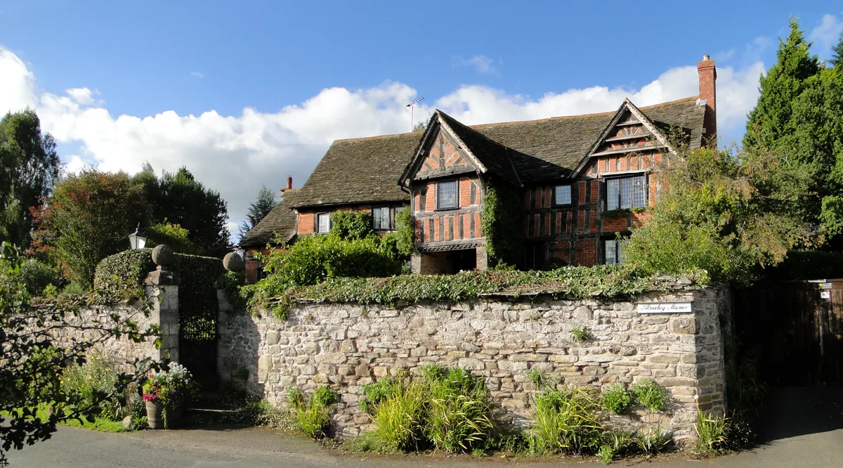
Almeley Manor
Stately homes · 2.1 km

Church of St Mary
Historic churches · 2.1 km
Almeley
Towns & cities · 2.1 km

Almeley War Memorial
Memorials & monuments · 2.2 km

Old Castle Twt
Castles · 2.2 km
Nearby
📷 7📷 5Towns & cities · Mid Wales
Eardisley
Eardisley in Wales Mid, United Kingdom.
📷 3Castles · Mid Wales
Eardisley Castle
Eardisley Castle — castle in Eardisley, Herefordshire, England, UK.
📷 5Literary houses · Mid Wales
Lemore Martins Castle
Lemore Martins Castle — a literary house museum in wales mid.
📷 5Heritage railway stations · Mid Wales
Eardisley railway station
Eardisley railway station in Wales Mid, United Kingdom.
📷 4Heritage railway stations · Mid Wales
Almeley railway station
Almeley railway station in Wales Mid, United Kingdom.
Where to eat & stay near Plateway Bridge West South West Of Gipsy Hall
Places to stay
 📷 5
📷 5 📷 7
📷 7 📷 5
📷 5 📷 5
📷 5 📷 5
📷 5 📷 4
📷 4Places to eat & drink
📷 7 📷 5
📷 5 📷 7
📷 7Historic pubs · Mid Wales
The Old Weymouth Arms And The Wharf
The Old Weymouth Arms And The Wharf in Wales Mid, United Kingdom.
 📷 5
📷 5Historic pubs · Mid Wales
32 and 33, Church Street
32 and 33, Church Street in Wales Mid, United Kingdom.
 📷 4
📷 4 📷 5
📷 5Historic pubs · Mid Wales
The Royal Oak Public House Including Rubblestone Wing To East
The Royal Oak Public House Including Rubblestone Wing To East in Wales Mid, United Kingdom.
More bridges in this region
%2C_Taicynhaeaf.jpg?width=1200) 📷 3
📷 3Historic bridges · Mid Wales
Penmaenpool Toll Bridge
Penmaenpool Toll Bridge is a historic bridge in the United Kingdom.
 📷 5
📷 5Historic bridges · Mid Wales
Pont Reilffordd Abermaw
Pont Reilffordd Abermaw is a historic bridge in the United Kingdom.
 📷 5
📷 5Historic bridges · Mid Wales
Pont Pandy'r-Odyn
Pont Pandy'r-Odyn — Grade II listed building-listed bridge in wales-north, United Kingdom.
 📷 5
📷 5Historic bridges · Mid Wales
Bridge 110 over the Montgomeryshire Canal
Bridge 110 over the Montgomeryshire Canal — Grade II listed building-listed bridge in wales-north, United Kingdom.
Frequently asked questions
- Where is Plateway Bridge West South West Of Gipsy Hall?
- Plateway Bridge West South West Of Gipsy Hall is in Mid Wales, United Kingdom (postcode HR3 6PR), in the parish of Almeley.
- What is Plateway Bridge West South West Of Gipsy Hall?
- Plateway Bridge West South West Of Gipsy Hall — Grade II listed building-listed bridge in wales-mid, United Kingdom.
- How do I get to Plateway Bridge West South West Of Gipsy Hall?
- The nearest railway station is Titley Junction, about 8.0 km away. Drivers can use postcode HR3 6PR.
- Is Plateway Bridge West South West Of Gipsy Hall a listed building?
- Plateway Bridge West South West Of Gipsy Hall is officially recognised as Grade II listed building listed.
- Is Plateway Bridge West South West Of Gipsy Hall a protected site?
- Yes — Plateway Bridge West South West Of Gipsy Hall is part of the River Lugg SSSI Site of Special Scientific Interest.
- Is Plateway Bridge West South West Of Gipsy Hall free to visit?
- Yes, Plateway Bridge West South West Of Gipsy Hall is free to enter.
- How do I get to Plateway Bridge West South West Of Gipsy Hall?
- Drivers can navigate to postcode HR3 6PR. It sits within the North Herefordshire parliamentary constituency.