
Campsites · East Midlands
Peak Park Conservation Centre
In or near Hathersage.
Peak Park Conservation Centre — a campsite in england east midlands.

Neil Theasby — CC BY-SA 2.0 via Wikimedia Commons licence

Plan your visit
- Typical visit
- 1 h–2 h
- Nearest railway station
- Bamford · 1.1 km
- Free entry
About
Peak Park Conservation Centre is a campsite located in england east midlands. Phone: +44 7802 871844. Address: Thornhill Lane, S33 0BR.
Photo gallery
Official information
The Peak Park Conservation Centre serves as a rest stop for visitors exploring the Peak District National Park. It offers basic facilities for camping and promotes conservation farming and renewable energy projects. The centre aims to engage the community and encourage outdoor activities.
Protected designations
- Site of Special Scientific Interest: Dark Peak SSSI
Designations sourced from Natural England open data under OGL v3.
Place summary
Peak Park Conservation Centre is a campsite located in the East Midlands, postcode S33. This site offers a natural setting for camping enthusiasts looking to explore the surrounding landscape. Visitors can expect basic amenities suitable for outdoor activities and a focus on conservation. The centre serves as a base for those interested in the area's wildlife and natural heritage.
AI-generated from the structured facts on this page (operator, designation, listing, era). Not a substitute for visiting.
- Coordinates
- 53.3453, -1.7016
- County
- Derbyshire
- District
- High Peak
- Parish
- Thornhill
- Postcode
- S33 0BR
- Parliamentary constituency
- High Peak
- Phone
- +44 7802 871844
- Nearest railway station
- Bamford — 1.1 km
- Official site
- peak-park-conservation-centre.org
Sources
- osm: n13786320201 (ODbL)
Other places nearby
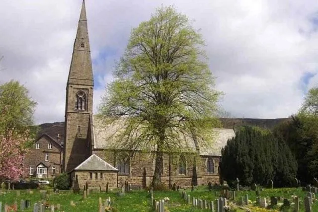
St John the Baptist church
Historic churches · 0.8 km

River Noe
Museums · 0.8 km

Cheesehouse
Hostels · 0.9 km
Homestead
Hostels · 0.9 km

Bamford
Museums · 0.9 km

Swallowholme Camping and Caravaning Park
Campsites · 0.9 km

Osprey
Public art & sculpture · 0.9 km

Pine Marten
Public art & sculpture · 1.1 km

Hardhurst Farm
Campsites · 1.4 km

Brough Bridge
Historic bridges · 1.7 km

Yorkshire Bridge
Mountains & hills · 1.8 km

Bamford Edge
Climbing & bouldering crags · 1.8 km
Nearby
📷 3Historic churches · East Midlands
St John the Baptist church
St John the Baptist church — Grade II* listed church in Bamford, England.
📷 5Museums · East Midlands
River Noe
River Noe — a museum in england-east-midlands, United Kingdom.
📷 5Hostels · East Midlands
Cheesehouse
Cheesehouse — a hostel in england east midlands.
📷 5Hostels · East Midlands
Homestead
Homestead — a hostel in england east midlands.
📷 5Museums · East Midlands
Bamford
Bamford is a village in the Peak District, Derbyshire, England, close to the River Derwent. To the north-east is Bamford Edge, and to the north-west the Ladybower, Derwent and Howden Reservoirs. At th
📷 5Campsites · East Midlands
Swallowholme Camping and Caravaning Park
Swallowholme Camping and Caravaning Park — a campsite in england east midlands.
Where to eat & stay near Peak Park Conservation Centre
Places to stay
📷 5Hostels · East Midlands
Cheesehouse
Cheesehouse — a hostel in england east midlands.
📷 5Hostels · East Midlands
Homestead
Homestead — a hostel in england east midlands.
📷 5Campsites · East Midlands
Swallowholme Camping and Caravaning Park
Swallowholme Camping and Caravaning Park — a campsite in england east midlands.
📷 5 📷 5
📷 5 📷 5
📷 5Campsites · East Midlands
Laneside Caravan Park
Laneside Caravan Park — a campsite in england east midlands.
Places to eat & drink
 📷 7
📷 7Historic pubs · Yorkshire & the Humber
The Fox House
The Fox House in England Yorkshire, United Kingdom.
 📷 7
📷 7Historic pubs · East Midlands
The Three Stags' Heads
The Three Stags' Heads in England South East, United Kingdom.
 📷 5
📷 5Historic pubs · East Midlands
The Old Nags Head
The Old Nags Head in England Yorkshire, United Kingdom.
 📷 5
📷 5Historic pubs · East Midlands
The Chequers Inn and attached outbuildings
The Chequers Inn and attached outbuildings in England East Midlands, United Kingdom.
 📷 5
📷 5Historic pubs · Yorkshire & the Humber
Norfolk Arms Public House
Norfolk Arms Public House in England Yorkshire, United Kingdom.
 📷 5
📷 5Historic pubs · East Midlands
The Eyre Arms Public House
The Eyre Arms Public House in England East Midlands, United Kingdom.
More places in this region
 📷 5
📷 5 📷 5
📷 5Campsites · East Midlands
Rosebay Camping (naturist)
Rosebay Camping (naturist) — a campsite in england london.
 📷 4
📷 4Campsites · East Midlands
The Secret Garden Touring Park
The Secret Garden Touring Park — a campsite in england london.
 📷 5
📷 5Frequently asked questions
- Where is Peak Park Conservation Centre?
- Peak Park Conservation Centre is in Derbyshire, the East Midlands, United Kingdom (postcode S33 0BR), in the parish of Thornhill.
- What is Peak Park Conservation Centre?
- Peak Park Conservation Centre — a campsite in england east midlands.
- How do I get to Peak Park Conservation Centre?
- The nearest railway station is Bamford, about 1.1 km away. The nearest town is Hathersage. Drivers can use postcode S33 0BR.
- Is Peak Park Conservation Centre a protected site?
- Yes — Peak Park Conservation Centre is part of the Dark Peak SSSI Site of Special Scientific Interest.
- Is Peak Park Conservation Centre free to visit?
- Yes, Peak Park Conservation Centre is free to enter.
- How do I get to Peak Park Conservation Centre?
- The nearest railway station is Bamford, about 1.1 km away. Drivers can navigate to postcode S33 0BR.