
Historic churches · South West England
Parish Church of St Giles
In or near Melplash.
Parish Church of St Giles — Grade I listed building-listed church in england-south-west, United Kingdom.

Ray Jennings — CC BY-SA 2.0 via Wikimedia Commons licence

Plan your visit
- Typical visit
- 30 min–1 h
- Nearest railway station
- Maiden Newton · 6.7 km
- Free entry
Getting there & planning your visit
To visit the Parish Church of St Giles in Dorset, the nearest railway station is Maiden Newton, located 6.7 km away. The postcode for the church is DT8 3PA, which you can use for sat-nav coordinates. Entry to the church is free.
About
Parish Church of St Giles is a Grade I listed building-listed church in england-south-west, United Kingdom, registered on the National Heritage List for England (NHLE entry 1119416). Listed status protects buildings and structures of special architectural or historic interest. See the linked Wikipedia article for further details.
Photo gallery
Heritage listing
Details ST 50 SW HOOKE HOOKE VILLAGE 2/130 Parish Church of 11.11.66 St Giles GV I Parish Church. C15 nave. Early C16 south chapel. Chancel rebuilt 1840 (NP). South tower-porch and vestry, 1874. Local rubble and ashlar walls, rock-faced masonry to C19 additions. Clay-tile roofs of fish-scale shape. Stone gable- copings with plain crosses on apices. Chancel, short with diagonal buttresses. East window of three trefoiled lights with tracery in a two-centred head with a label. Nave, with one buttress midway as north. North wall has 2 C15 windows, both of 3 cinquefoiled lights in square heads, western has a label with head-stops. West wall has a C15 doorway with moulded jambs, 4-centred arch in a square head, with a label and head-stops of a bishop and a king, traceried spandrels with paterae. South chapel has 3 windows in south wall of 2 four-centred lights in a square head, with moulded reveals and label. East wall has one of the same. South Tower: 3 stages, divided by strings and with an embattled parapet. Entrance: pointed-arch with label, 2-leaf plank door. 2nd stage has a single trefoiled light. Top stage, 2-light cusped, with panel tracery over. Label returned over. Interior: Chancel-arch, moulded responds and pointed arch, C19. Entrance to south chapel: moulded and 3-centred, with responds, continuous bands of running foliage ornament. On the soffit is a continuous band of quatrefoils enclosing shields; shield at the apex bears the arms of Coleshill impaling Cheyney, for Sir John Coleshill and Elizabeth (Cheyney) his wife. North wall of the chapel has a restored fireplace-recess. The C15 south doorway has chamfered jambs and 2-centred head. Fittings: Font, unusual, elongated hexagonal bowl, set against the wall, the outer faces with panels enclosing 6-pointed figure
From the Historic England List Entry under OGL v3.
Protected designations
- National Nature Reserve: KINGCOMBE
- Area of Outstanding Natural Beauty: Dorset
Designations sourced from Natural England open data under OGL v3.
Place summary
The Parish Church of St Giles is located in South-West England. It is a Grade I listed building, signifying its exceptional architectural and historical importance.
AI-generated from the structured facts on this page (operator, designation, listing, era). Not a substitute for visiting.
- Coordinates
- 50.7992, -2.6605
- District
- Dorset
- Parish
- Hooke
- Postcode
- DT8 3PA
- Parliamentary constituency
- West Dorset
- Established
- 1450
- Nearest railway station
- Maiden Newton — 6.7 km
Sources
- wikidata: Q17532390 (CC0)
Other places nearby

Hooke
Villages · 0.0 km

Hooke Court
Hotels · 0.5 km

Warren Hill
Mountains & hills · 1.1 km

Warren Hill, Hooke, Dorset
Mountains & hills · 1.2 km

Drackenorth
Mountains & hills · 1.6 km

Drakenorth
Mountains & hills · 1.7 km

Hillfort N of Burcombe Wood
Vineyards · 2.7 km
Burcomb Wood
Literary houses · 2.7 km

Spring Hill
Mountains & hills · 2.9 km

Mapperton
Other places · 3.2 km
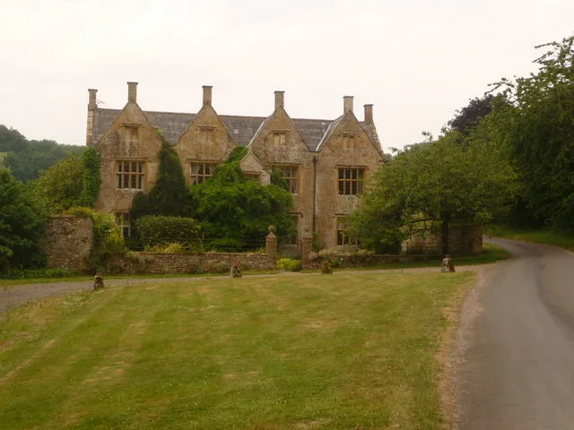
Wraxall Manor
Stately homes · 3.2 km

All Saints' Church, Mapperton
Historic churches · 3.2 km
Nearby
📷 5📷 5Hotels · South West England
Hooke Court
Hooke Court — a hotel in england south west.
📷 5Mountains & hills · South West England
Warren Hill
Warren Hill — a hill or mountain in england south west.
📷 4Mountains & hills · South West England
Warren Hill, Hooke, Dorset
Warren Hill, Hooke, Dorset — a mountain in england-south-west, United Kingdom, 215 m.
📷 4Mountains & hills · South West England
Drackenorth
Drackenorth — a mountain in england-south-west, United Kingdom, 221 m.
📷 5Mountains & hills · South West England
Drakenorth
Drakenorth — a hill or mountain in england south west.
Where to eat & stay near Parish Church of St Giles
Places to stay
📷 5Hotels · South West England
Hooke Court
Hooke Court — a hotel in england south west.
 📷 5
📷 5Caravan parks · South West England
Benville Manor Camping
Benville Manor Camping — a caravan park in england south west.
 📷 5
📷 5Campsites · South West England
Clay Pigeon Caravan Park
Clay Pigeon Caravan Park — a campsite in england south west.
 📷 5
📷 5Caravan parks · South West England
Bide Yer
Bide Yer — a caravan park in england south west.
 📷 5
📷 5Campsites · South West England
Greenacres Campsite.
Greenacres Campsite. — a campsite in england south west.
📷 5Caravan parks · South West England
Washingpool Caravan Site
Washingpool Caravan Site — a caravan park in england south west.
Places to eat & drink
 📷 7
📷 7Restaurants · South West England
Brassica
Brassica — a restaurant in england south west.
 📷 5
📷 5Historic pubs · South West England
Eight Bells Inn
Eight Bells Inn in England South West, United Kingdom.
 📷 6
📷 6 📷 5
📷 5Historic pubs · South West England
Loders Arms Inn
Loders Arms Inn in England South West, United Kingdom.
 📷 5
📷 5 📷 7
📷 7Historic pubs · South West England
Three Mariners Public House
Three Mariners Public House in England South West, United Kingdom.
More places in this region
 📷 5
📷 5Historic churches · South West England
Abbey Church of St Gregory the Great, Downside Abbey
Abbey Church of St Gregory the Great, Downside Abbey — church in Stratton-on-the-Fosse, Somerset, England, UK.
 📷 5
📷 5Historic churches · South West England
All Saints Church
All Saints Church — Grade I listed church in Woolley, Somerset, England, UK.
 📷 5
📷 5Historic churches · South West England
All Saints Church, Hampreston
All Saints Church, Hampreston — church in Hampreston, Dorset, England, UK.
 📷 5
📷 5Historic churches · South West England
All Saints Church, Nether Cerne
All Saints Church, Nether Cerne — church in Nether Cerne, Dorset, England, UK.
Frequently asked questions
- Where is Parish Church of St Giles?
- Parish Church of St Giles is in South-West England, United Kingdom (postcode DT8 3PA), in the parish of Hooke.
- What is Parish Church of St Giles?
- Parish Church of St Giles — Grade I listed building-listed church in england-south-west, United Kingdom.
- How do I get to Parish Church of St Giles?
- The nearest railway station is Maiden Newton, about 6.7 km away. Drivers can use postcode DT8 3PA.
- When was Parish Church of St Giles built?
- Built or established in 1450.
- Is Parish Church of St Giles a listed building?
- Parish Church of St Giles is officially recognised as Grade I listed building listed.
- Is Parish Church of St Giles a protected site?
- Yes — Parish Church of St Giles is part of the KINGCOMBE National Nature Reserve and the Dorset National Landscape (AONB).
- Is Parish Church of St Giles free to visit?
- Yes, Parish Church of St Giles is free to enter.
- How do I get to Parish Church of St Giles?
- The nearest railway station is Maiden Newton, about 6.7 km away. Drivers can navigate to postcode DT8 3PA.