
Memorials & monuments · East of England
Pampisford War Memorial in Churchyard West of South Porch
In or near Duxford.
Pampisford War Memorial in Churchyard West of South Porch — Grade II listed building-listed memorial in england-london, United Kingdom.

Tiger — CC BY-SA 2.0 via Wikimedia Commons licence

Plan your visit
- Typical visit
- 15 min–45 min
- Nearest railway station
- Whittlesford Parkway · 1.7 km
- Free entry
- Dog-friendly
Getting there & planning your visit
To visit the Pampisford War Memorial, the nearest railway station is Whittlesford Parkway, located 1.7 km away. Entry to the memorial is free. The postcode for sat-nav is CB22 3ES.
About
Pampisford War Memorial in Churchyard West of South Porch is a Grade II listed building-listed memorial in england-london, United Kingdom, registered on the National Heritage List for England (NHLE entry 1331151). Listed status protects buildings and structures of special architectural or historic interest. See the linked Wikipedia article for further details.
Photo gallery
Heritage listing
Details TL 4848 PAMPISFORD CHURCH LANE (East Side) 10/201 War Memorial in churchyard west of south porch with High Street GV II War memorial. c.1920. Designed by R Blomfield (1856-1942). Limestone. Octagonal sectioned cross standing on stepped plinth with names of war dead of two world wars inscribed on plinth. Listing NGR: TL4976848240 This List entry has been amended to add sources for War Memorials Online and the War Memorials Register. These sources were not used in the compilation of this List entry but are added here as a guide for further reading, 16 January 2017. Legacy The contents of this record have been generated from a legacy data system. Legacy System number: 52031 Legacy System: LBS
From the Historic England List Entry under OGL v3.
Place summary
Pampisford War Memorial is located in the churchyard west of the south porch in Pampisford, Cambridgeshire. This memorial is designated as a Grade II listed building, recognising its special architectural and historic interest.
AI-generated from the structured facts on this page (operator, designation, listing, era). Not a substitute for visiting.
- Coordinates
- 52.1122, 0.1857
- County
- Cambridgeshire
- District
- South Cambridgeshire
- Parish
- Pampisford
- Postcode
- CB22 3ES
- Parliamentary constituency
- South Cambridgeshire
- Nearest railway station
- Whittlesford Parkway — 1.7 km
Sources
- wikidata: Q26616083 (CC0)
Other places nearby

Pampisford
Villages · 0.2 km

Sawston
Villages · 1.5 km

Sawston War Memorial
Memorials & monuments · 1.5 km

Challis House
Museums · 1.6 km
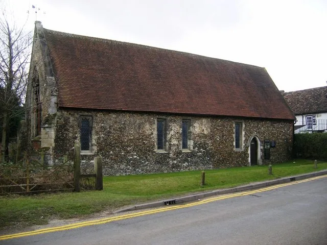
Duxford Chapel
Chapels · 1.6 km

Bethnal Green and King's Lynn Line
Historic bridges · 1.6 km

Pampisford high point
Mountains & hills · 1.7 km

Sawston Cinema
Theatres · 2.3 km

Bethnal Green and King's Lynn Line
Historic bridges · 2.3 km

Garden Sculpture North East Of Duxford Mill
Public art & sculpture · 2.4 km

Parish Church of St Mary and St Andrew
Historic churches · 2.4 km

Whittlesford Cross
Memorials & monuments · 2.4 km
Nearby
📷 5📷 5📷 5Memorials & monuments · East of England
Sawston War Memorial
Sawston War Memorial is a memorial in the United Kingdom.
📷 5📷 5Chapels · East of England
Duxford Chapel
Duxford Chapel — chapel in Whittlesford, Cambridgeshire, England, UK.
📷 5Historic bridges · East of England
Bethnal Green and King's Lynn Line
Bethnal Green and King's Lynn Line is a historic bridge in the United Kingdom.
Where to eat & stay near Pampisford War Memorial in Churchyard West of South Porch
Places to stay
 📷 5
📷 5 📷 5📷 5
 📷 7
📷 7Hotels · East of England
Crown House
Crown House — a hotel in england london.
 📷 5
📷 5Caravan parks · East of England
Caravan and Motorhome Club
Caravan and Motorhome Club — a caravan park in england london.
 📷 5
📷 5Campsites · East of England
Camping & Caravanning Club - Cambridge Club Site
Camping & Caravanning Club - Cambridge Club Site — a campsite in england london.
Places to eat & drink
 📷 5
📷 5Historic pubs · East of England
Tickells Arms Public House
Tickells Arms Public House in England East, United Kingdom.
 📷 5
📷 5 📷 5
📷 5Historic pubs · East of England
The Kings Head Inn
The Kings Head Inn in England East, United Kingdom.
 📷 7
📷 7Historic pubs · East of England
The Robin Hood
The Robin Hood in England East, United Kingdom.
 📷 7
📷 7Restaurants · East of England
sole & duck
sole & duck — a restaurant in england london.
 📷 7
📷 7Historic pubs · East of England
Old Carpenters Arms
Old Carpenters Arms in England East, United Kingdom.
More memorials in this region
 📷 5
📷 5Memorials & monuments · East of England
386th B.G.(M), 9th Air Force USAAF Memorial
386th B.G.(M), 9th Air Force USAAF Memorial is a memorial in the United Kingdom.
 📷 5
📷 5Memorials & monuments · East of England
Ailesbury Mausoleum
Ailesbury Mausoleum is a memorial in the United Kingdom.
 📷 5
📷 5Memorials & monuments · East of England
Archie F. Daniels Memorial
Archie F. Daniels Memorial is a memorial in the United Kingdom.
 📷 5
📷 5Memorials & monuments · East of England
Barnwell War Memorial
Barnwell War Memorial is a memorial in the United Kingdom.
Frequently asked questions
- Where is Pampisford War Memorial in Churchyard West of South Porch?
- Pampisford War Memorial in Churchyard West of South Porch is in Cambridgeshire, London, United Kingdom (postcode CB22 3ES), in the parish of Pampisford.
- What is Pampisford War Memorial in Churchyard West of South Porch?
- Pampisford War Memorial in Churchyard West of South Porch — Grade II listed building-listed memorial in england-london, United Kingdom.
- How do I get to Pampisford War Memorial in Churchyard West of South Porch?
- The nearest railway station is Whittlesford Parkway, about 1.7 km away. Drivers can use postcode CB22 3ES.
- Is Pampisford War Memorial in Churchyard West of South Porch a listed building?
- Pampisford War Memorial in Churchyard West of South Porch is officially recognised as Grade II listed building listed.
- Is Pampisford War Memorial in Churchyard West of South Porch free to visit?
- Yes, Pampisford War Memorial in Churchyard West of South Porch is free to enter.
- How do I get to Pampisford War Memorial in Churchyard West of South Porch?
- The nearest railway station is Whittlesford Parkway, about 1.7 km away. Drivers can navigate to postcode CB22 3ES.