
Archaeological sites · East of England
Othona Saxon Shore Fort
In or near East Mersea.
Othona Saxon Shore Fort — archaeological in england east.

Michael Garlick — CC BY-SA 2.0 via Wikimedia Commons licence

Plan your visit
- Typical visit
- 45 min–1.5 h
About
Othona Saxon Shore Fort is a archaeological located in england east. A British archaeological site recorded in OpenStreetMap with at least one heritage quality signal (Wikidata link, Wikipedia article or designated operator).
Photo gallery
See it from the streetimagery from 2025
Imagery © Mapillary contributors, CC BY-SA 4.0
Protected designations
- Site of Special Scientific Interest: Dengie SSSI
- National Nature Reserve: DENGIE
- Ramsar wetland: Dengie (Mid-Essex Coast Phase 1)
Designations sourced from Natural England open data under OGL v3.
Place summary
Othona Saxon Shore Fort is an archaeological site located in the East of England. It was part of a network of fortifications built during the Roman period to defend against coastal threats. The site provides insights into military architecture and the settlement patterns of the time. Visitors can explore the remnants of the fort and its historical context.
AI-generated from the structured facts on this page (operator, designation, listing, era). Not a substitute for visiting.
- Coordinates
- 51.7355, 0.9400
- County
- Essex
- District
- Maldon
- Parish
- Bradwell-on-Sea
- Postcode
- CM0 7PN
- Parliamentary constituency
- Maldon
Sources
- osm: w978167536 (ODbL)
- wikidata: Q1523463 (CC0)
Other places nearby

Othona Saxon Shore Fort
Archaeological sites · 0.0 km
Chapel of Saint Peter-on-the-Wall
Chapels · 0.0 km
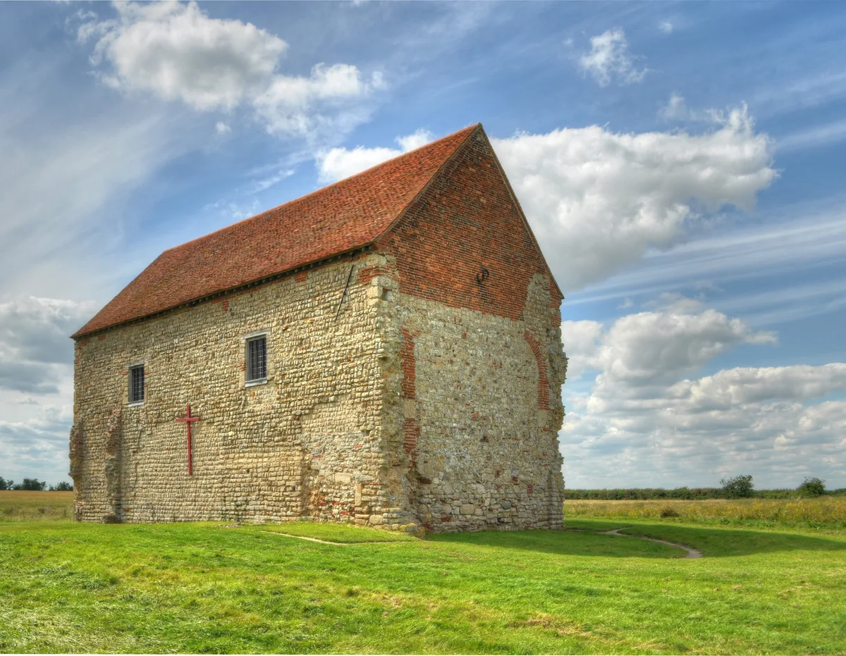
Chapel of St Peter-on-the-Wall
Historic churches · 0.0 km

RAF Bradwell Bay Preservation Group
Museums · 0.4 km
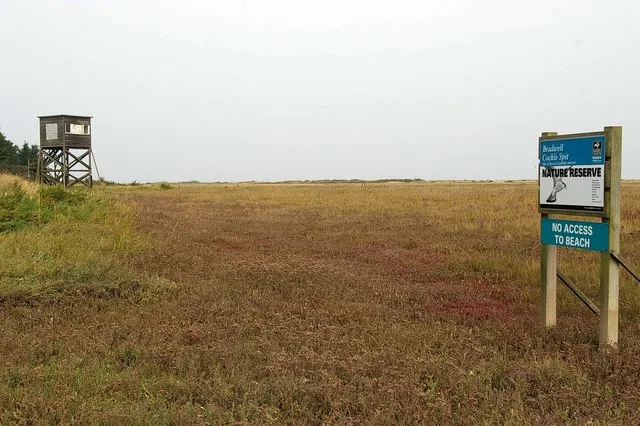
Bradwell Shell Bank
Wildlife reserves · 0.4 km

Weymarks Beach
Beaches · 1.9 km

RAF Bradwell Bay memorial
Memorials & monuments · 2.9 km

Bradwell-On-Sea War Memorial
Memorials & monuments · 3.0 km

Seaview
Caravan parks · 4.5 km

Waldegraves
Caravan parks · 4.7 km

Mersea Island Museum
Museums · 4.8 km

Cobmarsh Island
Islands · 4.9 km
Nearby
📷 3Archaeological sites · East of England
Othona Saxon Shore Fort
Othona Saxon Shore Fort — a archaeological in england-east, United Kingdom.
📷 3Chapels · East of England
Chapel of Saint Peter-on-the-Wall
Chapel of Saint Peter-on-the-Wall — a other in england-east, United Kingdom.
📷 5Historic churches · East of England
Chapel of St Peter-on-the-Wall
Chapel of St Peter-on-the-Wall — Grade I listed chapel in Bradwell-on-Sea, Essex, England, UK.
📷 3Museums · East of England
RAF Bradwell Bay Preservation Group
RAF Bradwell Bay Preservation Group — a museum in england-east, United Kingdom.
📷 3Wildlife reserves · East of England
Bradwell Shell Bank
Bradwell Shell Bank — Essex Wildlife Trust Nature reserve.
📷 3Where to eat & stay near Othona Saxon Shore Fort
Places to stay
📷 5📷 5 📷 5
📷 5Caravan parks · East of England
Coopers Beach Holiday Park
Coopers Beach Holiday Park — a caravan park in england east. Brand: Parkdean Resorts.
 📷 5📷 5
Caravan parks · East of England
Mersea Island Holiday Park
Mersea Island Holiday Park — a caravan park in england east.
 📷 5
📷 5Caravan parks · East of England
Waterside Holiday Park
Waterside Holiday Park — a caravan park in england east.
Places to eat & drink
 📷 5
📷 5Historic pubs · East of England
The Fox And Hounds
The Fox And Hounds in England East, United Kingdom.
 📷 7
📷 7Historic pubs · East of England
Dog And Pheasant Public House
Dog And Pheasant Public House in England East, United Kingdom.
 📷 5
📷 5Historic pubs · East of England
The King's Head Public House
The King's Head Public House in England East, United Kingdom.
 📷 7
📷 7Historic pubs · East of England
Peldon Rose Public House
Peldon Rose Public House in England East, United Kingdom.
 📷 7
📷 7Historic pubs · East of England
The Brewers Arms Public House
The Brewers Arms Public House in England East, United Kingdom.
 📷 7
📷 7Restaurants · East of England
The Creek
The Creek — a restaurant in england east.
More archaeological sites in this region
 Flagship📷 10
Archaeological sites · East of England
Nunn Wood
Nunn Wood — woods in Essex, England, a Site of Special Scientific Interest.
 📷 5
📷 5Archaeological sites · East of England
A Bronze Age post alignment and timber platform at Flag Fen and associated Bronze Age and later field systems and settlement to
A Bronze Age post alignment and timber platform at Flag Fen and associated Bronze Age and later field systems and settlement to — archaeological site in Thorney, City of Peterborough, England, UK.
 📷 5
📷 5Archaeological sites · East of England
Causewayed enclosure 900m west of Great Wilbraham parish church
Causewayed enclosure 900m west of Great Wilbraham parish church — archaeological site in Great Wilbraham, South Cambridgeshire, England, UK.
 📷 5
📷 5Archaeological sites · East of England
Dray's Ditches
Dray's Ditches — archaeological site in Streatley, Central Bedfordshire, England, UK.
Frequently asked questions
- Where is Othona Saxon Shore Fort?
- Othona Saxon Shore Fort is in Essex, East of England, United Kingdom (postcode CM0 7PN), in the parish of Bradwell-on-Sea.
- What is Othona Saxon Shore Fort?
- Othona Saxon Shore Fort — archaeological in england east.
- How do I get to Othona Saxon Shore Fort?
- Drivers can use postcode CM0 7PN.
- Is Othona Saxon Shore Fort a protected site?
- Yes — Othona Saxon Shore Fort is part of the Dengie SSSI Site of Special Scientific Interest and the DENGIE National Nature Reserve.
- How do I get to Othona Saxon Shore Fort?
- Drivers can navigate to postcode CM0 7PN. It sits within the Maldon parliamentary constituency.