
Castles · North West England
Oldham
In or near Manchester.
Oldham is a town in Greater Manchester, England. It lies amongst the Pennines on elevated ground between the rivers Irk and Medlock, 5 miles (8 km) southeast of Rochdale, and 7 miles (11 km) northeas

Stephen Heslington — CC BY-SA 2.0 via Wikimedia Commons licence

Plan your visit
- Typical visit
- 1.5 h–3 h
- Nearest railway station
- Mills Hill · 3.7 km
- Family-friendly
- Limited wheelchair access
Getting there & planning your visit
To visit Oldham Castle, the nearest railway station is Mills Hill, located 3.7 km away. The postcode for the castle is OL1 1NL. Please note that wheelchair accessibility is limited.
About
Oldham is a town in Greater Manchester, England. It lies amongst the Pennines on elevated ground between the rivers Irk and Medlock, 5 miles (8 km) southeast of Rochdale, and 7 miles (11 km) northeast of Manchester City Centre. It is the administrative centre of the Metropolitan Borough of Oldham, which had a population of 242,003 in 2021. Within the boundaries of the historic county of Lancashire, and with little early history to speak of, Oldham rose to prominence in the 19th century as an international centre of textile manufacture. It was a boomtown of the Industrial Revolution, and among the first ever industrialised towns, rapidly becoming "one of the most important centres of cotton and textile industries in England." At its zenith, it was the most productive cotton spinning mill town in the world, producing more cotton than France and Germany combined. Oldham's textile industry fell into decline in the mid-20th century; the town's last mill closed in 1998. The demise of textile processing in Oldham depressed and heavily affected the local economy. The town centre is the focus of a project that aims to transform Oldham into a centre for further education and the performing arts. It is, however, still distinguished architecturally by the surviving cotton mills and other buildings associated with that industry. In the 2021 United Kingdom census Oldham built-up area subdivision, as defined by the Office for National Statistics, had a population of 110,718 and an area of
Photo gallery
Protected designations
- Site of Special Scientific Interest: Rochdale Canal SSSI
Designations sourced from Natural England open data under OGL v3.
From the Wikipedia article
Oldham is a town in Greater Manchester, England. It lies amongst the Pennines on elevated ground between the rivers Irk and Medlock, 5 miles (8 km) southeast of Rochdale, and 7 miles (11 km) northeast of Manchester City Centre. It is the administrative centre of the Metropolitan Borough of Oldham, which had a population of 242,003 in 2021. Within the boundaries of the historic county of Lancashire, and with little early history to speak of, Oldham rose to prominence in the 19th century as an international centre of textile manufacture. It was a boomtown of the Industrial Revolution, and among the first ever industrialised towns, rapidly becoming "one of the most important centres of cotton and textile industries in England." At its zenith, it was the most productive cotton spinning mill town in the world, producing more cotton than France and Germany combined. Oldham's textile industry fell into decline in the mid-20th century; the town's last mill closed in 1998. The demise of textile processing in Oldham depressed and heavily affected the local economy. The town centre is the focus of a project that aims to transform Oldham into a centre for further education and the performing arts. It is, however, still distinguished architecturally by the surviving cotton mills and other buildings associated with that industry. In the 2021 United Kingdom census Oldham built-up area subdivision, as defined by the Office for National Statistics, had a population of 110,718 and an area of 1,639 hectares (6.33 sq mi), giving a population density of 67.57 inhabitants per hectare (17,500/sq mi), while the Borough of Oldham had a population of 242,003, an area of 1,424 hectares (5.50 sq mi), and a population density of 17.29 inhabitants per hectare (4,480/sq mi).
Excerpt from Wikipedia under CC BY-SA 4.0. See the source article linked in Sources below.
Background
History
The earliest known evidence of a human presence in what is now Oldham is attested by the discovery of Neolithic flint arrow-heads and workings found at Werneth and Besom Hill, implying habitation 7–10,000 years ago. Evidence of later Roman and Celtic activity is confirmed by an ancient Roman road and Bronze Age archaeological relics found at various sites within the town. Placenames of Celtic origin are still to be found in Oldham: Werneth derives from a Celtic personal name identical to the Gaulish vernetum, "alder swamp", and Glodwick may be related to the modern Welsh clawdd, meaning "dyke" or "ditch". Nearby Chadderton is also pre-Anglo-Saxon in origin, from the Old Welsh cadeir, itself…
Sourced from Wikipedia under CC BY-SA 4.0.
- Coordinates
- 53.5440, -2.1170
- District
- Oldham
- Parish
- Oldham, unparished area
- Postcode
- OL1 1NL
- Parliamentary constituency
- Oldham West, Chadderton and Royton
- Nearest railway station
- Mills Hill — 3.7 km
Sources
- wikipedia: Oldham (CC BY-SA 4.0)
Other places nearby

Fish and Chips
Memorials & monuments · 0.3 km

Al-Khasra Masjid
Historic churches · 0.4 km

The Market
Farmers’ markets · 0.4 km

George Street Chapel
Chapels · 0.4 km
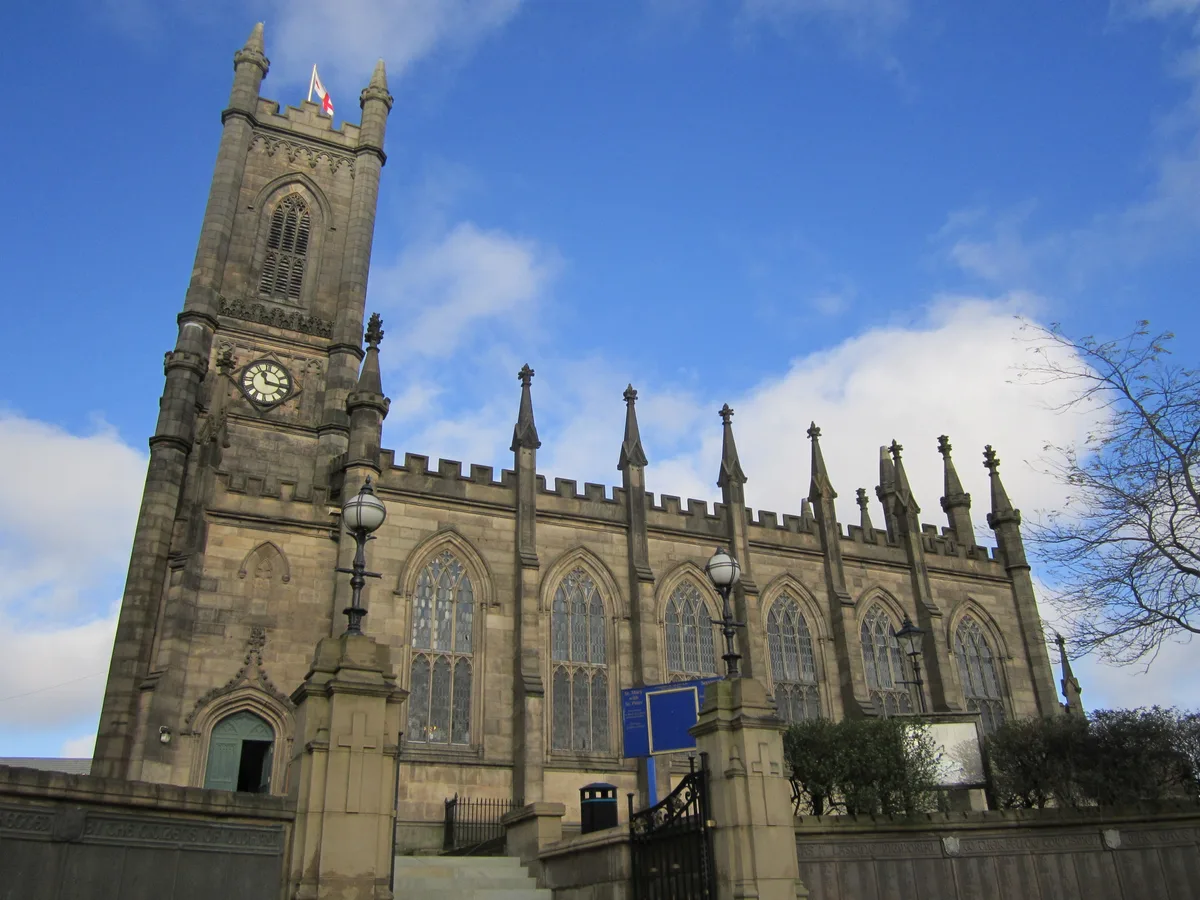
Parish Church of St Mary with St Peter, Oldham
Historic churches · 0.4 km

Annie Kenney
Memorials & monuments · 0.4 km

Oldham War Memorial
Memorials & monuments · 0.4 km

ODEON Oldham
Cinemas · 0.5 km

Oldham Theatre Workshop
Open-air theatres · 0.5 km

Grosvenor Super Cinema
Theatres · 0.5 km

Joseph Platt 1863-1930
Memorials & monuments · 0.5 km

Grand Theatre, Oldham
Theatres · 0.5 km
Nearby
📷 4Memorials & monuments · North West England
Fish and Chips
Fish and Chips — a memorial in North West England, United Kingdom.
📷 5Historic churches · North West England
Al-Khasra Masjid
Al-Khasra Masjid — a church in North West England, United Kingdom.
📷 5Farmers’ markets · North West England
The Market
The Market — a UK farmers' market in england north west.
📷 3Chapels · North West England
George Street Chapel
George Street Chapel — chapel in Oldham, Greater Manchester, England, UK.
📷 3Historic churches · North West England
Parish Church of St Mary with St Peter, Oldham
Parish Church of St Mary with St Peter, Oldham — church in Oldham, Greater Manchester, United Kingdom.
📷 5Memorials & monuments · North West England
Annie Kenney
Annie Kenney — a memorial in North West England, United Kingdom.
Where to eat & stay near Oldham
Places to stay
 📷 5
📷 5Campsites · North West England
Dog Hill Scout Campsite
Dog Hill Scout Campsite — a campsite in england north west.
 📷 5
📷 5Hotels · North West England
Norton Grange Hotel
Norton Grange Hotel — a hotel in england north west.
 📷 5
📷 5Campsites · North West England
Well-i-Hole Farm Caravan and Camping
Well-i-Hole Farm Caravan and Camping — a campsite in england north west.
 📷 5
📷 5Caravan parks · North West England
The Moorlands
The Moorlands — a caravan park in england north west.
 📷 5
📷 5Caravan parks · North West England
Roch Vale Caravan Park
Roch Vale Caravan Park — a caravan park in england north west.
 📷 5
📷 5Hotels · North West England
Broadfield Park Hotel
Broadfield Park Hotel — a hotel in england north west.
Places to eat & drink
 📷 7
📷 7 📷 5
📷 5Historic pubs · North West England
Colliers Arms Public House
Colliers Arms Public House in England North West, United Kingdom.
 📷 5
📷 5Historic pubs · North West England
Ye Olde Boars Head Public House
Ye Olde Boars Head Public House in England North West, United Kingdom.
 📷 7
📷 7 📷 5
📷 5 📷 7
📷 7Historic pubs · North West England
The Baum
The Baum in England North West, United Kingdom.
More castles in this region
 📷 3
📷 3Castles · North West England
Manchester Castle
Manchester Castle — medieval fortified manor house in England.
 📷 5
📷 5Castles · North West England
Mow Cop Castle
Mow Cop Castle — folly on the Cheshire and Staffordshire border, England, UK.
 📷 3
📷 3 📷 3
📷 3Castles · North West England
Ullerwood Castle
Ullerwood Castle — castle in Greater Manchester, England.
Frequently asked questions
- Where is Oldham?
- Oldham is in North-West England, United Kingdom (postcode OL1 1NL), in the parish of Oldham, unparished area.
- What is Oldham?
- Oldham is a town in Greater Manchester, England. It lies amongst the Pennines on elevated ground between the rivers Irk and Medlock, 5 miles (8 km) southeast of Rochdale, and 7 miles (11 km) northeas
- How do I get to Oldham?
- The nearest railway station is Mills Hill, about 3.7 km away. The nearest town is Manchester. Drivers can use postcode OL1 1NL.
- Is Oldham a protected site?
- Yes — Oldham is part of the Rochdale Canal SSSI Site of Special Scientific Interest.
- Does Oldham charge admission?
- Oldham typically charges admission. Check the official site for current ticket prices and opening hours.
- How do I get to Oldham?
- The nearest railway station is Mills Hill, about 3.7 km away. Drivers can navigate to postcode OL1 1NL.