
Windmills · South East England
Nutbourne Windmill
In or near Marehill.
Nutbourne Windmill is a windmill in the United Kingdom.

Wikimedia Commons contributors — see linked file page for photographer and licence licence

Plan your visit
- Typical visit
- 30 min–1 h
- Nearest railway station
- Pulborough · 3.5 km
- Free entry
- Family-friendly
- Dog-friendly
Getting there & planning your visit
Nutbourne Windmill is located in Horsham, West Sussex, with the postcode RH20 2HE. The nearest railway station is Pulborough, which is 3.5 km away. Entry to the windmill is free.
About
Nutbourne Windmill is a named windmill in the United Kingdom. Coordinates: 50.9592°, -0.4659°. This entry is part of The Great Britain Guide, a free, ad-free, open-data tourist directory.
Photo gallery
Heritage listing
Nutbourne Windmill is a tower mill at Nutbourne, Sussex, England which has been converted to retail use.
From the Historic England List Entry under OGL v3.
From the Wikipedia article
Nutbourne Windmill is a tower mill at Nutbourne, Sussex, England which has been converted to retail use.
Excerpt from Wikipedia under CC BY-SA 4.0. See the source article linked in Sources below.
Background
History
Nutbourne Windmill was built in 1854. It had a short working life, stopping c.1894. The mill gradually became derelict, although the cap was still on the mill during the Second World War. At some point, the tail beam failed, and the windshaft was left hanging down vertically at the top of the tower, supported by the stocks alone. The mill tower now serves as a tasting room and shop for Nutbourne vineyards.
Description
Nutbourne Windmill is a five-storey brick and stone tower mill with a stage at first floor level. The mill drove two pairs of underdrift millstones.
Sourced from Wikipedia under CC BY-SA 4.0.
- Coordinates
- 50.9592, -0.4659
- County
- West Sussex
- District
- Horsham
- Parish
- Pulborough
- Postcode
- RH20 2HE
- Parliamentary constituency
- Arundel and South Downs
- Established
- 1854
- Nearest railway station
- Pulborough — 3.5 km
Sources
- osm: w591763852 (ODbL)
- wikipedia: Nutbourne Windmill (CC BY-SA 4.0)
- commons: Nutbourne Mill.jpg (CC BY-SA 4.0)
Other places nearby

The Rising Sun Inn
Historic pubs · 0.4 km

Meeten's Mill
Historic houses · 1.0 km

West Chiltington
Villages · 1.2 km
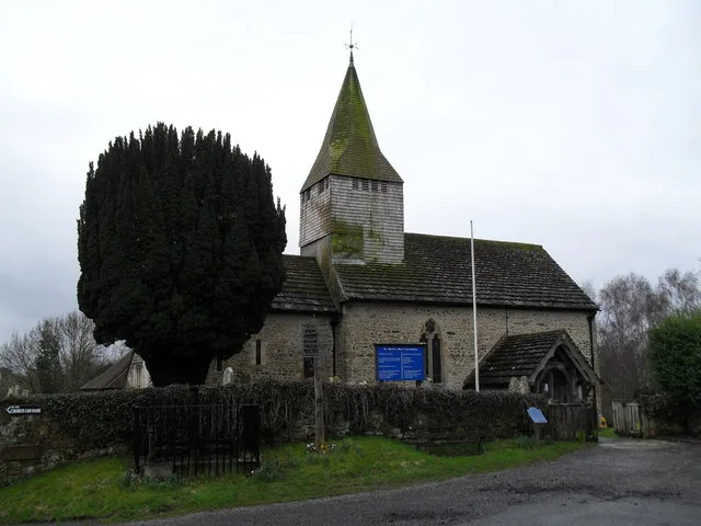
St Mary's Church, West Chiltington
Historic churches · 1.3 km

Broomershill
Mountains & hills · 1.3 km

Marehill
Towns & cities · 1.4 km

Lickfold Roman bath house
Archaeological sites · 1.9 km

Lickfold Roman bath house
Archaeological sites · 1.9 km

New Place Manor
Manor houses · 2.5 km

Cattlestone
Campsites · 2.6 km

Wiggonholt Church
Historic churches · 2.8 km

Chequers
Hotels · 3.0 km
Nearby
📷 5Historic pubs · South East England
The Rising Sun Inn
The Rising Sun Inn in England South East, United Kingdom.
📷 5Historic houses · South East England
Meeten's Mill
Meeten's Mill — a Grade II-listed historic house in england-south-east, United Kingdom.
📷 5📷 5Historic churches · South East England
St Mary's Church, West Chiltington
St Mary's Church, West Chiltington — Grade I listed church in West Chiltington, West Sussex, England, UK.
📷 5Mountains & hills · South East England
Broomershill
Broomershill — a hill or mountain in england south east.
📷 5Where to eat & stay near Nutbourne Windmill
Places to stay
📷 5📷 6 📷 7
📷 7 📷 5
📷 5Campsites · South East England
Limeburners Campsite
Limeburners Campsite — a campsite in england south east.
 📷 5
📷 5Caravan parks · South East England
Washington Caravan & Camping Park
Washington Caravan & Camping Park — a caravan park in england south east.
Caravan parks · South East England
Washington Caravan & Camping Park
Washington Caravan & Camping Park — a caravan park in england south east.
Places to eat & drink
📷 5Historic pubs · South East England
The Rising Sun Inn
The Rising Sun Inn in England South East, United Kingdom.
 📷 5
📷 5Historic pubs · South East England
The White Hart
The White Hart — Historic pub — listed building or notable heritage status.
 📷 7
📷 7Historic pubs · South East England
The Selsey Arms Public House
The Selsey Arms Public House in England South East, United Kingdom.
 📷 5
📷 5Historic pubs · South East England
The Frankland Arms Public House
The Frankland Arms Public House in England South East, United Kingdom.
 📷 5
📷 5 📷 5
📷 5Historic pubs · South East England
The Black Rabbit Public House
The Black Rabbit Public House in England South East, United Kingdom.
More windmills in this region
 📷 5
📷 5Windmills · South East England
Buckland Windmill
Buckland Windmill is a windmill in the United Kingdom.
 📷 5
📷 5Windmills · South East England
Meopham Windmill
Meopham Windmill is a windmill in the United Kingdom.
 📷 5
📷 5Windmills · South East England
Mugswell Windmill
Mugswell Windmill is a windmill in the United Kingdom.
 📷 5
📷 5Windmills · South East England
Reigate Mill Church
Reigate Mill Church is a windmill in the United Kingdom.
Frequently asked questions
- Where is Nutbourne Windmill?
- Nutbourne Windmill is in West Sussex, South-East England, United Kingdom (postcode RH20 2HE), in the parish of Pulborough.
- What is Nutbourne Windmill?
- Nutbourne Windmill is a windmill in the United Kingdom.
- How do I get to Nutbourne Windmill?
- The nearest railway station is Pulborough, about 3.5 km away. The nearest town is Marehill. Drivers can use postcode RH20 2HE.
- When was Nutbourne Windmill built?
- Built or established in 1854.
- Who owns Nutbourne Windmill?
- Nutbourne Windmill is owned by Nutbourne Vineyards.
- Is Nutbourne Windmill a listed building?
- Nutbourne Windmill is officially recognised as Grade II listed building listed.
- Is Nutbourne Windmill free to visit?
- Yes, Nutbourne Windmill is free to enter.
- How do I get to Nutbourne Windmill?
- The nearest railway station is Pulborough, about 3.5 km away. Drivers can navigate to postcode RH20 2HE.