Natural landmarks · North East England
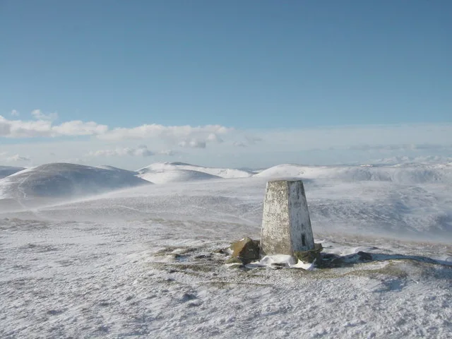
Northern End of the Pennine Way
In or near Cornhill-on-Tweed.
Northern End of the Pennine Way — a other in scotland-central, United Kingdom.

Dave Kelly — CC BY-SA 2.0 via Wikimedia Commons licence
Plan your visit
- Typical visit
- 1 h–2 h
- Free entry
- Family-friendly
- Dog-friendly
About
Northern End of the Pennine Way is a other located in scotland-central, United Kingdom. Sourced from OpenStreetMap (ODbL licence); see local listings for visitor information, opening hours and admission details.
Photo gallery
See it from the streetimagery from 2021
Imagery © Mapillary contributors, CC BY-SA 4.0
Place summary
The Northern End of the Pennine Way is located in central Scotland. This long-distance footpath stretches 268 miles from Edale in Derbyshire to Kirk Yetholm, marking the boundary between England and Scotland. It is known for its rugged terrain and scenic landscapes, attracting walkers and outdoor enthusiasts.
AI-generated from the structured facts on this page (operator, designation, listing, era). Not a substitute for visiting.
- Coordinates
- 55.5469, -2.2758
- District
- Scottish Borders
- Postcode
- TD5 8PJ
- Parliamentary constituency
- Berwickshire, Roxburgh and Selkirk
Sources
- osm: way/142273245 (ODbL)
Other places nearby

Cross Keys House, Main Street, Kirk Yetholm
Historic houses · 0.0 km

Kirk Yetholm
Historic churches · 0.0 km

Gypsy Memorial
Memorials & monuments · 0.0 km

The Gypsy Palace
Palaces · 0.1 km

Boyd of Cherrytrees Mausoleum
Follies · 0.1 km

Friends Of Nature House
Hostels · 0.1 km

Kirk Yetholm Parish Church
Historic churches · 0.2 km
Waukford Bridge
Historic bridges · 0.2 km
Yetholm
Archaeological sites · 0.2 km

Mill House
B&Bs · 0.2 km

War Memorial, Yetholm
Memorials & monuments · 0.3 km

Yetholm Bridge
Historic bridges · 0.4 km
Nearby
📷 3Historic houses · North East England
Cross Keys House, Main Street, Kirk Yetholm
Cross Keys House, Main Street, Kirk Yetholm — architectural structure in Scottish Borders, Scotland, UK.
📷 4Historic churches · North East England
Kirk Yetholm
Kirk Yetholm in England North East, United Kingdom.
📷 3Memorials & monuments · North East England
Gypsy Memorial
Gypsy Memorial — a memorial in scotland-central, United Kingdom.
📷 3Palaces · North East England
The Gypsy Palace
The Gypsy Palace — a palace in scotland-central, United Kingdom.
📷 3Follies · North East England
Boyd of Cherrytrees Mausoleum
Boyd of Cherrytrees Mausoleum is a folly in the United Kingdom.
📷 5Hostels · North East England
Friends Of Nature House
Friends Of Nature House — a hostel in scotland central.
Where to eat & stay near Northern End of the Pennine Way
Places to stay
📷 5Hostels · North East England
Friends Of Nature House
Friends Of Nature House — a hostel in scotland central.
📷 7B&Bs · North East England
Mill House
Mill House — a bed-and-breakfast in scotland central.
 📷 5
📷 5Caravan parks · North East England
Kirkfield Caravan Site
Kirkfield Caravan Site — a caravan park in scotland central.
 📷 7
📷 7Hotels · North East England
The Plough Hotel
The Plough Hotel — a hotel in scotland central.
 📷 7
📷 7 📷 5
📷 5Caravan parks · North East England
Crookhouse Farm Campsite
Crookhouse Farm Campsite — a caravan park in scotland central.
Places to eat & drink
 📷 4
📷 4Historic pubs · Scottish Lowlands
Newcastle Arms
Newcastle Arms — Historic pub — listed building or notable heritage status.
 📷 7
📷 7 📷 5
📷 5Historic pubs · Scottish Lowlands
The Masons Arms
The Masons Arms in Scotland Lowlands, United Kingdom.
 📷 7
📷 7Historic pubs · Scottish Lowlands
The Victoria Hotel
The Victoria Hotel in Scotland Lowlands, United Kingdom.
More natural landmarks in this region
 📷 4
📷 4Natural landmarks · North East England
Cleveland Way
109-mile horseshoe trail around the North York Moors and its sea cliffs.
 📷 3
📷 3Natural landmarks · North East England
The Hand Stone
The Hand Stone — a other in england-yorkshire, United Kingdom.
 📷 3
📷 3Natural landmarks · North East England
The Face Stone
The Face Stone — a other in england-yorkshire, United Kingdom.
 📷 3
📷 3Frequently asked questions
- Where is Northern End of the Pennine Way?
- Northern End of the Pennine Way is in central Scotland, United Kingdom (postcode TD5 8PJ).
- What is Northern End of the Pennine Way?
- Northern End of the Pennine Way — a other in scotland-central, United Kingdom.
- How do I get to Northern End of the Pennine Way?
- Drivers can use postcode TD5 8PJ.
- Is Northern End of the Pennine Way free to visit?
- Yes, Northern End of the Pennine Way is free to enter.
- How do I get to Northern End of the Pennine Way?
- Drivers can navigate to postcode TD5 8PJ. It sits within the Berwickshire, Roxburgh and Selkirk parliamentary constituency.