
Historic churches · East Midlands
North Cockerington
In or near Manby.
North Cockerington is a small village and civil parish in the East Lindsey district of Lincolnshire, England. It is situated approximately 3 miles (5 km) north-east from Louth. North Cockerington was

Ian S — CC BY-SA 2.0 via Wikimedia Commons licence

Plan your visit
- Typical visit
- 30 min–1 h
- Nearest railway station
- Ludborough · 8.3 km
- Free entry
Getting there & planning your visit
To visit North Cockerington, you can take a train to Ludborough station, which is 8.3 km away. The postcode for navigation is LN11 7ES, and entry to the church is free.
About
North Cockerington is a small village and civil parish in the East Lindsey district of Lincolnshire, England. It is situated approximately 3 miles (5 km) north-east from Louth. North Cockerington was formerly known as Cockerington St Mary, distinguishing it from Cockerington St Leonard, now South Cockerington. In 1670 Sir Jarvis Scrope founded six tenements for poor people of North and South Cockerington. The village has no shops or public houses. The former post office in Meadow Lane, once called Ashdene, is now Pump Cottage. The village school is North Cockerington Church of England Primary School. The school serves the villages of North and South Cockerington, Alvingham, Yarburgh as well as Louth itself. Village population has fluctuated between 150 and 200 since 1801 and currently remains at just below 200, with an equal distribution of males and females. The Greenwich Prime Zero meridian line passes through the village.
Photo gallery
Protected designations
- National Nature Reserve: LINCOLNSHIRE CORONATION COAST
- Area of Outstanding Natural Beauty: Lincolnshire Wolds
- Ramsar wetland: Humber Estuary
Designations sourced from Natural England open data under OGL v3.
From the Wikipedia article
North Cockerington is a small village and civil parish in the East Lindsey district of Lincolnshire, England. It is situated approximately 3 miles (5 km) north-east from Louth. North Cockerington was formerly known as Cockerington St Mary, distinguishing it from Cockerington St Leonard, now South Cockerington. In 1670 Sir Jarvis Scrope founded six tenements for poor people of North and South Cockerington. The village has no shops or public houses. The former post office in Meadow Lane, once called Ashdene, is now Pump Cottage. The village school is North Cockerington Church of England Primary School. The school serves the villages of North and South Cockerington, Alvingham, Yarburgh as well as Louth itself. Village population has fluctuated between 150 and 200 since 1801 and currently remains at just below 200, with an equal distribution of males and females. The Greenwich Prime Zero meridian line passes through the village.
Excerpt from Wikipedia under CC BY-SA 4.0. See the source article linked in Sources below.
- Coordinates
- 53.3967, 0.0648
- County
- Lincolnshire
- District
- East Lindsey
- Parish
- North Cockerington
- Postcode
- LN11 7ES
- Parliamentary constituency
- Louth and Horncastle
- Nearest railway station
- Ludborough — 8.3 km
- Official site
- www.neighbourhood.statistics.gov.uk
Sources
- wikipedia: North Cockerington (CC BY-SA 4.0)
Other places nearby

North Cockerington Hall
Archaeological sites · 0.7 km

Church of St Adelwold
Historic churches · 0.7 km
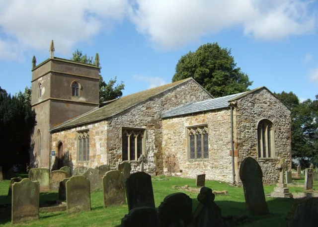
St Mary's Church, North Cockerington
Historic churches · 0.8 km

Alvingham Priory
Historic churches · 0.8 km

Alvingham Lock And Inverted Syphon Tf 365909
Canal locks · 0.9 km

Alvingham Mill
Watermills · 0.9 km

Alvingham
Historic churches · 1.1 km

Rushmoor Country Park
Zoos & aquariums · 1.7 km

South Cockerington
Historic churches · 1.8 km

Church of St Leonard, South Cockerington
Historic churches · 2.3 km

Louth Abbey
Abbeys & priories · 3.0 km
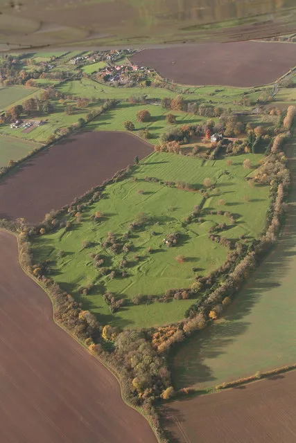
Louth Park Abbey
Abbeys & priories · 3.0 km
Nearby
📷 3Archaeological sites · East Midlands
North Cockerington Hall
North Cockerington Hall — a archaeological in england-east-midlands, United Kingdom.
📷 3Historic churches · East Midlands
Church of St Adelwold
Church of St Adelwold — a Grade I-listed church in england-east-midlands, United Kingdom.
📷 3Historic churches · East Midlands
St Mary's Church, North Cockerington
St Mary's Church, North Cockerington — church in Alvingham, Lincolnshire, England, UK.
📷 5Historic churches · East Midlands
Alvingham Priory
Alvingham Priory was a Gilbertine priory in St. Mary, Alvingham, Lincolnshire, England. The Priory, established between 1148 and 1154, was a "double house", where religious of both sexes lived in two
📷 3Canal locks · East Midlands
Alvingham Lock And Inverted Syphon Tf 365909
Alvingham Lock And Inverted Syphon Tf 365909 — lock in Alvingham, East Lindsey, Lincolnshire, England, UK.
📷 3Where to eat & stay near North Cockerington
Places to stay
 📷 5
📷 5Caravan parks · East Midlands
Furze Farm Estate
Furze Farm Estate — a caravan park in england east midlands.
 📷 5
📷 5Campsites · East Midlands
Lakeside Camping & Fisheries
Lakeside Camping & Fisheries — a campsite in england east midlands.
 📷 5
📷 5B&Bs · East Midlands
The Pack Horse
The Pack Horse — a bed-and-breakfast in england east midlands.
 📷 5
📷 5Caravan parks · East Midlands
Brickyard Fisheries
Brickyard Fisheries — a caravan park in england east midlands.
 📷 5
📷 5Campsites · East Midlands
Happyford CL
Happyford CL — a campsite in england east midlands.
 📷 5
📷 5Campsites · East Midlands
Lowis Farm Camp Site
Lowis Farm Camp Site — a campsite in england east midlands.
Places to eat & drink
 📷 5
📷 5 📷 5
📷 5Historic pubs · East Midlands
Massingberd Arms
Massingberd Arms in England East Midlands, United Kingdom.
 📷 5
📷 5 📷 5
📷 5Historic pubs · East Midlands
The Signal Box Inn
The Signal Box Inn in England East Midlands, United Kingdom.
 📷 3
📷 3Historic pubs · Yorkshire & the Humber
Tivoli Tavern
Tivoli Tavern — Historic pub — listed building or notable heritage status.
 📷 5
📷 5More places in this region
 📷 5
📷 5Historic churches · East Midlands
All Saints' Church, Stamford
All Saints' Church, Stamford — church in Stamford, Lincolnshire, England, UK.
 📷 5
📷 5Historic churches · East Midlands
Church of All Saints
Church of All Saints — church in Little Casterton, Rutland, United Kingdom.
 📷 5
📷 5Historic churches · East Midlands
Church of All Saints
Church of All Saints — church in Fenland, UK.
 📷 5
📷 5Historic churches · East Midlands
Church of St Leonard
Church of St Leonard — church in Fenland, UK.
Frequently asked questions
- Where is North Cockerington?
- North Cockerington is in Lincolnshire, the East Midlands, United Kingdom (postcode LN11 7ES), in the parish of North Cockerington.
- What is North Cockerington?
- North Cockerington is a small village and civil parish in the East Lindsey district of Lincolnshire, England. It is situated approximately 3 miles (5 km) north-east from Louth. North Cockerington was
- How do I get to North Cockerington?
- The nearest railway station is Ludborough, about 8.3 km away. Drivers can use postcode LN11 7ES.
- Is North Cockerington a protected site?
- Yes — North Cockerington is part of the LINCOLNSHIRE CORONATION COAST National Nature Reserve and the Lincolnshire Wolds National Landscape (AONB).
- Is North Cockerington free to visit?
- Yes, North Cockerington is free to enter.
- How do I get to North Cockerington?
- Drivers can navigate to postcode LN11 7ES. It sits within the Louth and Horncastle parliamentary constituency.