
Canal locks · East Midlands
Alvingham Lock And Inverted Syphon Tf 365909
In or near Manby.
Alvingham Lock And Inverted Syphon Tf 365909 — lock in Alvingham, East Lindsey, Lincolnshire, England, UK.

Wikimedia Commons contributors — see linked file page for photographer and licence licence

Plan your visit
- Typical visit
- 20 min–45 min
- Nearest railway station
- Ludborough · 7.6 km
- Free entry
- Dog-friendly
About
Alvingham Lock And Inverted Syphon Tf 365909 is a place of interest in the East Midlands. Officially recognised as Grade II listed building. The site is within the Lincolnshire Wolds National Landscape (AONB), and is part of the LINCOLNSHIRE CORONATION COAST National Nature Reserve. The nearest railway station is Ludborough, about 7.6 km away.
Photo gallery
Protected designations
- National Nature Reserve: LINCOLNSHIRE CORONATION COAST
- Area of Outstanding Natural Beauty: Lincolnshire Wolds
- Ramsar wetland: Humber Estuary
Designations sourced from Natural England open data under OGL v3.
Place summary
Alvingham Lock and Inverted Syphon is a Grade II listed lock located in the East Midlands. It is part of the Lincolnshire Coronation Coast NNR, the Lincolnshire Wolds AONB, and the Humber Estuary RAMSAR site. This structure serves important hydraulic functions within the region's waterway system.
AI-generated from the structured facts on this page (operator, designation, listing, era). Not a substitute for visiting.
- Coordinates
- 53.3973, 0.0515
- County
- Lincolnshire
- District
- East Lindsey
- Parish
- Alvingham
- Postcode
- LN11 7EU
- Parliamentary constituency
- Louth and Horncastle
- Nearest railway station
- Ludborough — 7.6 km
Sources
- wikidata: Q26316423 (CC0)
- commons: Alvingham lock.JPG (CC BY-SA 4.0)
Other places nearby

Alvingham
Historic churches · 0.4 km

Church of St Adelwold
Historic churches · 0.5 km
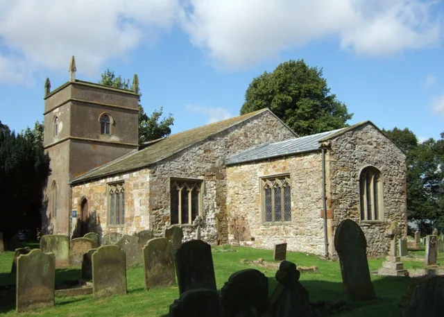
St Mary's Church, North Cockerington
Historic churches · 0.5 km

Alvingham Mill
Watermills · 0.5 km

Alvingham Priory
Historic churches · 0.6 km

North Cockerington
Historic churches · 0.9 km

North Cockerington Hall
Archaeological sites · 1.3 km

Rushmoor Country Park
Zoos & aquariums · 1.5 km

South Cockerington
Historic churches · 2.4 km

Louth Abbey
Abbeys & priories · 2.5 km
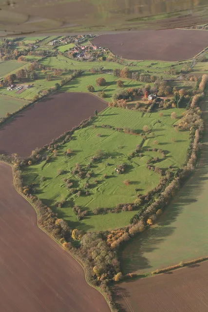
Louth Park Abbey
Abbeys & priories · 2.6 km
Louth Park Abbey
Cathedrals · 2.6 km
Nearby
📷 5Historic churches · East Midlands
Alvingham
Alvingham is a village and civil parish in the East Lindsey district of Lincolnshire, England. It is situated 3 miles (5 km) north-east from the market town of Louth.
📷 3Historic churches · East Midlands
Church of St Adelwold
Church of St Adelwold — a Grade I-listed church in england-east-midlands, United Kingdom.
📷 3Historic churches · East Midlands
St Mary's Church, North Cockerington
St Mary's Church, North Cockerington — church in Alvingham, Lincolnshire, England, UK.
📷 3📷 5Historic churches · East Midlands
Alvingham Priory
Alvingham Priory was a Gilbertine priory in St. Mary, Alvingham, Lincolnshire, England. The Priory, established between 1148 and 1154, was a "double house", where religious of both sexes lived in two
📷 5Historic churches · East Midlands
North Cockerington
North Cockerington is a small village and civil parish in the East Lindsey district of Lincolnshire, England. It is situated approximately 3 miles (5 km) north-east from Louth. North Cockerington was
Where to eat & stay near Alvingham Lock And Inverted Syphon Tf 365909
Places to stay
 📷 5
📷 5Caravan parks · East Midlands
Furze Farm Estate
Furze Farm Estate — a caravan park in england east midlands.
 📷 5
📷 5 📷 5
📷 5Campsites · East Midlands
Happyford CL
Happyford CL — a campsite in england east midlands.
 📷 5
📷 5Campsites · East Midlands
Lakeside Camping & Fisheries
Lakeside Camping & Fisheries — a campsite in england east midlands.
 📷 5
📷 5Caravan parks · East Midlands
Brickyard Fisheries
Brickyard Fisheries — a caravan park in england east midlands.
 📷 5
📷 5Campsites · East Midlands
Old Hall Caravan Club
Old Hall Caravan Club — a campsite in england east midlands.
Places to eat & drink
 📷 5
📷 5 📷 5
📷 5Historic pubs · East Midlands
Massingberd Arms
Massingberd Arms in England East Midlands, United Kingdom.
 📷 5
📷 5Historic pubs · East Midlands
The Signal Box Inn
The Signal Box Inn in England East Midlands, United Kingdom.
 📷 5
📷 5 📷 3
📷 3Historic pubs · Yorkshire & the Humber
Tivoli Tavern
Tivoli Tavern — Historic pub — listed building or notable heritage status.
 📷 5
📷 5More places in this region
 📷 3
📷 3Canal locks · East Midlands
Anton's Gowt Lock
Anton's Gowt Lock — building in Fishtoft, Boston, Lincolnshire, England, UK.
 📷 3
📷 3Canal locks · East Midlands
Castle Lock
Castle Lock — canal lock on the Nottingham Canal in the English city of Nottingham.
 📷 3
📷 3Canal locks · East Midlands
Cromwell Lock
Cromwell Lock — lock in Cromwell, Nottinghamshire, England, UK.
 📷 3
📷 3Frequently asked questions
- Where is Alvingham Lock And Inverted Syphon Tf 365909?
- Alvingham Lock And Inverted Syphon Tf 365909 is in Lincolnshire, the East Midlands, United Kingdom (postcode LN11 7EU), in the parish of Alvingham.
- What is Alvingham Lock And Inverted Syphon Tf 365909?
- Alvingham Lock And Inverted Syphon Tf 365909 — lock in Alvingham, East Lindsey, Lincolnshire, England, UK.
- How do I get to Alvingham Lock And Inverted Syphon Tf 365909?
- The nearest railway station is Ludborough, about 7.6 km away. The nearest town is Manby. Drivers can use postcode LN11 7EU.
- Is Alvingham Lock And Inverted Syphon Tf 365909 a listed building?
- Alvingham Lock And Inverted Syphon Tf 365909 is officially recognised as Grade II listed building listed.
- Is Alvingham Lock And Inverted Syphon Tf 365909 a protected site?
- Yes — Alvingham Lock And Inverted Syphon Tf 365909 is part of the LINCOLNSHIRE CORONATION COAST National Nature Reserve and the Lincolnshire Wolds National Landscape (AONB).
- Is Alvingham Lock And Inverted Syphon Tf 365909 free to visit?
- Yes, Alvingham Lock And Inverted Syphon Tf 365909 is free to enter.
- How do I get to Alvingham Lock And Inverted Syphon Tf 365909?
- The nearest railway station is Ludborough, about 7.6 km away. Drivers can navigate to postcode LN11 7EU.