
Natural landmarks · South East England
Newells Preparatory School
In or near Lower Beeding.
Newells Preparatory School — a school heritage in england-south-east, United Kingdom.

Martin Dawes — CC BY-SA 2.0 via Wikimedia Commons licence

Plan your visit
- Typical visit
- 1 h–2 h
- Nearest railway station
- Horsham · 5.6 km
- Free entry
- Dog-friendly
About
Newells Preparatory School is a school heritage located in england-south-east, United Kingdom. Catalogued from Wikidata's UK heritage register; see the Wikipedia article for further historical and visitor details.
Photo gallery
Protected designations
- Area of Outstanding Natural Beauty: High Weald
Designations sourced from Natural England open data under OGL v3.
Place summary
Newells Preparatory School is located in South-East England. It serves as an educational institution catering to younger students, focusing on preparatory education.
AI-generated from the structured facts on this page (operator, designation, listing, era). Not a substitute for visiting.
Background
History
The school was originally known as Wykeham Hall. It was founded in 1887 by Rev. William Henry Webb, at Wykeham Hall, Lee-on-Solent. It was taken over by his son Ernest Webb in 1903 and later moved to nearby Seafield Park. Seafield Park had been the name of a large Victorian mansion built in 1872 by Sir Henry Sykes on 83 acres of land at Hill Head. It was destroyed by fire in 1948. In 1888 the house and grounds were sold to the Rev.R.W Pain, and in 1890 Seafield Park was registered for scholastic purposes under Mr.Pain and the Rev. Courtney Spencer Foster. In 1903 ownership was transferred to William Hoare and the school was changed to an engineering establishment. In 1907 the property was…
Sourced from Wikipedia under CC BY-SA 4.0.
- Coordinates
- 51.0320, -0.2600
- County
- West Sussex
- District
- Horsham
- Parish
- Lower Beeding
- Postcode
- RH13 6NS
- Parliamentary constituency
- Horsham
- Established
- 1887
- Nearest railway station
- Horsham — 5.6 km
Sources
- wikidata: Q7017722 (CC0)
- wikipedia: Newells Preparatory School (CC BY-SA 4.0)
Other places nearby
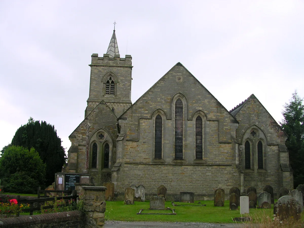
Lower Beeding
Towns & cities · 0.1 km
Lower Beeding War Memorial
Memorials & monuments · 0.1 km

Doll's House Museum
Museums · 1.3 km
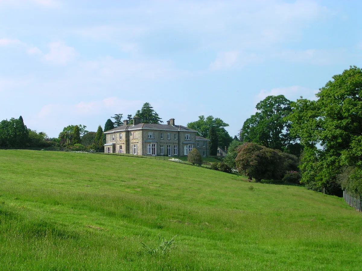
Leonardslee
Parks · 1.4 km

Leonardslee
Historic houses · 1.4 km

Faith
Public art & sculpture · 1.4 km

Wallaby Enclosure
Zoos & aquariums · 1.6 km

Hammer Pond Guest House
Historic houses · 1.7 km

Copperfield Farm Caravan Club Site
Caravan parks · 2.2 km

Nuthurst
Villages · 3.0 km
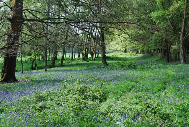
St Leonard's Forest
Archaeological sites · 3.5 km
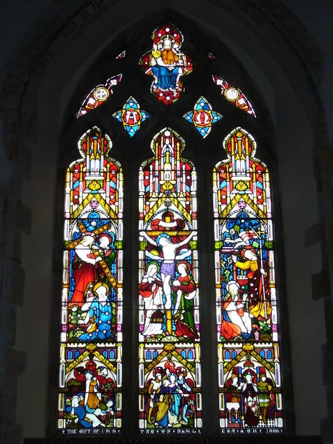
St Mary's Church, Slaugham
Historic churches · 3.7 km
Nearby
Flagship📷 10Towns & cities · South East England
Lower Beeding
Lower Beeding — village in West Sussex, England, UK.
📷 5Memorials & monuments · South East England
Lower Beeding War Memorial
Lower Beeding War Memorial — Grade II listed building-listed memorial in england-south-east, United Kingdom.
📷 5Museums · South East England
Doll's House Museum
Doll's House Museum — a museum in england-south-east, United Kingdom.
Flagship📷 10📷 5Historic houses · South East England
Leonardslee
Leonardslee — Italianate house in Lower Beeding, Horsham, West Sussex, RH13.
📷 5Public art & sculpture · South East England
Faith
Faith — a public art in england-south-east, United Kingdom.
Where to eat & stay near Newells Preparatory School
Places to stay
📷 5Caravan parks · South East England
Copperfield Farm Caravan Club Site
Copperfield Farm Caravan Club Site — a caravan park in england south east.
 📷 5
📷 5 📷 5
📷 5Caravan parks · South East England
Woodside Park
Woodside Park — a caravan park in england south east.
 📷 5
📷 5Caravan parks · South East England
Raylands Park
Raylands Park — a caravan park in england south east.
 📷 5
📷 5Campsites · South East England
Beacon Hill Scout Campsite
Beacon Hill Scout Campsite — a campsite in england south east.
 📷 5
📷 5Caravan parks · South East England
Roundstone Caravan Park
Roundstone Caravan Park — a caravan park in england south east.
Places to eat & drink
 📷 5
📷 5Restaurants · South East England
Mekong House
Mekong House — a restaurant in england south east.
 📷 5
📷 5Historic pubs · South East England
The Jolly Tanners Public House
The Jolly Tanners Public House in England South East, United Kingdom.
 📷 7
📷 7 📷 7
📷 7Restaurants · South East England
Chak de India
Chak de India — a restaurant in england south east.
 📷 7
📷 7Historic pubs · South East England
The Sussex Oak Inn
The Sussex Oak Inn in England South East, United Kingdom.
 📷 5
📷 5Historic pubs · South East England
White Hart Inn
White Hart Inn in England South East, United Kingdom.
More natural landmarks in this region
 📷 5
📷 5Natural landmarks · South East England
Queen Victoria Statue
Queen Victoria Statue — Public artwork (statue) by Victor Ferdinand Franz Eugen Gustaf Adolf Constantin Friedrich of Hohenlohe-Langenburg.
 📷 5
📷 5Natural landmarks · South East England
Silent Pool
Silent Pool — lake in the United Kingdom.
 📷 5
📷 5Natural landmarks · South East England
Thomas & Jane Holloway Statue
Thomas & Jane Holloway Statue — Public artwork (statue) by Victor Ferdinand Franz Eugen Gustaf Adolf Constantin Friedrich of Hohenlohe-Langenburg.
 📷 5
📷 5Natural landmarks · South East England
Polesden Lacey
Polesden Lacey — a other in england-london, United Kingdom.
Frequently asked questions
- Where is Newells Preparatory School?
- Newells Preparatory School is in West Sussex, South-East England, United Kingdom (postcode RH13 6NS), in the parish of Lower Beeding.
- What is Newells Preparatory School?
- Newells Preparatory School — a school heritage in england-south-east, United Kingdom.
- How do I get to Newells Preparatory School?
- The nearest railway station is Horsham, about 5.6 km away. Drivers can use postcode RH13 6NS.
- When was Newells Preparatory School built?
- Built or established in 1887.
- Is Newells Preparatory School a protected site?
- Yes — Newells Preparatory School is part of the High Weald National Landscape (AONB).
- Is Newells Preparatory School free to visit?
- Yes, Newells Preparatory School is free to enter.
- How do I get to Newells Preparatory School?
- The nearest railway station is Horsham, about 5.6 km away. Drivers can navigate to postcode RH13 6NS.