Mountains & hills · South Wales
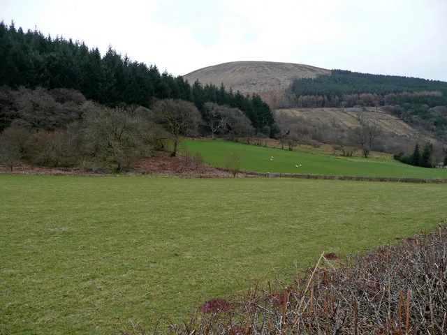
Mynydd Y Gaer
Mynydd Y Gaer — Named summit at 314 m.

Wikimedia Commons contributors — see linked file page for photographer and licence licence
Plan your visit
- Typical visit
- 3 h–8 h
- Best time of year
- Late spring – early autumn (May–Oct)
- Nearest railway station
- Baglan · 2.3 km
- Free entry
- Dog-friendly
About
Mynydd Y Gaer is a named summit in the United Kingdom. Wikidata describes it as: "Named summit at 314 m.". Coordinates: 51.6276°, -3.7845°.
Photo gallery
From the Wikipedia article
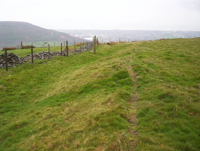
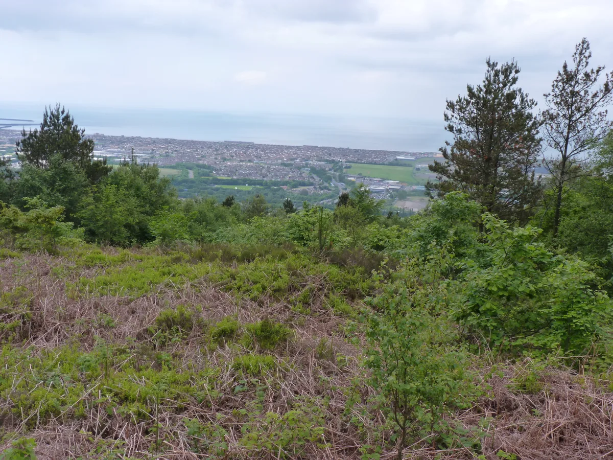
Mynydd-y-Gaer is a hill that sits on the boundaries between the South Wales communities of Baglan (south-western quarter), Cwmavon (south-eastern quarter) and Briton Ferry, (northern half), all within Neath Port Talbot county borough. The summit, at 314 m (1,030 ft), has grassland fields subdivided by dry stone walls. Foel Fynyddau lies 2 km to east. To the south is the coastal plain of the Bristol Channel. To the West is the Vale of Neath. To the north is the Crythan Brook and the town of Neath. It has numerous prehistoric monuments, and evidence of occupation in medieval times, as well as 19th and 20th century coalmining.
Excerpt from Wikipedia under CC BY-SA 4.0. See the source article linked in Sources below.
Background
Visiting
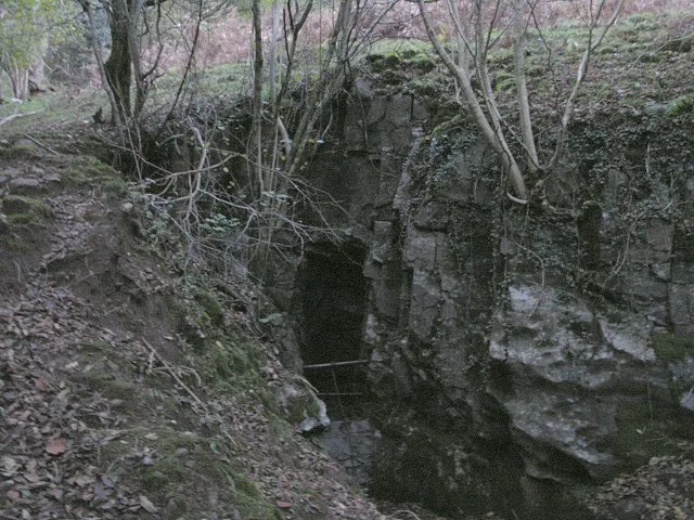
No footpaths run to the summit of the hill. On the eastern side a minor road crosses the high saddle 80m below the summit. A section of the Forestry Commission's Margam Forest may allow access to its rides. On the western side are the Briton Ferry Woods, a mixed woodland including plantations and broadleaved trees, occupying a large area of the slopes and ridges on that side of the hill, and with many paths and rides. The Wales Coast Path has an inland section that runs along the south-western rim of these woods. In 1861 the Ynysmaerdy Railway Incline was opened along the northern edge of the hill, to transport coal down to Briton Ferry docks. The line closed in 1910.
Sourced from Wikipedia under CC BY-SA 4.0.
- Coordinates
- 51.6276, -3.7845
- District
- Neath Port Talbot
- Parish
- Baglan
- Postcode
- SA12 9YA
- Parliamentary constituency
- Aberafan Maesteg
- Nearest railway station
- Baglan — 2.3 km
Sources
- osm: n272803029 (ODbL)
- wikipedia: Mynydd-y-Gaer (CC BY-SA 4.0)
- commons: Buarth y Gaer Iron Age Hill Fort - geograph.org.uk - 95125.jpg (CC BY-SA 4.0)
Other places nearby
Loading nearby places…
Nearby
 📷 3
📷 3Hill forts · South Wales
Buarth-y-Gaer
Buarth-y-Gaer — archaeological site in United Kingdom.
Vineyards · South Wales
Buarth y Gaer
Buarth y Gaer — a UK vineyard in wales south, producing English or Welsh wine from cool-climate grape varieties.
Vineyards · South Wales
Gaer Fawr Lower Camp, Mynydd y Gaer
Gaer Fawr Lower Camp, Mynydd y Gaer — a UK vineyard in wales south, producing English or Welsh wine from cool-climate grape varieties.
 📷 3
📷 3Hill forts · South Wales
Craig Ty-Isaf
Craig Ty-Isaf — hillfort in Neath Port Talbot.
 📷 5
📷 5Historic bridges · South Wales
Railway bridge near Crythan Farm (partly in Neath Community)
Railway bridge near Crythan Farm (partly in Neath Community) — Grade II listed building-listed bridge in wales-south, United Kingdom.
 📷 3
📷 3Mountains & hills · South Wales
Foel Fynyddau
Foel Fynyddau — a mountain in wales-south, United Kingdom, 370 m.
More mountains in this region
 Flagship📷 3
Mountains & hills · South Wales
Milford Haven Waterway
Milford Haven Waterway — ria, or flooded valley, in Pembrokeshire, south-west Wales, UK.
 📷 5
📷 5Mountains & hills · South Wales
Ogof Ffynnon Ddu
Ogof Ffynnon Ddu — cave in the Upper Swansea Valley in South Wales.
 📷 3
📷 3Mountains & hills · South Wales
Abereiddi Bay
Abereiddi Bay — bay in the United Kingdom.
 📷 3
📷 3Mountains & hills · South Wales
Allt Lwyd
Allt Lwyd — Named summit at 653 m.
Frequently asked questions
- Where is Mynydd Y Gaer?
- Mynydd Y Gaer is in South Wales, United Kingdom (postcode SA12 9YA), in the parish of Baglan.
- Is Mynydd Y Gaer free to visit?
- Yes, Mynydd Y Gaer is free to enter.
- How do I get to Mynydd Y Gaer?
- The nearest railway station is Baglan, about 2.3 km away. Drivers can navigate to postcode SA12 9YA.