
Historic churches · North Wales
Mynydd Llandygai
In or near Deiniolen.
Mynydd Llandygai (also spelled Mynydd Llandegai; Welsh: Mynydd Llandygái, [ˌmənɨðˌɬandəˈɡai] ; 'Llandygai mountain') is a small, partly forested hill in Gwynedd, North Wales. It forms the start of the

Meirion — CC BY-SA 2.0 via Wikimedia Commons licence

Plan your visit
- Typical visit
- 30 min–1 h
- Nearest railway station
- Cei Llydan · 5.0 km
- Free entry
Getting there & planning your visit
To visit Mynydd Llandygai, the nearest railway station is Cei Llydan, located 5 km away. The postcode for navigation is LL57 4FF, and entry to the church is free.
About
Mynydd Llandygai (also spelled Mynydd Llandegai; Welsh: Mynydd Llandygái, [ˌmənɨðˌɬandəˈɡai] ; 'Llandygai mountain') is a small, partly forested hill in Gwynedd, North Wales. It forms the start of the Glyderau ridge. It is also the name of the quarry village at the base of the hill situated at the edge of Snowdonia National Park at grid reference SH603655. The village lies at about 1,000 feet (300 m) above sea level and gets strong winds and above average rainfall. Many of the houses are spread along long roads rather than clustered around a point, giving the village a somewhat decentralised feel. However the village is distinguished by two parallel rows of semi-detached quarrymen's cottages constructed during the 19th century for workers of Penrhyn Quarry, which mined slate. The first mention of housing on the site can be found in the census of 1841. Each of the houses was provided with an area of land (approximately one acre (0.40 ha)) sufficient to feed the family. This arrangement is clearly visible on the map of the area. This can be contrasted with the situation in the South Wales coalfields or in the industrial Midlands where no such provision was made for the workers. Originally named Douglas Hill, the name was changed in the 1930s after the inhabitants decided that they did not want to associate with the name Douglas, namely part of the Penrhyn family surname. (See Baron Penrhyn.) Physically the village has changed little since it was originally built. The area to th
Photo gallery
From the Wikipedia article
Mynydd Llandygai (also spelled Mynydd Llandegai; Welsh: Mynydd Llandygái, [ˌmənɨðˌɬandəˈɡai] ; 'Llandygai mountain') is a small, partly forested hill in Gwynedd, North Wales. It forms the start of the Glyderau ridge. It is also the name of the quarry village at the base of the hill situated at the edge of Snowdonia National Park at grid reference SH603655. The village lies at about 1,000 feet (300 m) above sea level and gets strong winds and above average rainfall. Many of the houses are spread along long roads rather than clustered around a point, giving the village a somewhat decentralised feel. However the village is distinguished by two parallel rows of semi-detached quarrymen's cottages constructed during the 19th century for workers of Penrhyn Quarry, which mined slate. The first mention of housing on the site can be found in the census of 1841. Each of the houses was provided with an area of land (approximately one acre (0.40 ha)) sufficient to feed the family. This arrangement is clearly visible on the map of the area. This can be contrasted with the situation in the South Wales coalfields or in the industrial Midlands where no such provision was made for the workers. Originally named Douglas Hill, the name was changed in the 1930s after the inhabitants decided that they did not want to associate with the name Douglas, namely part of the Penrhyn family surname. (See Baron Penrhyn.) Physically the village has changed little since it was originally built. The area to the south is mountainous and there are a number of slate and stone quarries in the vicinity.
Excerpt from Wikipedia under CC BY-SA 4.0. See the source article linked in Sources below.
- Coordinates
- 53.1680, -4.0890
- District
- Gwynedd
- Parish
- Llandygai
- Postcode
- LL57 4FF
- Parliamentary constituency
- Bangor Aberconwy
- Nearest railway station
- Cei Llydan — 5 km
Sources
- wikipedia: Mynydd Llandygai (CC BY-SA 4.0)
Other places nearby

Moelyci
Mountains & hills · 1.2 km

Pont Coed-y-parc
Historic bridges · 1.3 km
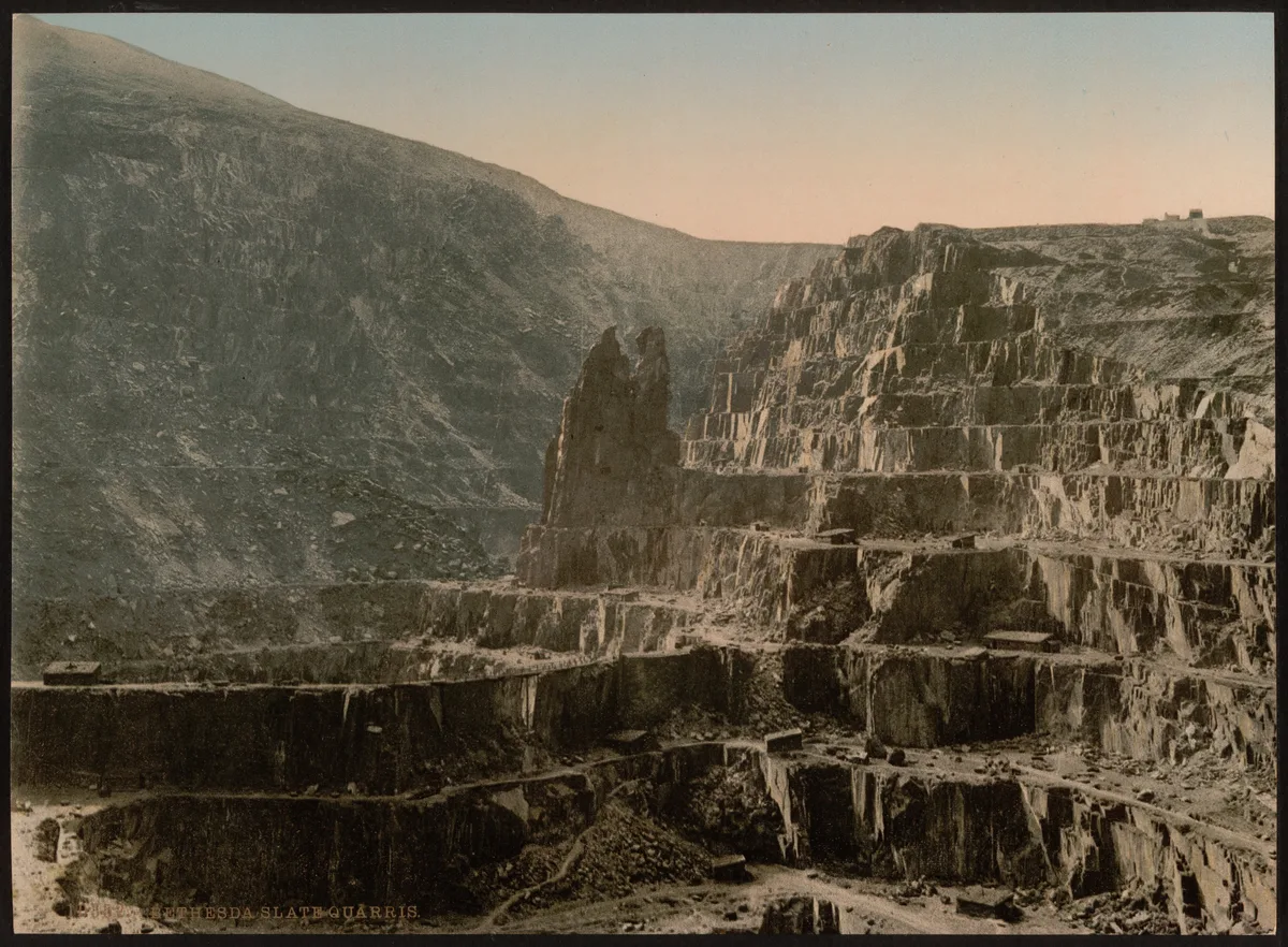
Penrhyn Slate Quarry and Bethesda, and the Ogwen valley to Port Penrhyn
Museums · 1.4 km
Water Mill & Wheel House at Felin Fawr Slate Works
Watermills · 1.4 km

Moel y Ci
Mountains & hills · 1.5 km

Penrhyn Quarry
Quarries · 1.5 km
Carnedd Moelyci
Mountains & hills · 1.5 km

Carnedd Moelyci
Historic houses · 1.5 km

Zip World Penrhyn Quarry
Natural landmarks · 1.7 km

Ty'n Llidiart Round Hut
Archaeological sites · 1.7 km
T'yn Llidiard Round Hut
Archaeological sites · 1.7 km

Bryn Llys Caravan Site
Caravan parks · 1.7 km
Nearby
📷 5📷 5Historic bridges · North Wales
Pont Coed-y-parc
Pont Coed-y-parc — Grade II listed building-listed bridge in wales-north, United Kingdom.
📷 3Museums · North Wales
Penrhyn Slate Quarry and Bethesda, and the Ogwen valley to Port Penrhyn
Penrhyn Slate Quarry and Bethesda, and the Ogwen valley to Port Penrhyn — part of the World Heritage site “The Slate Landscape of Northwest Wales” in the United Kingdom.
📷 5Watermills · North Wales
Water Mill & Wheel House at Felin Fawr Slate Works
Water Mill & Wheel House at Felin Fawr Slate Works — Grade II listed building-listed watermill in wales-north, United Kingdom.
📷 3Mountains & hills · North Wales
Moel y Ci
Moel y Ci — a mountain in wales-north, United Kingdom, 410 m.
📷 5Where to eat & stay near Mynydd Llandygai
Places to stay
📷 5Caravan parks · North Wales
Bryn Llys Caravan Site
Bryn Llys Caravan Site — a caravan park in wales north.
 📷 5
📷 5Campsites · North Wales
Ogwen Bank Holiday Park & Country Club
Ogwen Bank Holiday Park & Country Club — a campsite in wales north.
 📷 5
📷 5 📷 5
📷 5 📷 5
📷 5 📷 5
📷 5Hostels · North Wales
Jesse James Bunkhouse
Jesse James Bunkhouse — a hostel in wales north.
Places to eat & drink
 📷 7
📷 7Restaurants · North Wales
Tafarn Tryfan
Tafarn Tryfan — a restaurant in wales north.
 📷 5
📷 5 📷 7
📷 7 📷 5
📷 5Historic pubs · North Wales
The George and Dragon
The George and Dragon — Historic pub — listed building or notable heritage status.
 📷 7
📷 7 📷 6
📷 6More places in this region
 📷 3
📷 3Historic churches · North Wales
All Saints Church
All Saints Church — Anglican church in Deganwy, Wales.
 📷 3
📷 3Historic churches · North Wales
All Saints Church, Great Saughall
All Saints Church, Great Saughall — grade II listed church in Saughall, Cheshire West and Chester, Cheshire, England, UK.
 📷 3
📷 3Historic churches · North Wales
All Saints Church, Higher Kinnerton
All Saints Church, Higher Kinnerton — church in United Kingdom.
 📷 3
📷 3Historic churches · North Wales
All Saints' Church, Gresford
All Saints' Church, Gresford — church in Gresford, north Wales.
Frequently asked questions
- Where is Mynydd Llandygai?
- Mynydd Llandygai is in North Wales, United Kingdom (postcode LL57 4FF), in the parish of Llandygai.
- What is Mynydd Llandygai?
- Mynydd Llandygai (also spelled Mynydd Llandegai; Welsh: Mynydd Llandygái, [ˌmənɨðˌɬandəˈɡai] ; 'Llandygai mountain') is a small, partly forested hill in Gwynedd, North Wales. It forms the start of the
- How do I get to Mynydd Llandygai?
- The nearest railway station is Cei Llydan, about 5.0 km away. Drivers can use postcode LL57 4FF.
- Is Mynydd Llandygai free to visit?
- Yes, Mynydd Llandygai is free to enter.
- How do I get to Mynydd Llandygai?
- The nearest railway station is Cei Llydan, about 5.0 km away. Drivers can navigate to postcode LL57 4FF.