Mountains & hills · South Wales
Mynydd Drumau
Mynydd Drumau — Named summit at 272 m.

Wikimedia Commons contributors — see linked file page for photographer and licence licence
Plan your visit
- Typical visit
- 3 h–8 h
- Best time of year
- Late spring – early autumn (May–Oct)
- Nearest railway station
- Skewen · 2.7 km
- Free entry
- Dog-friendly
About
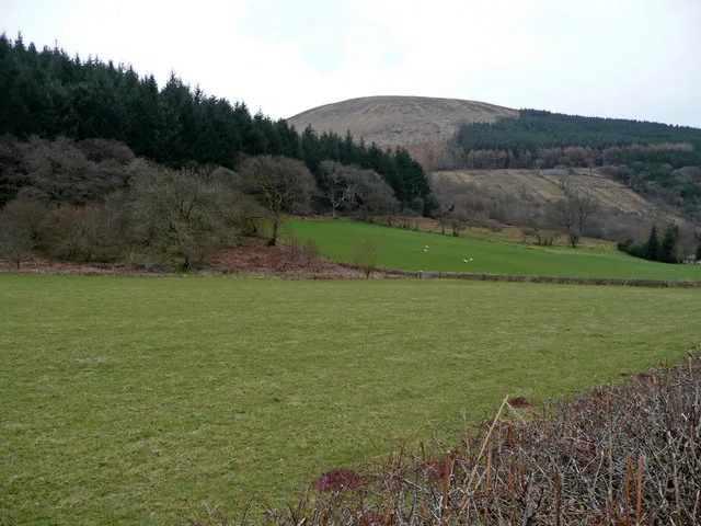
Mynydd Drumau is a named summit in the United Kingdom. Wikidata describes it as: "Named summit at 272 m.". Coordinates: 51.6858°, -3.8458°.
Photo gallery
From the Wikipedia article
Mynydd Drumau (meaning "Mountain of the Ridges" in English) is a hill in south Wales lying on the border between Swansea and the county of Neath Port Talbot. It is 272m / 892 ft high, and is a Marilyn. The hill is situated in a suburban and rural upland zone and is dotted with a number of farms and woodlands. Villages and suburbs lining the foot of the hill include: Skewen, Birchgrove, Bryncoch, Rhos and Glais.
Excerpt from Wikipedia under CC BY-SA 4.0. See the source article linked in Sources below.
- Coordinates
- 51.6858, -3.8458
- District
- Neath Port Talbot
- Parish
- Dyffryn Clydach
- Postcode
- SA10 7BJ
- Parliamentary constituency
- Neath and Swansea East
- Nearest railway station
- Skewen — 2.7 km
Sources
- osm: n3598802971 (ODbL)
- wikipedia: Mynydd Drumau (CC BY-SA 4.0)
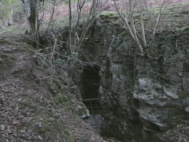
- commons: Bunker on Mynydd Drumau - geograph.org.uk - 318639.jpg (CC BY-SA 4.0)
Other places nearby
Loading nearby places…
Nearby
Climbing & bouldering crags · South Wales
Dyffryn Woods Crag
Dyffryn Woods Crag — a climbing crag in wales south.
 📷 3
📷 3Archaeological sites · South Wales
Carreg Bica Stone
Carreg Bica Stone — a archaeological in wales-south, United Kingdom.
 📷 5
📷 5Historic churches · South Wales
Church of Saint Matthew, Dyffryn
Church of Saint Matthew, Dyffryn — Grade II listed building-listed church in wales-south, United Kingdom.
 📷 3
📷 3Cemeteries · South Wales
Coedgwilym Cemetery
Coedgwilym Cemetery is a cemetery in the United Kingdom.
 📷 5
📷 5Historic bridges · South Wales
Bridge over Tennant Canal N of former Mines Royal Copper Works
Bridge over Tennant Canal N of former Mines Royal Copper Works — Grade II listed building-listed bridge in wales-south, United Kingdom.
 📷 3
📷 3Other places · South Wales
Neath Port Talbot College
Neath Port Talbot College (NPTC) was a further education institution established as two campuses in Port Talbot and Neath in Wales. The college allowed study of many courses including GCSEs, AS Level/
More mountains in this region
 Flagship📷 3
Mountains & hills · South Wales
Milford Haven Waterway
Milford Haven Waterway — ria, or flooded valley, in Pembrokeshire, south-west Wales, UK.
 📷 5
📷 5Mountains & hills · South Wales
Ogof Ffynnon Ddu
Ogof Ffynnon Ddu — cave in the Upper Swansea Valley in South Wales.
 📷 3
📷 3Mountains & hills · South Wales
Abereiddi Bay
Abereiddi Bay — bay in the United Kingdom.
 📷 3
📷 3Mountains & hills · South Wales
Allt Lwyd
Allt Lwyd — Named summit at 653 m.
Frequently asked questions
- Where is Mynydd Drumau?
- Mynydd Drumau is in South Wales, United Kingdom (postcode SA10 7BJ), in the parish of Dyffryn Clydach.
- Is Mynydd Drumau free to visit?
- Yes, Mynydd Drumau is free to enter.
- How do I get to Mynydd Drumau?
- The nearest railway station is Skewen, about 2.7 km away. Drivers can navigate to postcode SA10 7BJ.