
Mountains & hills · South Wales
Myarth
Myarth — Named summit at 296 m.

Wikimedia Commons contributors — see linked file page for photographer and licence licence

Plan your visit
- Typical visit
- 3 h–8 h
- Best time of year
- Late spring – early autumn (May–Oct)
- Free entry
- Dog-friendly
About
Myarth is a named summit in the United Kingdom. Wikidata describes it as: "Named summit at 296 m.". Coordinates: 51.8792°, -3.2052°.
Photo gallery
From the Wikipedia article
Myarth is a hill in the Usk Valley in the county of Powys in South Wales, about 2 miles west of Crickhowell. Its summit at 292 metres (958 ft) is covered by trees, whilst the larger part of its slopes are also wooded. It is listed as a Marilyn. Myarth has an elongate form commonly ascribed to erosion by the west-to-east movement of the Usk Valley glacier during successive ice ages. The River Usk runs along the foot of the hill on its southern side. Myarth forms a prominent feature in many views over the Usk Valley and often features in commercial photography of the area. Though it is ringed by public roads—the A40 to the north and a minor road to the south—there is no public access to the hill itself, which is in private ownership. In 2016, the hill was used as the location for a segment of an episode of the motoring series The Grand Tour. The summit of the hill once contained a prehistoric hill fort, known as Myarth Camp, now largely obliterated by trees. It is thought to date from the Iron Age (c. 800 BC – AD 74). It had a double vallum, or rampart, and measured around 350m WNW/ESE by 210m, with an entrance at the east end. In the valley directly below the hill fort, half a mile to the north, a Roman fort was established in the mid-70s AD, when the Romans subdued the local tribe, the Silures. The fort, known today as Pen-y-Gaer, remained in use until the mid-2nd century AD. Near the Roman fort, on its south side, a civilian settlement or vicus grew up, the traces of which are mostly buried below ground today; it was occupied between the 1st and 3rd centuries AD. On the south side of Myarth Hill a ford, now no longer used, once crossed the River Usk to Cyffredin, a hamlet near Llangynidr, from where a road passes over Llangynidr Mountain to Ebbw Vale.
Excerpt from Wikipedia under CC BY-SA 4.0. See the source article linked in Sources below.
- Coordinates
- 51.8792, -3.2052
- District
- Powys
- Parish
- Cwmdu and District
- Postcode
- NP8 1RL
- Parliamentary constituency
- Brecon, Radnor and Cwm Tawe
Sources
- osm: n8792845364 (ODbL)
- wikipedia: Myarth (CC BY-SA 4.0)
- commons: View east from Bwlch 3 - geograph.org.uk - 1069776.jpg (CC BY-SA 4.0)
Other places nearby

Penmyarth Camp
Vineyards · 0.1 km

Dyfnant Bridge
Historic bridges · 1.2 km

Pen-y-gaer Roman Camp
Archaeological sites · 1.3 km

Aberhoyw Bridge
Historic bridges · 1.3 km

Old House Bridge
Historic bridges · 1.4 km
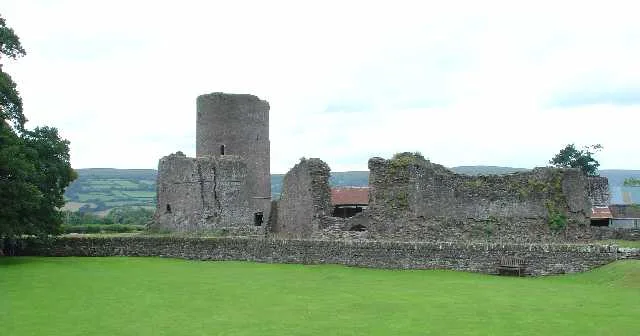
Tretower Castle
Castles · 1.4 km

Maen Pyscodyn(Fish Stone)
Archaeological sites · 1.5 km

Panteague Upper Bridge
Historic bridges · 1.5 km

Tretower Court
Historic houses · 1.5 km

Glanusk Caravan Park
Campsites · 1.5 km

Aberyail Bridge
Historic bridges · 1.6 km
Gliffaes Stone(Llwyn-Y-Fedwen)
Archaeological sites · 1.6 km
Nearby
Vineyards · South Wales
Penmyarth Camp
Penmyarth Camp — a UK vineyard in wales south, producing English or Welsh wine from cool-climate grape varieties.
📷 5Historic bridges · South Wales
Dyfnant Bridge
Dyfnant Bridge — Grade II listed building-listed bridge in wales-south, United Kingdom.
📷 3Archaeological sites · South Wales
Pen-y-gaer Roman Camp
Pen-y-gaer Roman Camp — a archaeological in wales-south, United Kingdom.
📷 5Historic bridges · South Wales
Aberhoyw Bridge
Aberhoyw Bridge — Grade II listed building-listed bridge in wales-south, United Kingdom.
📷 5Historic bridges · South Wales
Old House Bridge
Old House Bridge — Grade II listed building-listed bridge in wales-south, United Kingdom.
📷 5Castles · South Wales
Tretower Castle
Tretower Castle — castle in the village of Tretower, Powys, Wales.
Where to eat & stay near Myarth
Places to stay
📷 5Campsites · South Wales
Glanusk Caravan Park
Glanusk Caravan Park — a campsite in wales south.
 📷 5
📷 5 📷 5
📷 5 📷 5
📷 5Campsites · South Wales
Cwmdu Campsite
Cwmdu Campsite — a campsite in wales south.
 📷 5
📷 5 📷 5
📷 5Places to eat & drink
 📷 7
📷 7 📷 5
📷 5Historic pubs · South Wales
White Hart
White Hart — Historic pub — listed building or notable heritage status.
 📷 4
📷 4 📷 7
📷 7 📷 5
📷 5Restaurants · South Wales
Sultan of Wales
Sultan of Wales — a restaurant in wales south.
 📷 5
📷 5Historic pubs · South Wales
Skirrid Mountain Inn
Skirrid Mountain Inn — Historic pub — listed building or notable heritage status.
More mountains in this region
 Flagship📷 3
Mountains & hills · South Wales
Milford Haven Waterway
Milford Haven Waterway — ria, or flooded valley, in Pembrokeshire, south-west Wales, UK.
 📷 5
📷 5Mountains & hills · South Wales
Ogof Ffynnon Ddu
Ogof Ffynnon Ddu — cave in the Upper Swansea Valley in South Wales.
 📷 3
📷 3 📷 3
📷 3Frequently asked questions
- Where is Myarth?
- Myarth is in South Wales, United Kingdom (postcode NP8 1RL), in the parish of Cwmdu and District.
- What is Myarth?
- Myarth — Named summit at 296 m.
- How do I get to Myarth?
- Drivers can use postcode NP8 1RL.
- Is Myarth free to visit?
- Yes, Myarth is free to enter.
- How do I get to Myarth?
- Drivers can navigate to postcode NP8 1RL. It sits within the Brecon, Radnor and Cwm Tawe parliamentary constituency.