
Mountains & hills · Scottish Lowlands
Murdoch's Cave
In or near Auchinleck.
Murdoch's Cave — cave in East Ayrshire, Scotland, UK.

Wikimedia Commons contributors — see linked file page for photographer and licence licence

Plan your visit
- Typical visit
- 3 h–8 h
- Best time of year
- Late spring – early autumn (May–Oct)
- Nearest railway station
- Auchinleck · 4.8 km
- Free entry
- Dog-friendly
About
Murdoch's Cave is a named summit in the United Kingdom. Wikidata describes it as: "cave in East Ayrshire, Scotland, UK". Coordinates: 55.4676°, -4.2192°.
Photo gallery
From the Wikipedia article
Murdoch's Cave, is a relatively small artificial cave created by William Murdoch (1754-1839) and his siblings in the soft red sandstone Lugar river bank cliff just upstream of the old Bellow Mill close to the confluence of the Bellow or Bello Water and the Glenmuir Water in Lugar, East Ayrshire, Scotland. The spelling 'Bellow' is used for consistency.
Excerpt from Wikipedia under CC BY-SA 4.0. See the source article linked in Sources below.
Background
History
William Murdoch, the acknowledged inventor of gas lighting, was born on 21 August 1754, the third of seven children. His father was John Murdoch, a millwright and tenant of Sir James Boswell at Bellow Mill in Auchinleck parish. William is said to have carried out early experiments into the use of steam and the manufacturing and use of natural gas. He is said to have placed a perforated thimble on the spout of the kettle and lit the gases escaping from the heated coal it contained as a source of light. He is at least said to have heated coal in a copper kettle in the Bello cave that lay around 70 feet or 21 metres from his father, John Murdoch's oatmeal mill. No written record exists of the…
Description
Murdoch's cave is located in a red sandstone cliff above the River Lugar on the north side of the water course, just below the old Bellow miller's house. It is not known whether or not the cave was altered after he left home in 1777 to find work in Birmingham and later in Cornwall. The cave opening is obvious from the River Lugar and lies above the flood level of the river, with hand and foot holds that have been hammered into the rock face, however access is quite difficult during wet weather. Internally this small cave has several features such as a shelf for sitting, a small window, a well finished ceiling and a complex fireplace. A chimney flue constructed using a clay pipe ran from…
Sourced from Wikipedia under CC BY-SA 4.0.
- Coordinates
- 55.4676, -4.2192
- District
- East Ayrshire
- Postcode
- KA18 3LJ
- Parliamentary constituency
- Kilmarnock and Loudoun
- Nearest railway station
- Auchinleck — 4.8 km
Sources
- wikidata: Q60786762 (CC0)
- wikipedia: Murdoch's Cave (CC BY-SA 4.0)
- commons: William Murdoch's Cave interior view of door, Bello Mill, Lugar, East Ayrshire, Scotland.jpg (CC BY-SA 4.0)
Other places nearby

Murdoch's Cave
Caves · 0.0 km

Lugar
Villages · 0.5 km

Lugar Parish Church
Historic churches · 0.7 km

Old Tile Works
Archaeological sites · 1.1 km

Cronberry
Villages · 1.1 km

Medieval turf building in Cronberry
Hill forts · 1.3 km
Cronberry Village
Archaeological sites · 1.4 km

Logan Bridge
Historic bridges · 1.5 km

Glenmuir Bridge
Historic bridges · 1.9 km

Stonepark Monument
Memorials & monuments · 2.2 km
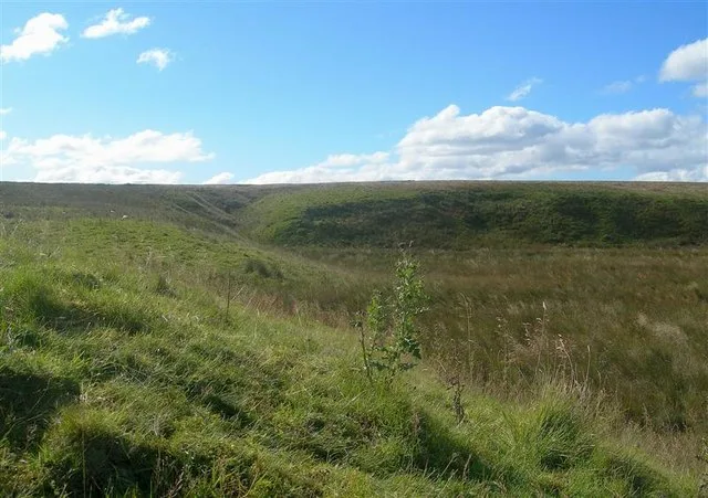
Airds Moss RSPB Reserve
Wildlife reserves · 2.5 km

Woodroad Viaduct
Historic bridges · 2.6 km
Nearby
📷 5📷 5📷 5Historic churches · Scottish Lowlands
Lugar Parish Church
Lugar Parish Church — category C listed building-listed church in scotland-lowlands, United Kingdom.
📷 3Archaeological sites · Scottish Lowlands
Old Tile Works
Old Tile Works — an archaeological site in Scottish Lowlands, United Kingdom.
📷 5📷 3Hill forts · Scottish Lowlands
Medieval turf building in Cronberry
Medieval turf building in Cronberry — turf building excavated in East Ayrshire, Scotland, UK.
Where to eat & stay near Murdoch's Cave
Places to stay
 📷 5
📷 5Campsites · Scottish Lowlands
Catrine House Caravan and Camping
Catrine House Caravan and Camping — a campsite in scotland lowlands.
 📷 5
📷 5Caravan parks · Scottish Lowlands
Sundrum Castle Holiday Park
Sundrum Castle Holiday Park — a caravan park in scotland lowlands. Brand: Parkdean Resorts.
 📷 5
📷 5Caravan parks · Scottish Lowlands
Crofthead Holiday Park
Crofthead Holiday Park — a caravan park in scotland lowlands.
 📷 5
📷 5Caravan parks · Scottish Lowlands
Dutch House Caravan Park
Dutch House Caravan Park — a caravan park in scotland highlands.
📷 5Caravan parks · Scottish Lowlands
Dutch House Caravan Park
Dutch House Caravan Park — a caravan park in scotland highlands.
 📷 5
📷 5Caravan parks · Scottish Lowlands
Loch Doon Caravan Park
Loch Doon Caravan Park — a caravan park in scotland lowlands.
Places to eat & drink
 📷 5
📷 5Historic pubs · Scottish Lowlands
The Sun Inn, 23 The Square, Cumnock
The Sun Inn, 23 The Square, Cumnock in Scotland Lowlands, United Kingdom.
 📷 7
📷 7Historic pubs · Scottish Lowlands
Commercial Inn, 1-3 Mill Street, Ochiltree
Commercial Inn, 1-3 Mill Street, Ochiltree in Scotland Lowlands, United Kingdom.
 📷 7
📷 7Historic pubs · Scottish Lowlands
Queensberry Arms Hotel
Queensberry Arms Hotel in Scotland Lowlands, United Kingdom.
 📷 5
📷 5Historic pubs · Scottish Lowlands
Loudoun Arms, 69 Main Street, Newmilns
Loudoun Arms, 69 Main Street, Newmilns in Scotland Central, United Kingdom.
 📷 5
📷 5Historic pubs · Scottish Lowlands
Doon Tavern, High Street, Dalmellington
Doon Tavern, High Street, Dalmellington in Scotland Lowlands, United Kingdom.
 📷 5
📷 5Historic pubs · Scottish Lowlands
The Clansman, 58, 60, 62 John Finnie Street, Kilmarnock
The Clansman, 58, 60, 62 John Finnie Street, Kilmarnock in Scotland Central, United Kingdom.
More mountains in this region
 📷 3
📷 3 📷 5
📷 5Mountains & hills · Scottish Lowlands
Aros Bay
Aros Bay — bay on Islay, Argyll and Bute, Scotland, UK.
 📷 3
📷 3Mountains & hills · Scottish Lowlands
Beinn Bharrain
Beinn Bharrain — Named summit at 717 m.
 📷 5
📷 5Frequently asked questions
- Where is Murdoch's Cave?
- Murdoch's Cave is in the Scottish Lowlands, United Kingdom (postcode KA18 3LJ).
- What is Murdoch's Cave?
- Murdoch's Cave — cave in East Ayrshire, Scotland, UK.
- How do I get to Murdoch's Cave?
- The nearest railway station is Auchinleck, about 4.8 km away. The nearest town is Auchinleck. Drivers can use postcode KA18 3LJ.
- Is Murdoch's Cave free to visit?
- Yes, Murdoch's Cave is free to enter.
- How do I get to Murdoch's Cave?
- The nearest railway station is Auchinleck, about 4.8 km away. Drivers can navigate to postcode KA18 3LJ.