Mountains & hills · Scottish Lowlands
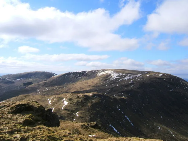
Mulldonoch
Mulldonoch — a hill or mountain in scotland lowlands.

Graham Robson — CC BY-SA 2.0 via Wikimedia Commons licence
Plan your visit
- Typical visit
- 3 h–8 h
- Best time of year
- Late spring – early autumn (May–Oct)
About
A British hill or mountain, named on Ordnance Survey maps and walked by hill-baggers. Mulldonoch is a named hill or mountain in scotland lowlands, recorded in the GeoNames UK gazetteer. British landmarks of this type are typically marked on Ordnance Survey maps and recorded in the national gazetteer for cartographic and navigational reference. Coordinates and feature classification are sourced from the GeoNames open dataset.
Photo gallery
Place summary
Mulldonoch is a mountain located in the Scottish Lowlands. It is characterised by its rugged terrain and scenic views of the surrounding landscape. The area offers opportunities for walking and hiking, appealing to those interested in outdoor activities. The mountain is part of a region known for its natural beauty and varied wildlife.
AI-generated from the structured facts on this page (operator, designation, listing, era). Not a substitute for visiting.
- Coordinates
- 55.0760, -4.4656
Sources
- manual: geonames-12614131 (CC BY 4.0)
Other places nearby
Loading nearby places…
Nearby
 📷 5
📷 5Lakes · Scottish Lowlands
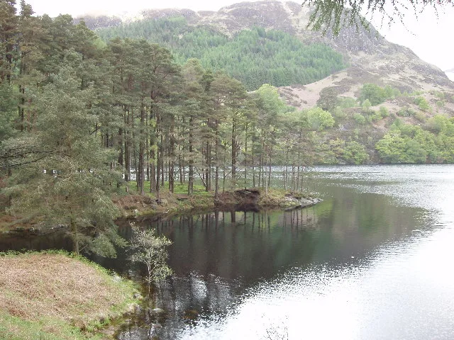
Loch Trool
Loch Trool — a lake in scotland lowlands.
 📷 3
📷 3Mountains & hills · Scottish Lowlands
Lamachan Hill
Lamachan Hill — Named summit at 716 m.
 📷 3
📷 3Natural landmarks · Scottish Lowlands
Lamachan Hill
Lamachan Hill — 717m high mountain in Dumfries and Galloway, Scotland, UK.
 📷 5
📷 5Historic bridges · Scottish Lowlands
Buchan Bridge
Buchan Bridge — category C listed building-listed bridge in scotland-lowlands, United Kingdom.
 📷 3
📷 3Natural landmarks · Scottish Lowlands
Loch Trool
Loch Trool — lake in Dumfries and Galloway, Scotland, UK, outflows west to the Water of Trool.
 📷 4
📷 4Memorials & monuments · Scottish Lowlands
Bruce's Stone
Bruce's Stone — Monument, dating to 1929.
Where to eat & stay near Mulldonoch
Places to stay
 📷 5
📷 5Campsites · Scottish Lowlands
Glentrool Camping & Caravan Site
Glentrool Camping & Caravan Site — a campsite in scotland lowlands.
 📷 5
📷 5Hostels · Scottish Lowlands
Minigaff Youth Hostel
Minigaff Youth Hostel — a hostel in scotland lowlands.
 📷 5
📷 5Hotels · Scottish Lowlands
Cree Bridge House Hotel
Cree Bridge House Hotel — a hotel in scotland lowlands.
 📷 5
📷 5Campsites · Scottish Lowlands
Creebridge Caravan Park
Creebridge Caravan Park — a campsite in scotland lowlands.
 📷 5
📷 5Campsites · Scottish Lowlands
Otter Pool "Stay the night"
Otter Pool "Stay the night" — a campsite in scotland lowlands.
 📷 5
📷 5Campsites · Scottish Lowlands
Balloch O' Dee
Balloch O' Dee — a campsite in scotland lowlands.
Places to eat & drink


More mountains in this region
 📷 3
📷 3Mountains & hills · Scottish Lowlands
Andrewhinney Hill
Andrewhinney Hill — Named summit at 677 m.
 📷 3
📷 3Mountains & hills · Scottish Lowlands
Arbory Hill
Arbory Hill — Named summit at 429 m.
 📷 3
📷 3Mountains & hills · Scottish Lowlands
Auchenton Hill ( East Mount Lowther)
Auchenton Hill ( East Mount Lowther) — Named summit at 631 m.
 📷 3
📷 3Mountains & hills · Scottish Lowlands
Bakestall
Bakestall — Named summit at 673.5 m.
Frequently asked questions
- Where is Mulldonoch?
- Mulldonoch is in the Scottish Lowlands, United Kingdom.
- What is Mulldonoch?
- Mulldonoch — a hill or mountain in scotland lowlands.
- How do I get to Mulldonoch?
- Its coordinates are 55.0760°, -4.4656°.