
Natural landmarks · Northern Ireland
Moylehid
In or near Derrygonnelly.
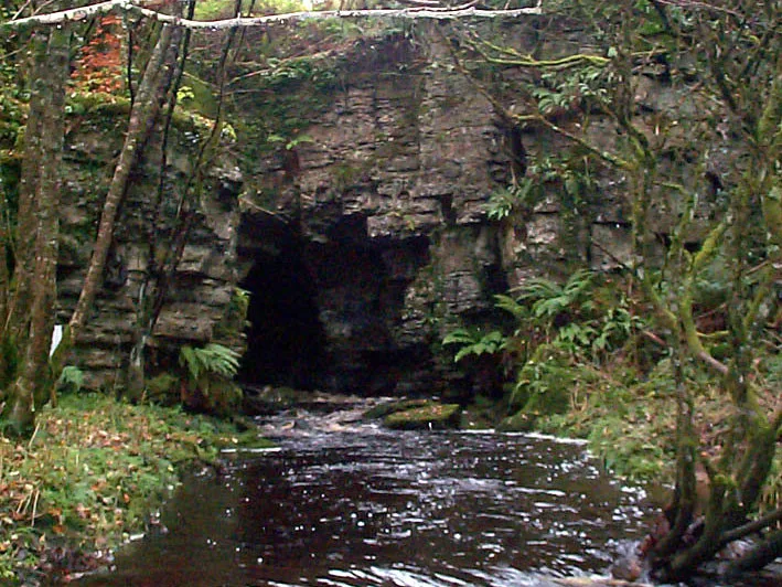
Moylehid in Northern Ireland, United Kingdom.

Gareth Buchanan — CC BY-SA 2.0 via Wikimedia Commons licence

Plan your visit
- Typical visit
- 1 h–2 h
- Free entry
- Dog-friendly
About
Moylehid is a place of interest in Northern Ireland, United Kingdom — drawn from open-data sources for visitor reference. See the linked Wikipedia article for the full description.
From the Wikipedia article
Moylehid (from Irish Mulleithid/Maol Leathan 'broad bare hill') is a townland in County Fermanagh, Northern Ireland. It is in the civil parish of Boho. This townland has also been variously known as Moylehide (1609), Moolet (1659), Moylehit, Mullyleet, Mul Leathaid and Mul-leithid (hill of breadth) (1834).
Excerpt from Wikipedia under CC BY-SA 4.0. See the source article linked in Sources below.
Background
History
Mylehid townland contains two scheduled historic monuments as described on the Northern Ireland Environment Agency, DOE, Scheduled Historic Monuments list (1 April 2015). These are the Eagle's Knoll Cairn passage tomb and the Moylehid ring cairn. Both sites were discovered by archaeologist Thomas Plunkett in 1894 and contain evidence of Neolithic settlement. The cairn or passage grave is laid out in a cross shaped arrangement, 13 ft long and 7 ft 4 inches wide and divided into 7 areas.
Sourced from Wikipedia under CC BY-SA 4.0.
- Coordinates
- 54.3291, -7.7777
- District
- Fermanagh and Omagh
- Postcode
- BT74 5AY
- Parliamentary constituency
- Fermanagh and South Tyrone
Sources
Other places nearby

Belmore Mountain
Natural landmarks · 0.9 km

Belmore Mountain
Mountains & hills · 0.9 km

Drummacoorin
Natural landmarks · 2.3 km

Kilnamaddoo
Natural landmarks · 2.4 km

Drumboy
Villages · 2.4 km

Pollnagollum Cave
Caves · 2.4 km
Boho Caves
Mountains & hills · 2.5 km
Boho
Natural landmarks · 2.6 km
Knocknahunshin
Natural landmarks · 2.6 km

Belcoo Fault
Natural landmarks · 2.8 km

Aghaherrish
Natural landmarks · 3.1 km

Carn
Natural landmarks · 3.2 km
Nearby
📷 5Natural landmarks · Northern Ireland
Belmore Mountain
Belmore Mountain — mountain in the United Kingdom.
📷 5📷 3Natural landmarks · Northern Ireland
Drummacoorin
Drummacoorin in Northern Ireland, United Kingdom.
📷 2Natural landmarks · Northern Ireland
Kilnamaddoo
Kilnamaddoo in Northern Ireland, United Kingdom.
📷 5📷 3Caves · Northern Ireland
Pollnagollum Cave
Pollnagollum Cave is a cave in the United Kingdom.
Where to eat & stay near Moylehid
Places to stay
 📷 5
📷 5Caravan parks · Northern Ireland
Rushin House Caravan Park
Rushin House Caravan Park — a caravan park in northern ireland.
 📷 4
📷 4Caravan parks · Northern Ireland
Riverside Farm, Marina & Caravan Park
Riverside Farm, Marina & Caravan Park — a caravan park in northern ireland.
 📷 5
📷 5Hotels · Northern Ireland
Lough Erne Golf Resort
Lough Erne Golf Resort — a hotel in northern ireland.
 📷 5
📷 5Caravan parks · Northern Ireland
Drumhoney Holiday Park
Drumhoney Holiday Park — a caravan park in northern ireland.
 📷 5
📷 5 📷 5
📷 5Caravan parks · Northern Ireland
Clareview Caravan Park
Clareview Caravan Park — a caravan park in northern ireland.
More natural landmarks in this region
 Flagship📷 4
Natural landmarks · Northern Ireland
Lough Erne
Lough Erne — lake in County Fermanagh, Northern Ireland, UK.
 Flagship📷 4
Natural landmarks · Northern Ireland
Lough Neagh
Lough Neagh — large lake in Northern Ireland.
 📷 3
📷 3Natural landmarks · Northern Ireland
Ballysaggart Lough
Ballysaggart Lough — lake in the United Kingdom.
📷 5Natural landmarks · Northern Ireland
Belmore Mountain
Belmore Mountain — mountain in the United Kingdom.
Frequently asked questions
- Where is Moylehid?
- Moylehid is in Northern Ireland, United Kingdom (postcode BT74 5AY).
- What is Moylehid?
- Moylehid in Northern Ireland, United Kingdom.
- How do I get to Moylehid?
- Drivers can use postcode BT74 5AY.
- Is Moylehid free to visit?
- Yes, Moylehid is free to enter.
- How do I get to Moylehid?
- Drivers can navigate to postcode BT74 5AY. It sits within the Fermanagh and South Tyrone parliamentary constituency.